Fire Analysis with ArcGIS Online
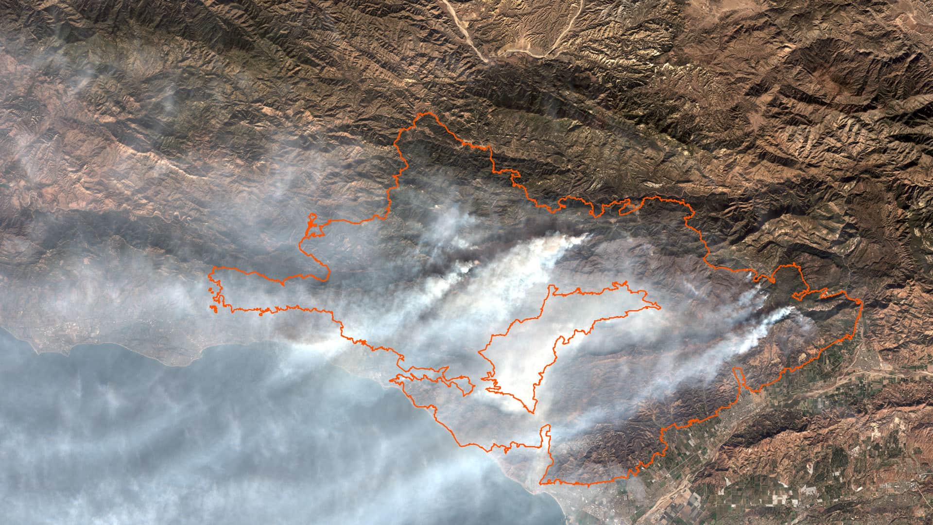
Study several aspects of the Thomas Fire by using ArcGIS Online analysis tools and data from ArcGIS Living Atlas of the World.
Study several aspects of the Thomas Fire by using ArcGIS Online analysis tools and data from ArcGIS Living Atlas of the World.
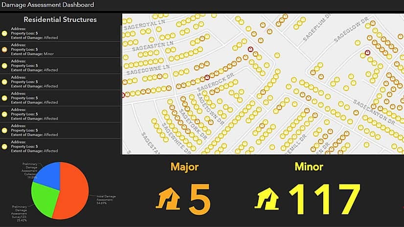
Work with ArcGIS apps and ArcGIS Pro software to create, collect, and share hurricane damage assessment information in this Learn ArcGIS lesson.
New trail markers and an Esri app speeds the response to emergency calls from hikers on a state park trail in Long Island, New York.
In an Esri podcast, journalist and author James Fallows discusses how digital maps can be used to explore economic, transportation, climate...