Inspecting Railroad Crossings with GIS
The Vermont Agency of Transportation used the Collector for ArcGIS app on a smartphone to identify and inspect railroad crossings.
The Vermont Agency of Transportation used the Collector for ArcGIS app on a smartphone to identify and inspect railroad crossings.
Worried that another Snowmageddon will strike? This snowfall forecast map will prepare people for what's next, snow wise, across the US.
The Town of South Windsor, Connecticut (pop. 26,000) is dreaming big with GIS, thanks to its Esri enterprise license agreement.
Planning and Development Services (PDS) of Kenton County uses GIS in imaginative ways, using maps and data to tell stories about...
If you use ArcGIS in any way, shape, or form, Scott Morehouse had a big hand in bringing your software to life.
The Register of Deeds office in Racine County, Wisconsin, created a series of Web GIS apps that the public can use to view land records...
Organizations can use ArcGIS Enterprise Sites to create a tailored web GIS experience with their ArcGIS Enterprise portal.
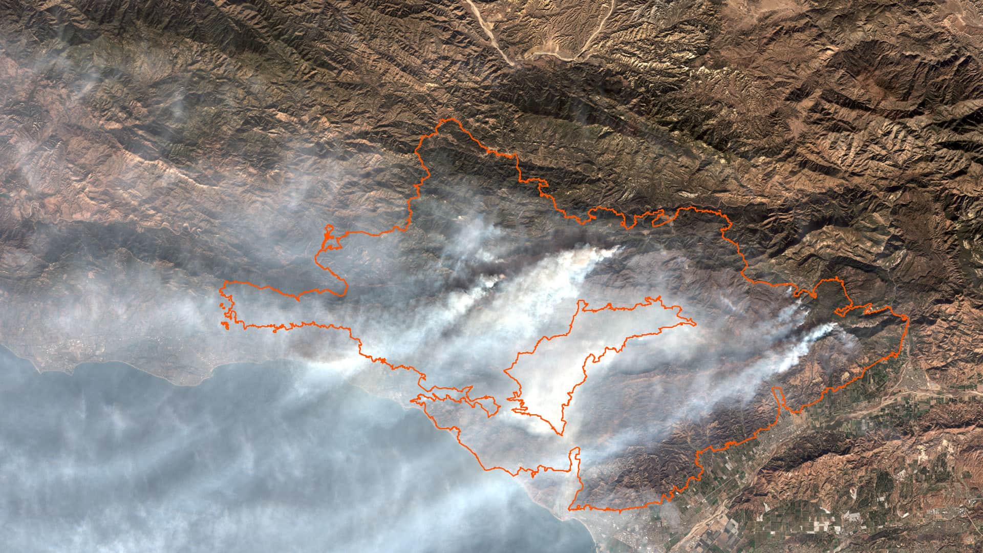
Study several aspects of the Thomas Fire by using ArcGIS Online analysis tools and data from ArcGIS Living Atlas of the World.
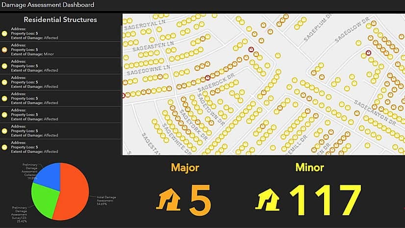
Work with ArcGIS apps and ArcGIS Pro software to create, collect, and share hurricane damage assessment information in this Learn ArcGIS lesson.
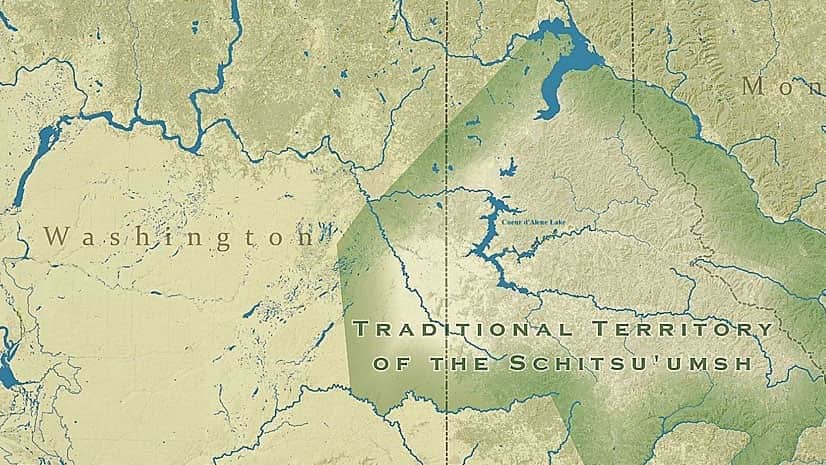
The Samish Indian tribe, the Native Village of Georgetown, and the Coeur d'Alene tribe of Indians were recent Tribal Story Map Challenge winners.
New trail markers and an Esri app speeds the response to emergency calls from hikers on a state park trail in Long Island, New York.
Esri Redistricting is a web-based solution for governments, advocates, and citizens to create and share regulation-compliant redistricting plans.