Create a Network Dataset
Kyle Bauer of Esri walks you through the process of creating a network dataset from street centerline data.
Kyle Bauer of Esri walks you through the process of creating a network dataset from street centerline data.
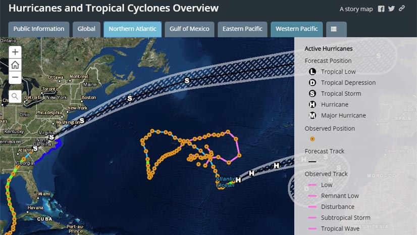
When hurricanes and other disasters strike, the Esri Disaster Response Program (DRP) steps up to help with data, software, and configurable apps.
Esri offers Arxys servers preinstalled with ArcGIS Enterprise software. Use this solution to complement or upgrade your GIS infrastructure.
GIS for government will be the focus of the Esri Federal GIS Conference, which will be held January 29-20, 2019, in Washington, D.C.
Thi app was created by the City of Brooklyn Park to encourage people to volunteer to keep hydrants free of snow and ice during the winter months,
Sanitation trucks in the city of Los Angeles and surrounding communities are now being routed using ArcGIS Online and apps such as...
Esri's ArcGIS platform supports the concept of smart communities—places that thrive economically and where citizens live healthy, safe...
PenBay Media and Esri partner GISi use the ArcGIS platform to help EPA scientists make more informed decisions...
Presidential candidate Martin O'Malley, former governor of Maryland, will be the keynote speaker at the Esri User Conference in July.
Greg Brown, the GIS manager for the City of New Braunfels, Texas, talks about how Web GIS apps and an open data portal benefit both city staff...
Richard Littlefield, GIS manager for the City of Altamonte Springs, Florida, explains how the city's new enterprise GIS...
The Land Information Portal, created for St. Louis County, Minnesota, provides staff with instant access to land records and maps.