Famed physicist Albert Einstein has been quoted as saying, “We cannot solve our problems with the same thinking we used when we created them.”
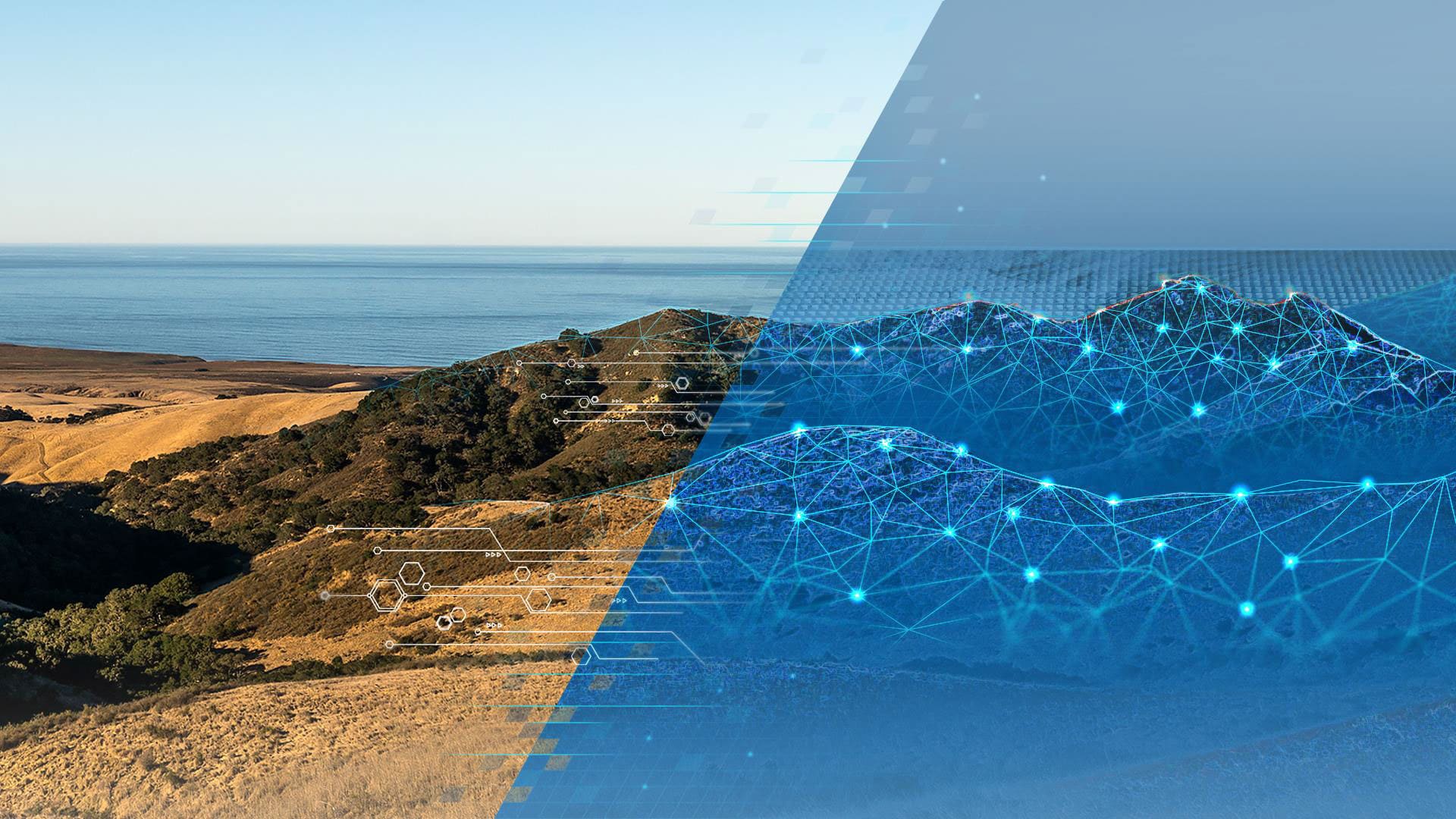
The same could be said today as society faces many crises, both global and local. New thinking, supported by methodologies such as geodesign and technologies such as GIS, represents a recalibrated approach to addressing a myriad of issues. Climate change, resource scarcity, mass migration, strained infrastructural resources, economic exclusionism, and problems with environmental quality are but a few of our communal challenges. Geodesign provides the retooled framework needed to turn the tide and find solutions to these types of issues and formulate a clear vision for creating a more sustainable, vibrant future.
What is Geodesign?
Geodesign combines the art of design with the science of geography. Using stakeholder input, creative design techniques, rigorous discipline, specific methodologies, and spatial analysis and mapping, a geodesign practitioner can find the most suitable, environmentally friendly, and sustainable options for solving problems and using space. This may be space for development, agriculture, wildlife conservation, marine protected areas, transportation systems, or green infrastructure, to name a few examples.
Using geodesign tools, you can model the effects of decisions in advance to prevent mistakes from occurring. Therefore, geodesign’s ability to digitally highlight potential mistakes, before they could be implemented in the real world, can help communities choose the best design options. The geodesign process also brings in subject matter experts and stakeholders to provide insight and feedback.
How geodesign is being put into practice to help overcome challenges will be the focus of the 11th annual Geodesign Summit. The summit will be held February 24–27, 2020, at Esri headquarters in Redlands, California.
The theme of the event will be Seeing Clearly in 2020. The summit typically draws more than 300 geodesign thought leaders and practitioners from fields such as environmental planning, municipal government, land use and urban planning, academia, architecture, landscape architecture, conservation, GIS, and building information modeling (BIM).The Geodesign Summit focuses on big ideas and offers an opportunity to observe and learn from geodesign pioneers who are using the methodology and GIS to revolutionize their work and solve problems.
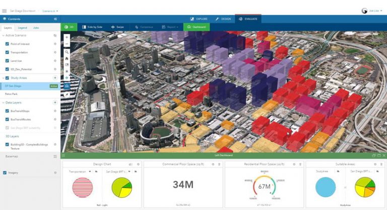
The summit’s first day, February 24, will be mainly devoted to training. Geodesign workflows are supported by Esri technology, especially the new products that have been engineered specifically for geodesign. Four technical workshops will be offered on those products: ArcGIS Pro, GeoPlanner for ArcGIS, Esri CityEngine, and ArcGIS Urban.
In the late afternoon, the International Geodesign Collaboration (IGC) will give a presentation. This consortium, which consists of over 100 universities worldwide, has convened to systematically apply geodesign to a myriad of diverse projects, both real and conceptual. The IGC presentation will provide a meta-analysis that will distill the commonalities among and differences between these projects to help identify geodesign best practices.
On February 25, Esri president Jack Dangermond will give a talk entitled “Geospatial Infrastructure—A Foundation for Geodesign.” He will share Esri’s vision of how rapidly evolving technology will help catalyze the future of geodesign and better enable us to See What Others Can’t.
Other featured speakers at the summit include the following:
- Petra Hurtado, research director, at the American Planning Association (APA)—The APA is a professional organization representing the field of urban planning in the United States that is uniquely poised to orchestrate next generation geodesign thinking within the context of existing planning trends.
- Ian McGuinness, partner and head of geospatial technology at Knight Frank UK—The global property capital firm specializes in using locational intelligence to manage real estate assets.
- Jennifer Pettyjohn, senior planner for the City of Seattle—The city is pioneering the use of growth capacity tools as part of its buildable lands analysis.
- Glen Low, cofounder of The Earth Genome—Low’s firm develops tools and services to provide actionable insights from big environmental data.
- Nicole Beck, principal at 2NDNATURE—The firm provides analytical tools for use by cities to benchmark, manage, and improve the quality of their urban waterways.
- Kristy Senatori, executive director of the Cape Cod Commission—The commission is a regional land-use planning, economic development, and regulatory agency that uses innovative approaches to decision-making.
- Stuart Cowan, director of the Regenerative Communities Network at the Capital Institute—Regenerative Communities Network is a pioneer in bioregional regenerative design.
- Devine Lavigne, principal at Houseal Lavigne Associates—Lavigne’s company is a professional consulting firm that uses geodesign in community planning, urban design, and economic development.
An additional 50 speakers will showcase how they are revolutionizing their work, advancing best practices, and tackling communal challenges by using geodesign.

See More Clearly with Geodesign
The 2020 Geodesign Summit’s theme, Seeing Clearly in 2020, illustrates how technology, innovation, and professional practice can be leveraged to devise, evaluate, and chart a clear path forward to meet a wide variety of challenges. The summit showcases world-class leaders and examples of geodesign in action and its application at many scales and in a wide spectrum of domains and disciplines.
Geodesign can be applied within many different fields, providing opportunities for new insights and innovation. For this to happen, the benefits of adopting a geodesign approach need to be clearly articulated.
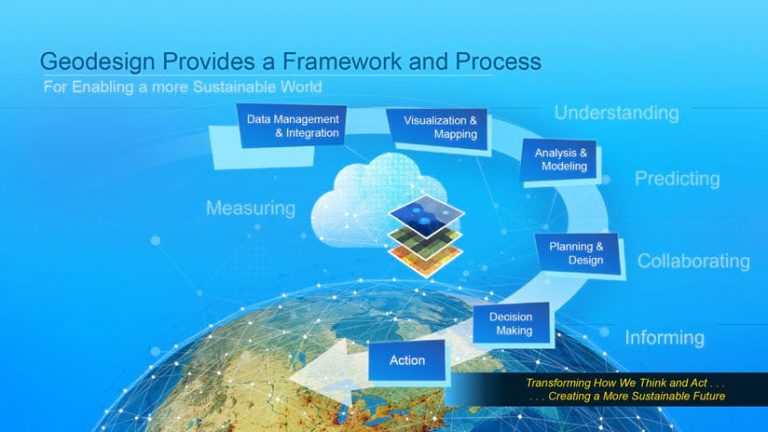
Put simply, geodesign provides the framework for testing alternatives, understanding their impacts, and visualizing their outcomes. One of the most powerful elements of using geodesign methodology and tools is being able to predict and help articulate what the future will look like should certain decisions be made.
This is achieved by leveraging data and analysis to guide your choice of design alternatives, create impact simulations to test performance, and use reporting mechanisms to communicate how different design decisions affect the bigger picture. The ingrained ability to contextualize, analyze, and visualize data helps stakeholders and decision-makers better understand the performance—and consequences—of alternatives. This means that an alternative’s success can be predicted, and failure can be avoided.
Organizations that use the geodesign process arrive at more sustainable, defensible, and justifiable decisions. Stakeholders get involved early in the design process, not at the end. This helps ensure that participants are actively invested and involved in developing alternatives instead of merely reacting to them. This more meaningful participation results in better alternatives while also building consensus. Consensus building, as a workflow element, helps participants feel a sense of ownership, thus mobilizing them to support the project, share in its successes, and overcome any stagnation and opposition that may come from a lack of understanding.
Geodesign has been leveraged by professionals in planning, design, government, and nonprofit organizations to tackle a wide variety of projects. As a framework, geodesign can direct efforts to enhance the resiliency of environmental systems, develop carbon-neutral and smart cities, optimize networks, revitalize natural and urban areas, implement energy solutions, and manage ecological assets.
Geodesign can be used to address all these things and more; in so doing, a future can be built that balances the many needs placed on our planet and mitigates stressors in the areas that are most fragile.