displaying 173 results
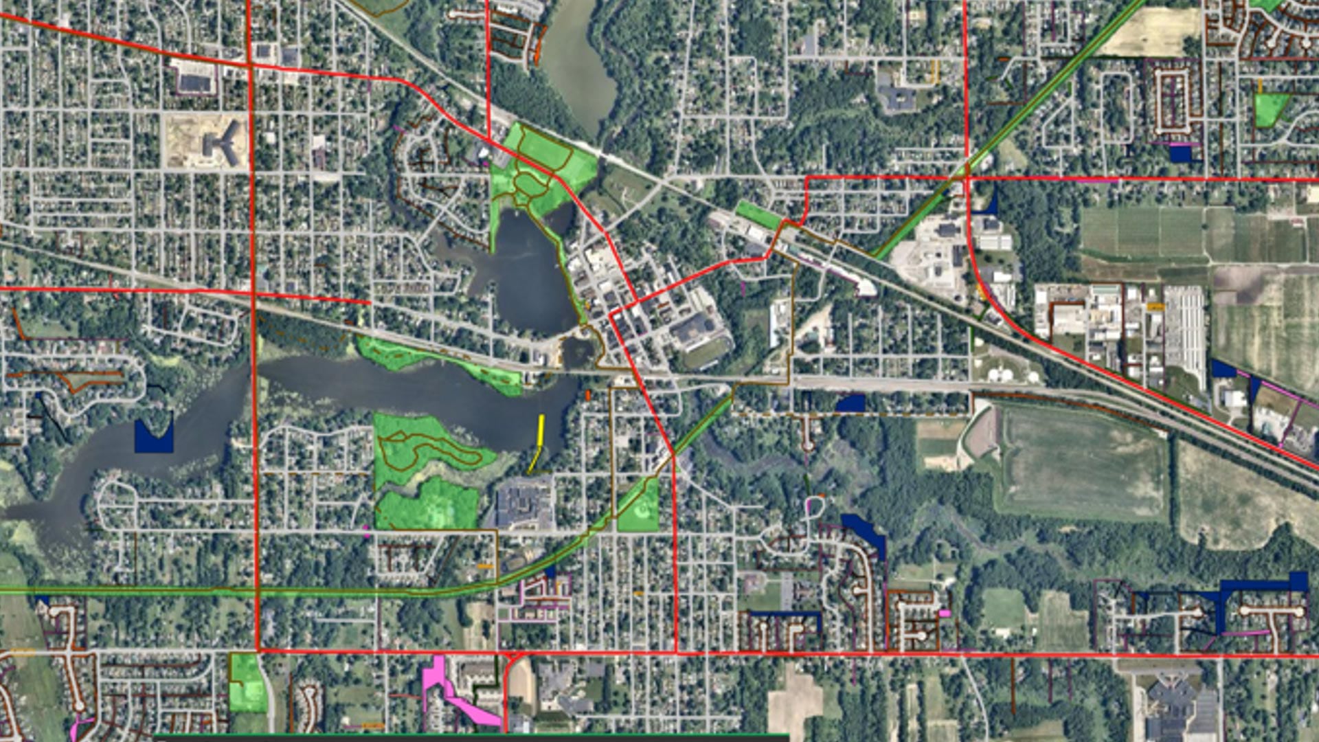
With help from Geographic Technologies Group, Hobart, Indiana, is building a sustainable, resilient, and scalable GIS for the whole city.
The GIS manager in the city of Jihlava in the Czech Republic, enjoys a variety of tasks.
While residents are ultimately responsible for knowing what exists around them, could cities also provide greater access to such information?
The author developed an app to help wheelchair users more easily travel across Kutztown University of Pennsylvania campus.

Site Wind Right, from The Nature Conservancy, focuses renewable energy development in optimal places that won’t harm wildlife habitats.
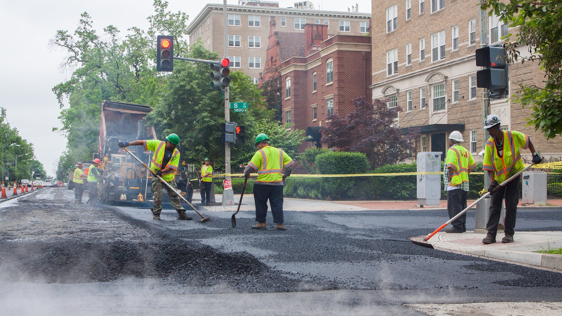
The PaveDC Paving Plan helped the DDOT pave more than 100 miles of roadway in 2019—the most it had ever completed in a year.
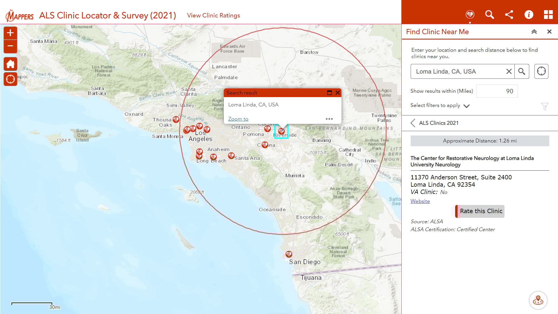
Pat Dolan, diagnosed with ALS or Lou Gehrig's disease, uses his GIS knowledge and skills to help other ALS patients locate care services.
Esri staff show how organizations can use Esri technology such as Operations Dashboard for ArcGIS, Web AppBuilder for ArcGIS, and Esri Story Map
Create a locator app that gives users the ability to find COVID-19 testing sites near any United States location.
Check out this collection of ArcGIS Online apps that you can configure or use that let you swipe or compare multiple layers or maps.
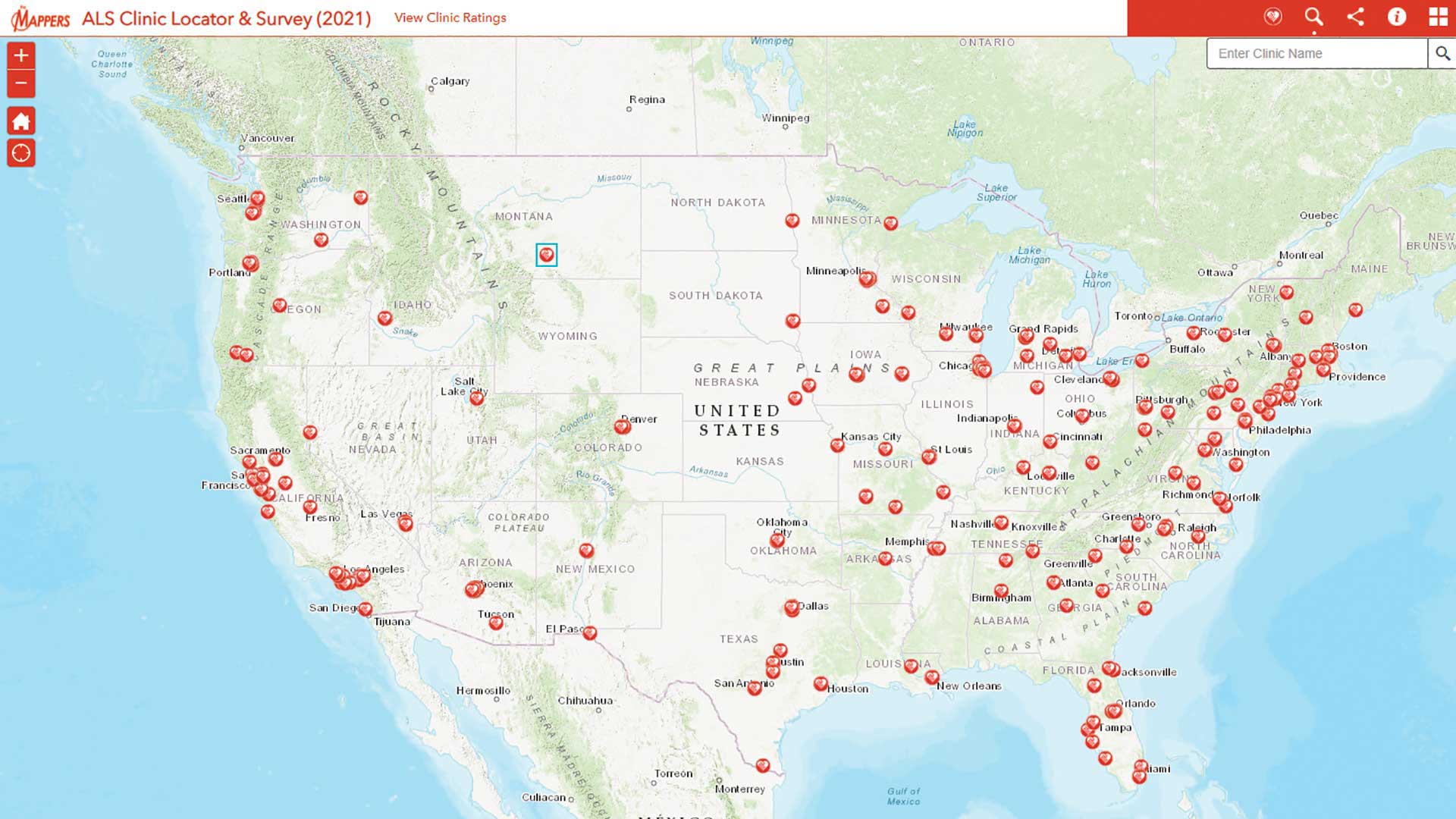
Pat Dolan used his GIS expertise to build tools to help the amyotrophic lateral sclerosis (ALS) community.
Visualize the recent earthquakes in Alaska with an app built with Web AppBuilder for ArcGIS.