displaying 557 results
In India, an independent not-for-profit organization prototyped a process for digitizing health facility data.
The US Navy's new standardized addressing system will help dispatchers route police and ambulances to emergencies.

Kim Morrison is helping the world’s largest gold miner improve operational performance and visibility with GIS dashboards, drones, and more.

A smart workplace begins with awareness—of assets, conditions, people, and performance. It gets smarter at each stage of maturity.

The real-time data sharing, analysis, visualization, and planning capabilities will be key to equitable and speedy vaccine distribution.

To identify areas with inadequate facilities, the organization used GIS at the village level—and is making progress in improving assets.
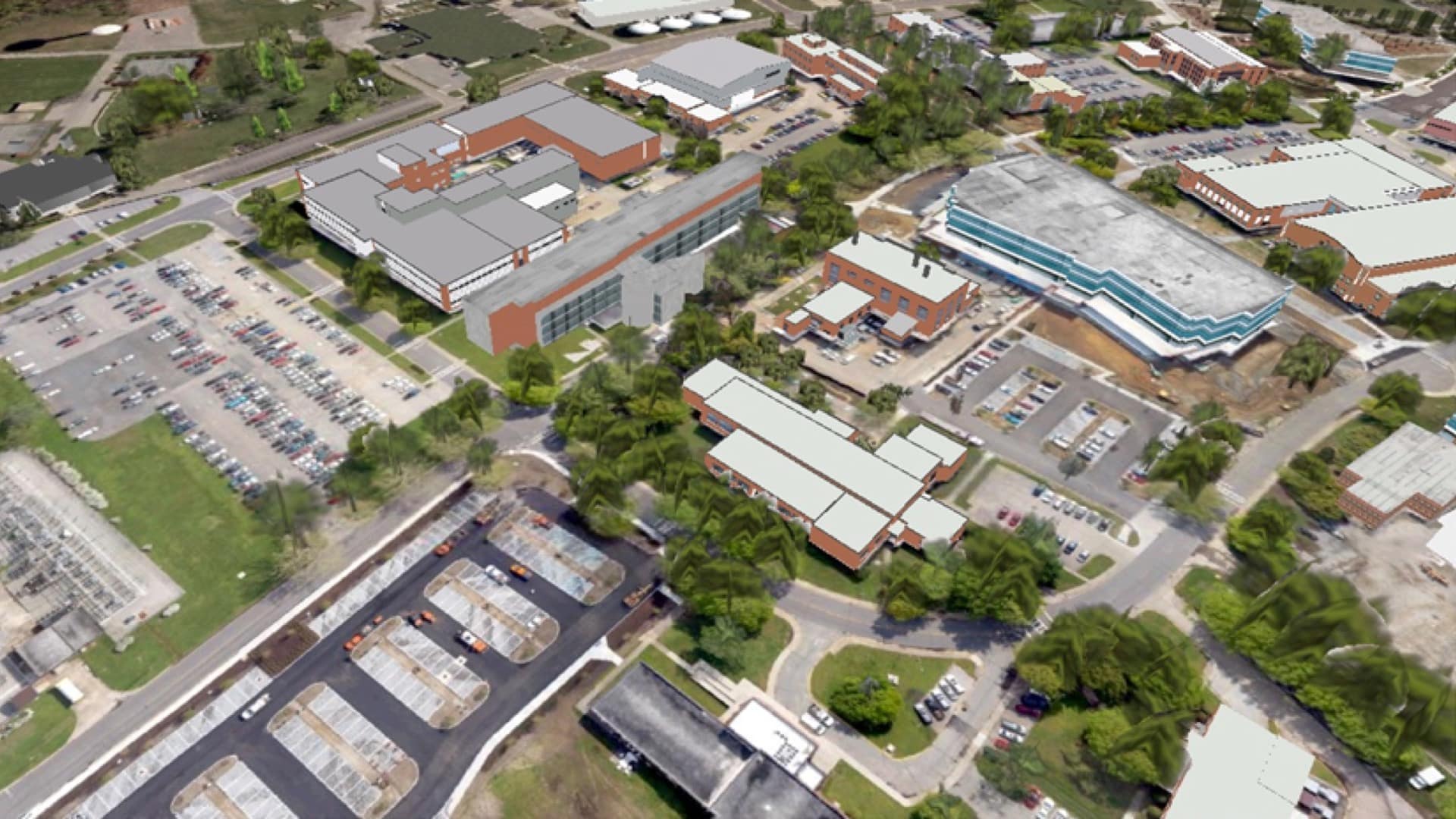
NASA’s Langley Research Center uses a digital twin as backdrop to nearly 300 lightweight and purpose-driven facility management apps.
While residents are ultimately responsible for knowing what exists around them, could cities also provide greater access to such information?

Military bases lacked standard addresses, so the US Navy mapped out all the streets on naval bases and gave military buildings E911-compliant.