displaying 1242 results
Harvard University Educates with Mobile Mapping Technology

The Park Trails mobile app, developed with AppStudio for ArcGIS, helps visitors navigate trails in nine Allegheny County, Pennsylvania, parks.
Texas A&M Forest Service and Esri partner Timmons Group developed a GIS mobile app to assess trees for trimming or other maintenance.
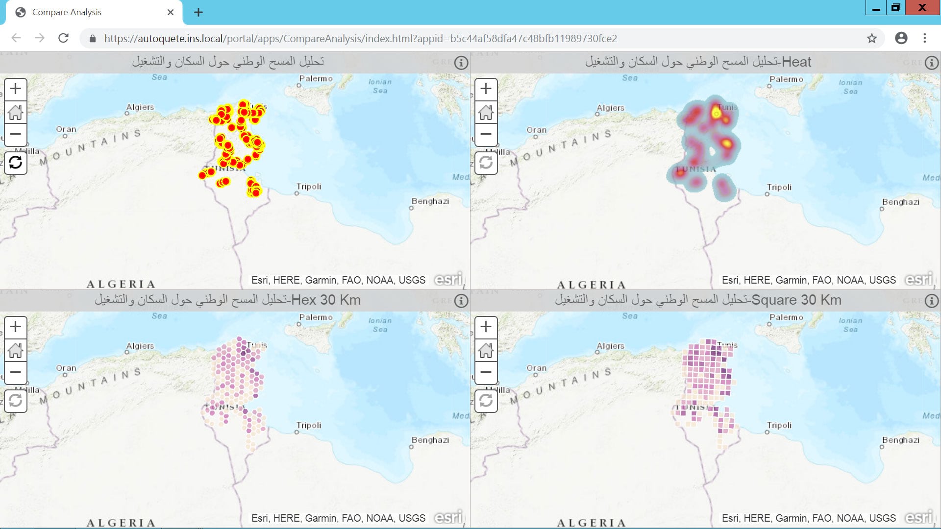
Tunisia’s National Statistical Institute developed a GIS-based system to automate census surveys and their related statistics processes.

Workers are seeing how much their economic value varies by location, and one startup is capitalizing on this workforce mobility.
Survey123 for ArcGIS is a simple and intuitive formcentric field data gathering solution that makes creating, sharing, and analyzing surveys

New Jersey American Water has saved millions of dollars each year by mapping water asset locations across the state with pinpoint accuracy.

When organizations need to upgrade technology, manage and analyze large amounts of data, and synchronize systems, Esri partners can help.

To avoid residents of mobile home parks being permanently displaced, town employees create maps to allocate land for affordable housing.

The Lower Valley Water District adopted a GIS-centric approach to investigating unusual spikes in water use in El Paso County, Texas.