displaying 295 results
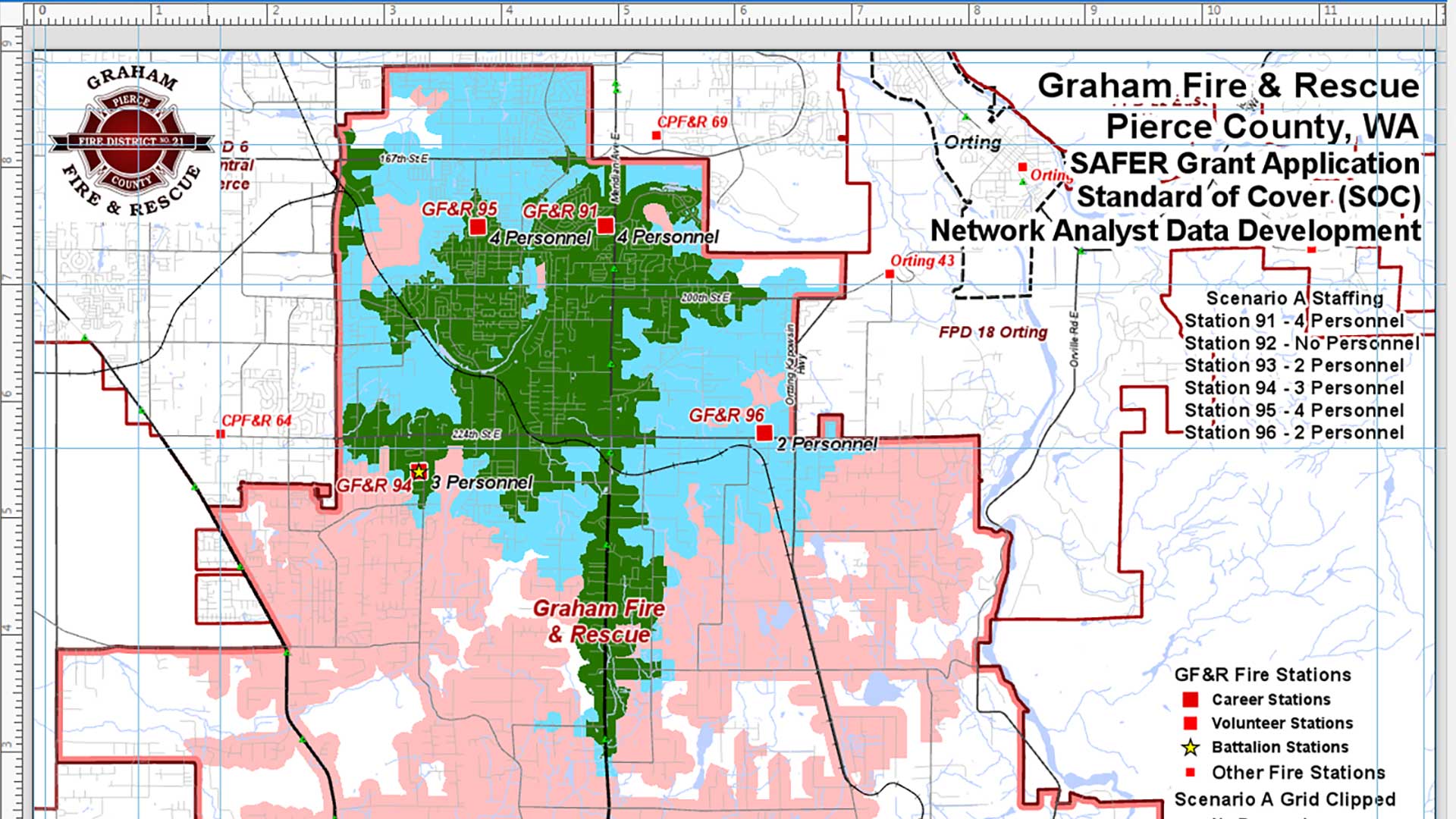
The Mike Price tutorial walks you through analyzing the effective response force for a fire district given different staffing scenarios.

Build resilience and innovation into your organization because disruption from digital transformation is inevitable.
Remote sensing has always rapidly incorporated advances in technology, but the pace of change has quickened recently.
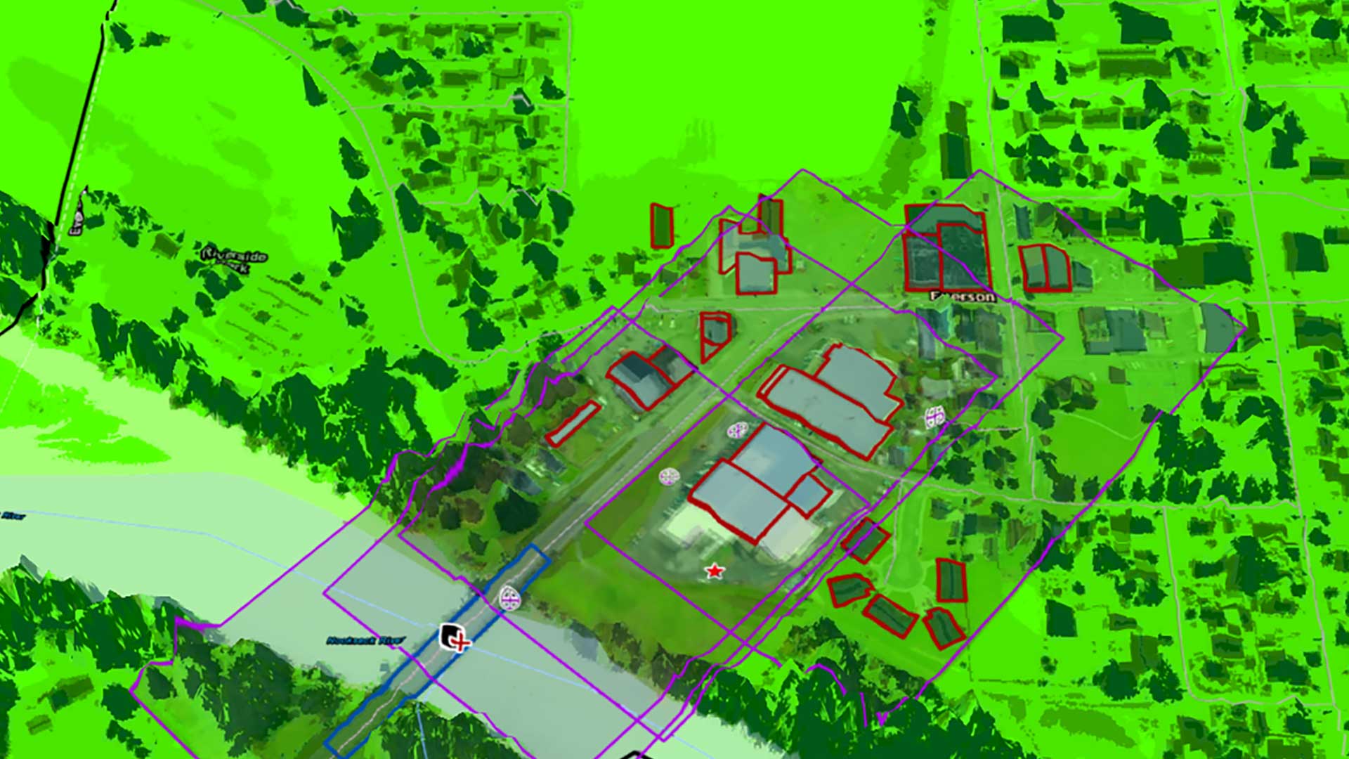
This tutorial combines 2D and 3D data in an ArcGIS Pro Local Scene to visualize the topography, imagery, and cultural features of a region.
With the ArcGIS API for JavaScript, developers can now create 3D experiences that work well in both mobile and desktop browsers.

Johns Creek, Georgia, drives economic growth and citizen engagement by making its data available through Alexa, dashboards, and charts.