displaying 999 results
ArcGIS Indoors includes new tools that modernize floor plan management and helps ensure employees' health and safety as they return to work.

New books from Esri include GIS Tutorial for ArcGIS Pro 2.8 and GIS for Science, Volume 3: Maps for Saving the Planet.
Check the new CovidPulse map from Esri to see the trend lines for reported cases of and deaths from COVID-19 in the United States.
Esri cartographer John Nelson walks through how to use ArcGIS Pro to map the population in the United States who are vulnerable to COVID-19.
Honolulu, Hawaii; Yonkers, New York; and Minneapolis, Minnesota, were all on Livability's Top 10 Healthiest Cities list.

Want to know when the air quality’s too bad to exercise outdoors or where to get alternative fuel? The South Coast AQMD app does both.

The government of Azerbaijan uses a cutting-edge mapping and workflow system to construct maps of the country’s working lands.

With 3D visualization, the EPA can better understand and respond to groundwater contamination in LA County and beyond.
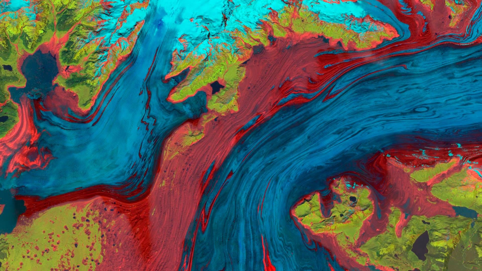
The Landsat Explorer app in ArcGIS Living Atlas of the World provides an easy way for users to access and interpret Landsat satellite data.

A botanical garden, an infrastructure company, and the State of West Virginia all benefited from the GIS expertise of Esri partners.
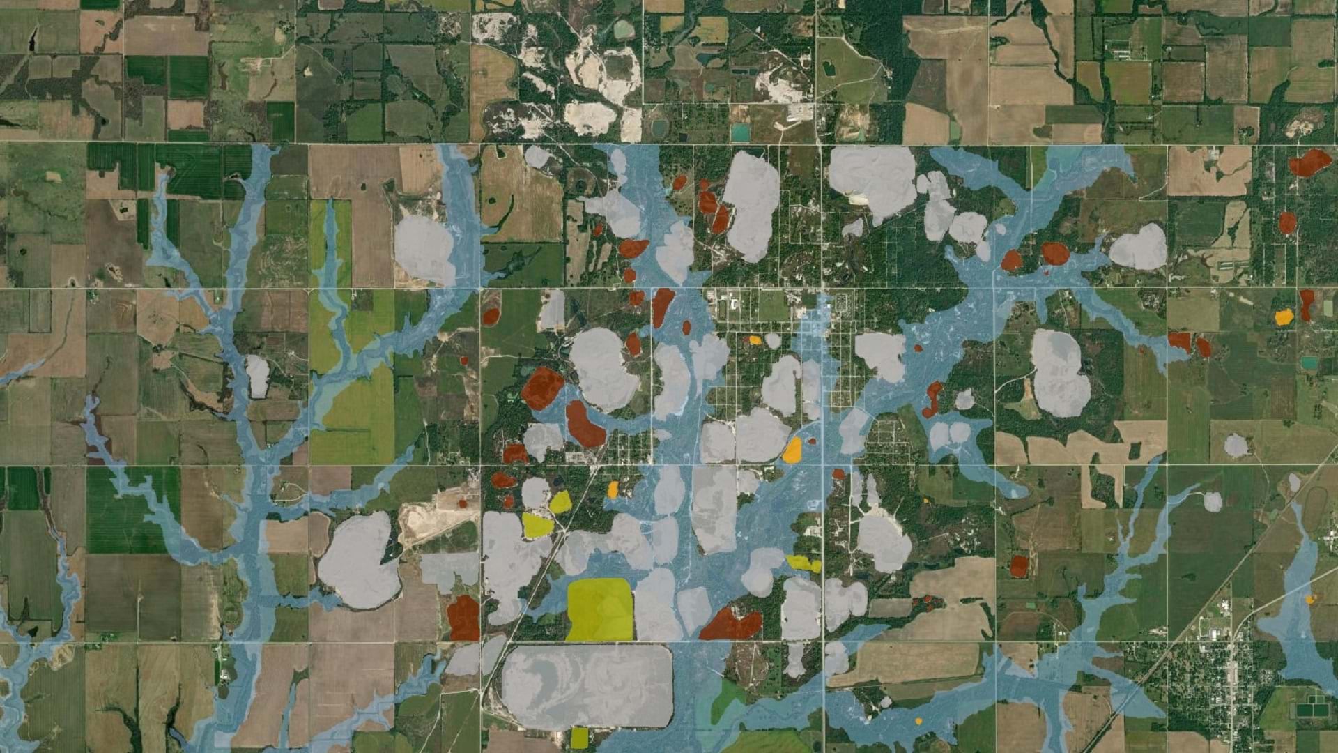
The Tar Creek Superfund site created one of the most toxic floodplains in the US. LEAD Agency is using GIS to advocate for environmental justice.

URISA supports climate resilience and addressing climate change impacts through geospatial solutions, workshops, and resources.