displaying 998 results
Suffolk County, New York, officials use dashboards and location-based data to ensure residents have equitable access to the COVID-19 vaccine.
Learning GIS is an important skill set, but the goal is to understand an issue or problem in a deeper, more holistic way and then taking action.

Organizations around the world are using GIS to build new housing, improve roads, and fix water supply issues—with help from Esri partners.

Durham-Chapel Hill-Carrboro Metropolitan Planning Organization used Esri software and Microsoft Azure to recover from a cyberattack.

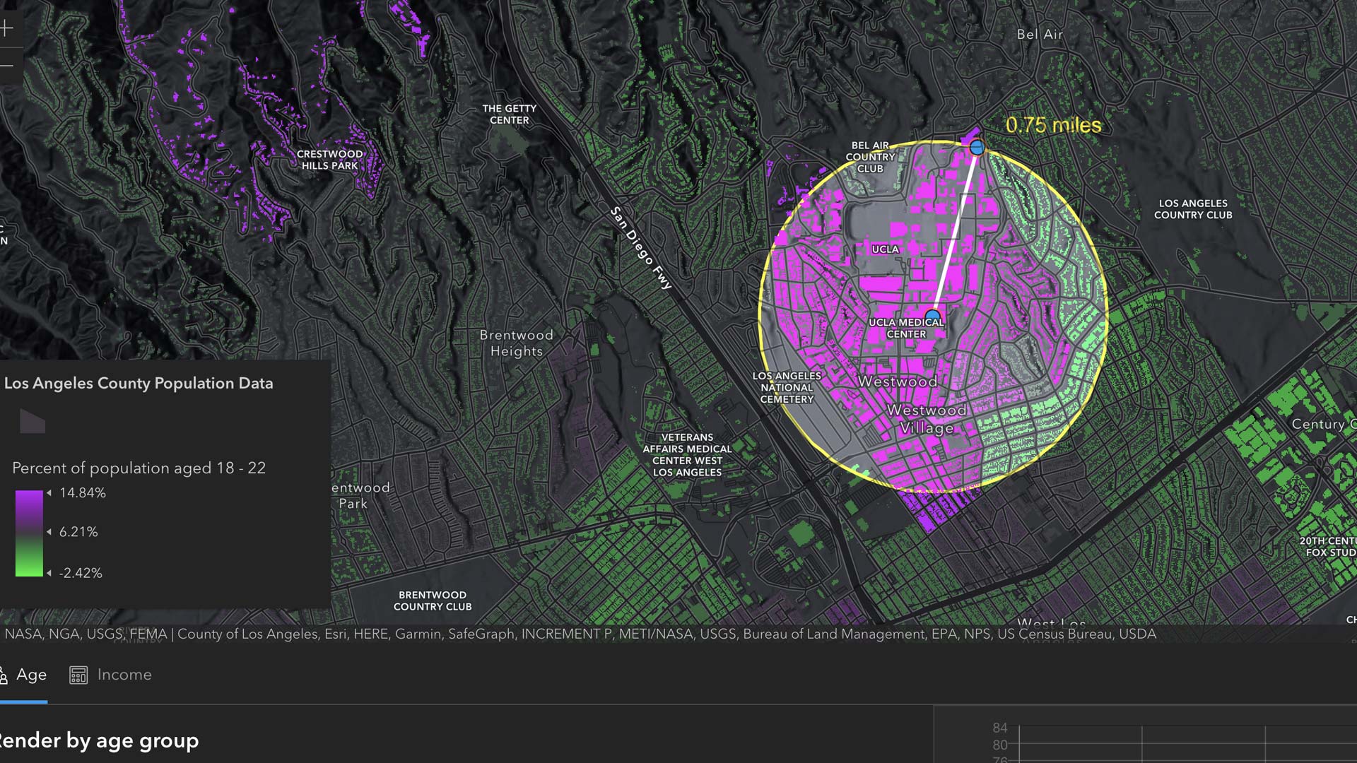
A new version of ArcGIS Dashboards that provides better performance, enhanced features, and refreshed designs is available for general use.

When data is accessible, reusable, and open for improvement, it has a big impact on communities. So join the thriving open data ecosystem.

GIS is advancing quickly, benefiting software developers in many ways. That was made evident at the 2021 Esri Developer Summit.

Airflow Analyst uses 3D urban models and meteorological data to predict ventilation in places like stadiums and public transit stations.

The City of Durham lost access to its servers and data, so GeoDecisions put in place processes to ensure that this would never happen again.
The release of ArcGIS Enterprise on Kubernetes was just one of several noteworthy announcements at the 2021 Esri Developer Summit.

A new mobile app, ArcGIS Field Maps, gives mobile workers a single app that can perform multiple critical field activities.
With GIS, Tim Prather found a powerful tool for making agriculture more sustainable, both environmentally and economically.