displaying 781 results

The GIS Managers’ Open Summit (GISMOS) on July 9, 2019 at the Esri User Conference will help you become a leader in your organization.
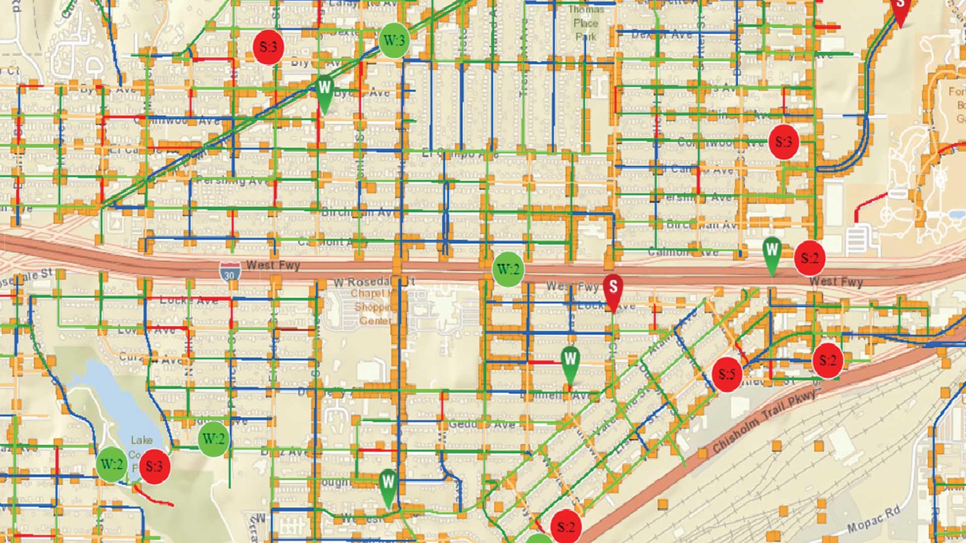
The City of Fort Worth, Texas, makes smarter decisions based on known asset conditions as a result of its extensive use of digital processes.

Study uses the ArcGIS Network Analyst extension to track the daily movements of carp in harbor located aof the Manistique River.
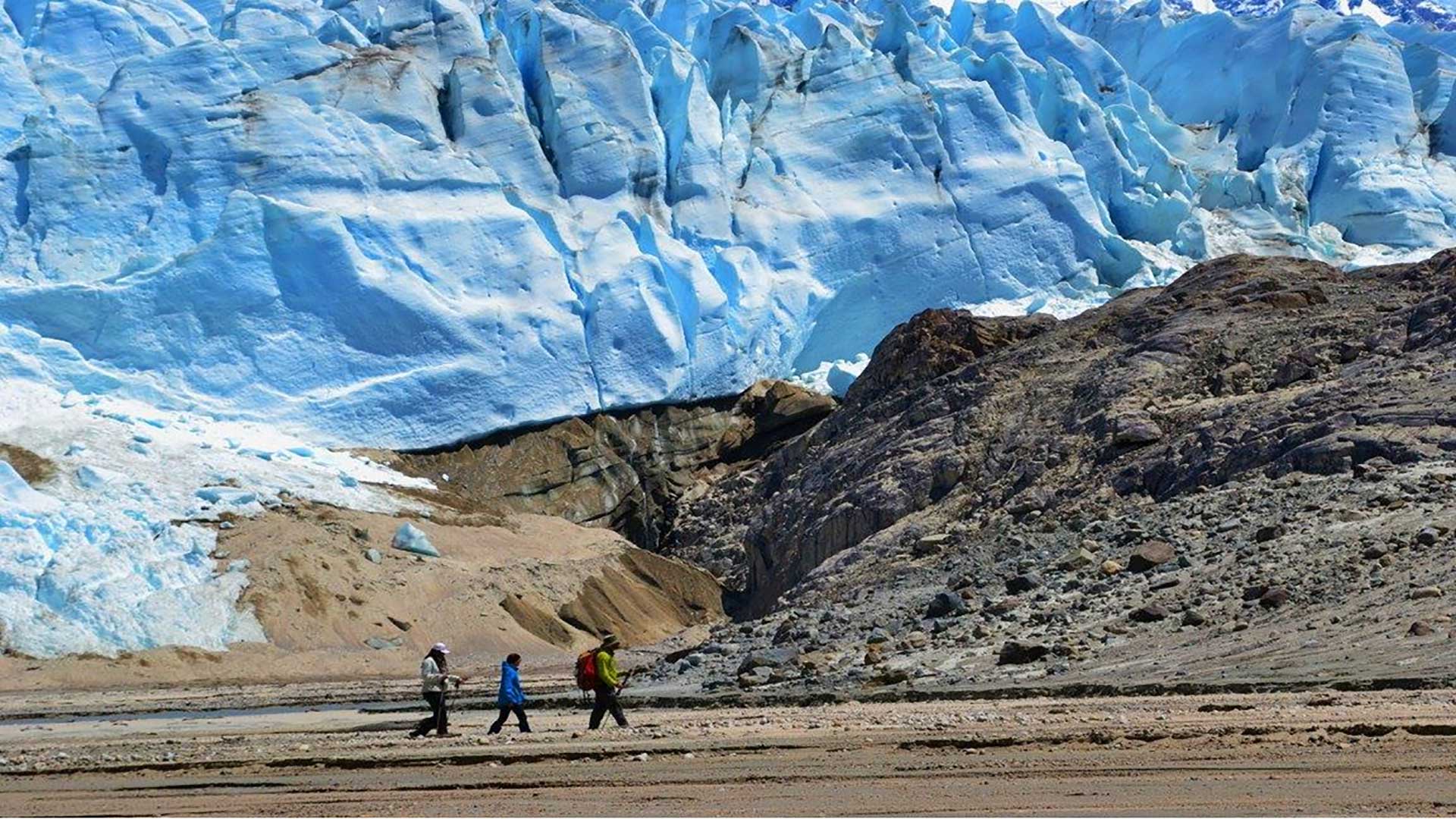
The National Geospatial-Intelligence Agency (NGA) studies the risk posed by glacial lake outburst flood (GLOF) events caused by the effects of cl

Esri's Matthew Lewin refutes some common myths about what location intelligence is and its value.
This tutorial introduces georeferencing techniques available in ArcGIS Pro using imagery collected by drones during a multi-day training exercis…
Imagery and GIS have a symbiotic relationship: Imagery is the foundation of most GIS datasets, and GIS can be used to more effectively manage…
The big issues are fundamentally tied to space and grappling with these issues requires a geoliterate population.
Learn about Graham Fire & Rescue (GF&R), a fire district in Washington state that received a $3.5 million grant.
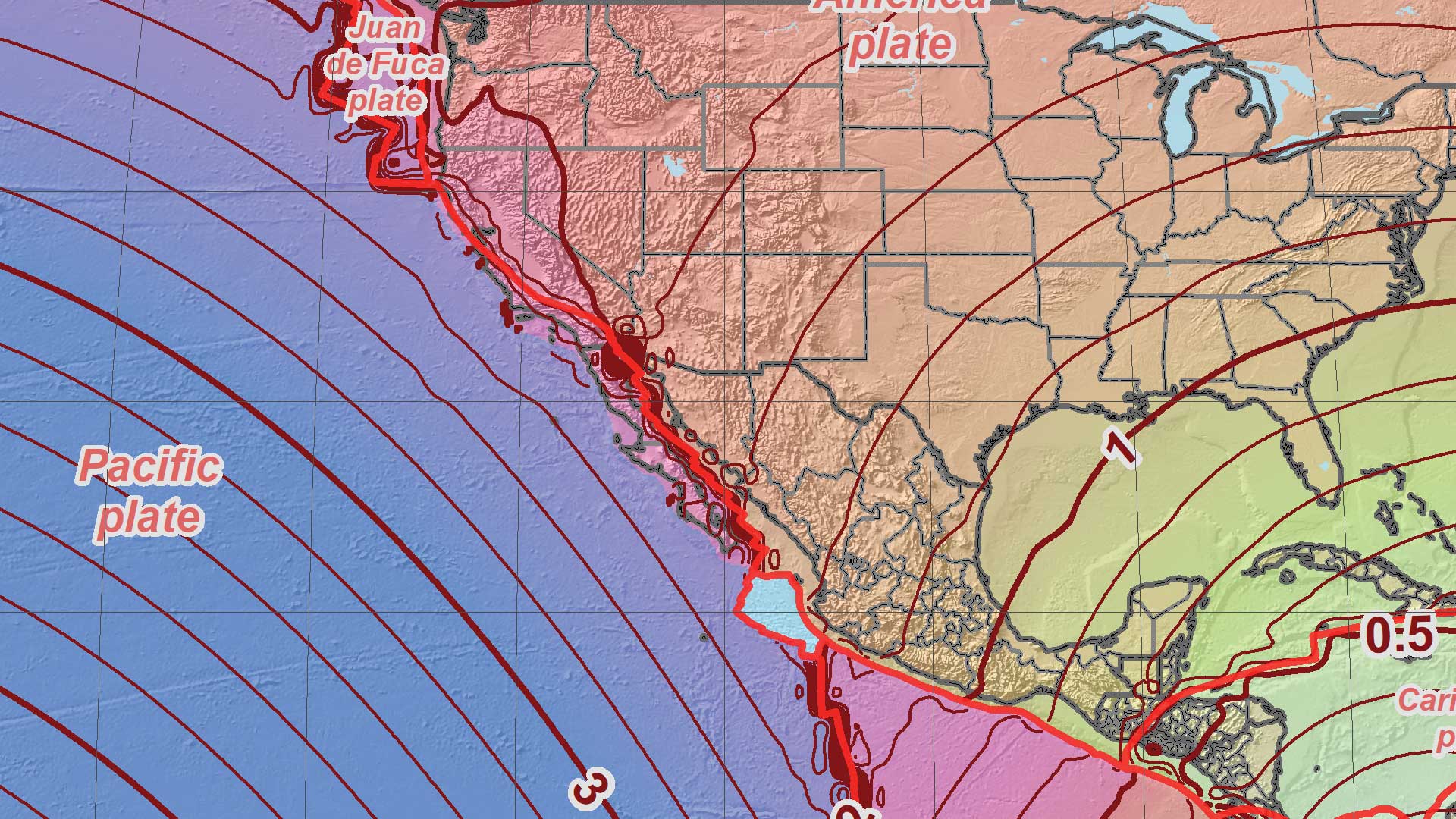
The National Geodetic Survey (NGS) is moving to nonstatic national datums in the United States.

ArcGIS Online organizational security settings now allow access only through HTTPS and standard SQL queries.
ArcGIS 10.2, a full release of ArcGIS, makes it easier to deploy web GIS, the key component for implementing GIS as a platform...