displaying 779 results

Thomas Fisher, director of the Minnesota Design Center, explains how design and the digital revolution will change how people will live and work.

Despite years of foreshadowing, drones aren’t dropping packages at our doorsteps. Before they can, they’ll need precise location intel.

Erik Henderson is one of many GIS pros whose use of location intelligence technology saves his company time and money and boosts worker safety.

With lives at stake, companies are using location analysis to prevent injuries and deaths.
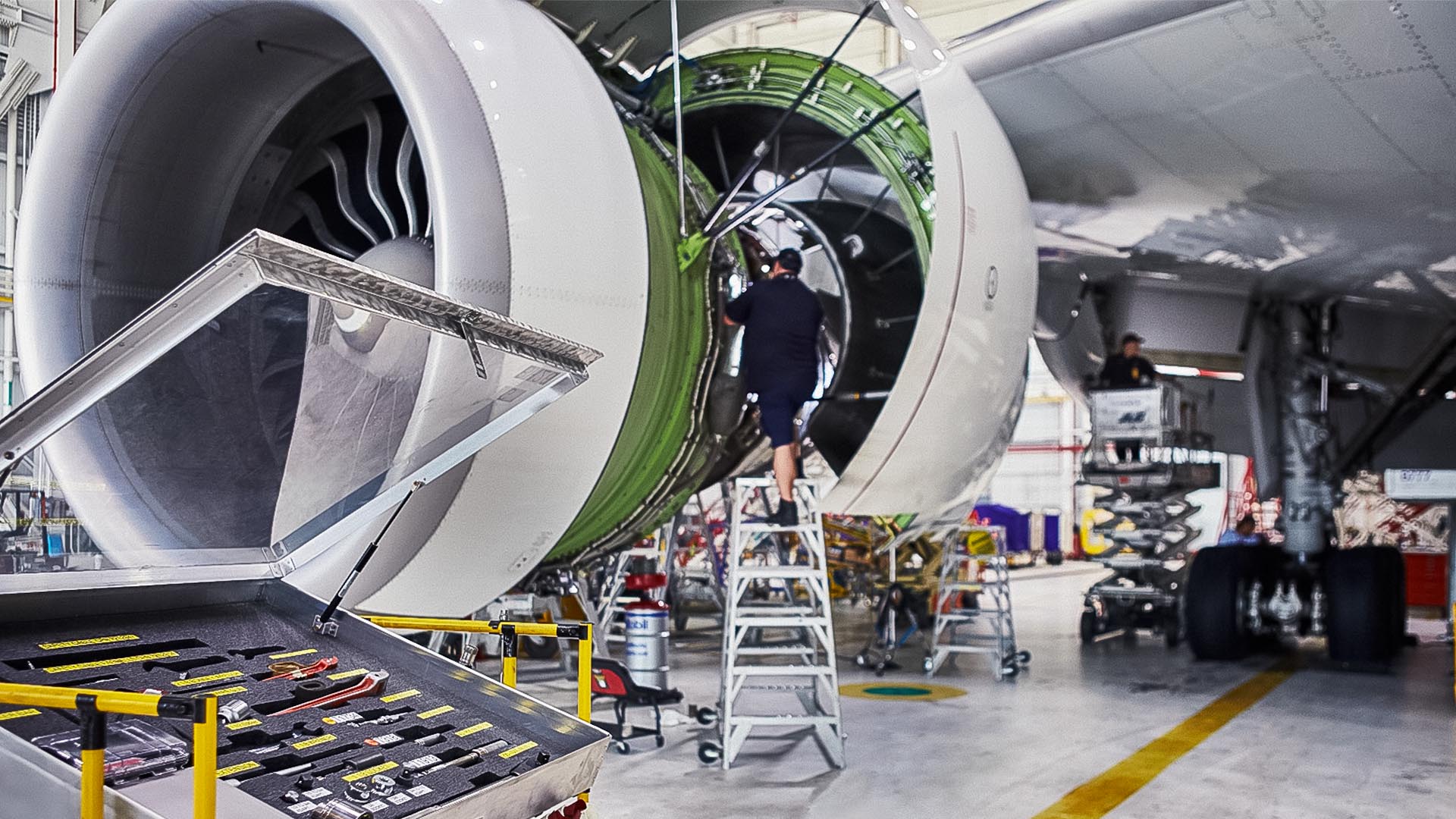
By any measure, the numbers are staggering: 570,000 parts, 20,000 flights each month. FedEx manages it all with help from GIS.

A Colorado-based railroad management company is maximizing asset value by using ArcGIS Field Maps and a custom GIS app.

After inventorying its roads, the city built a network schema to show where pavement needed to be replaced and how much it would cost.

The Inner West Light Rail, located in Sydney, Australia, runs for 8 miles predominantly along the corridor of a former freight railway line.

To improve road quality ratings, the City of Houston wanted more detailed data about its road surfaces. It turned to augmented reality.
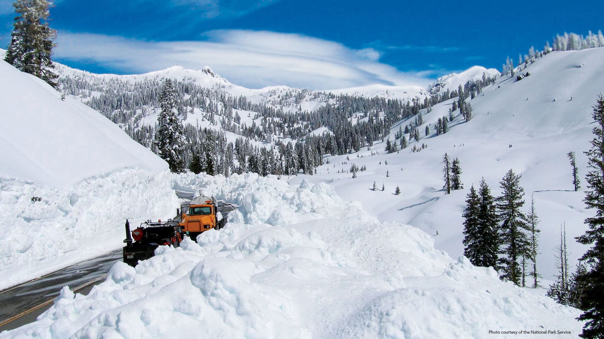
Winter storms pile snow onto Lassen Volcanic National Park’s Route 89. To plow it, field crews need precise maps—and a little bit of faith.
ArcGIS for Aviation is a new solution to support users in the aeronautical information management, air navigation service provider, and...