displaying 594 results
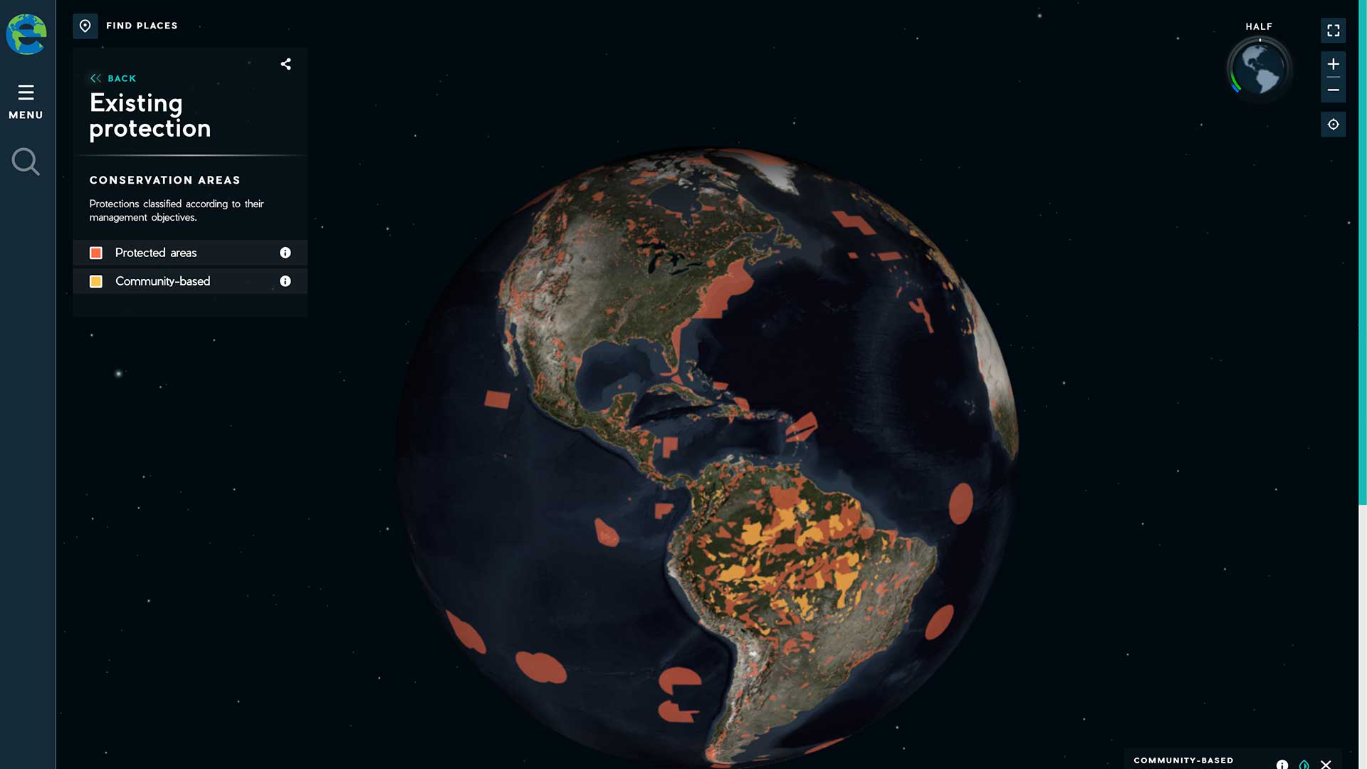
The Half-Earth Project, an initiative of the E.O. Wilson Biodiversity Foundation, advocates conserving half the earth’s lands and seas.

Esri supports the work of Jane Goodall and E.O. Wilson; CropScape data available; Esri and MobilEye partner.
Biodiversity, United Nations' Global Data Hub, GISCorps, Artificial Intelligence
The Chesapeake Conservancy is using raster analytics to perform land-cover updates using raster analytics in the cloud.
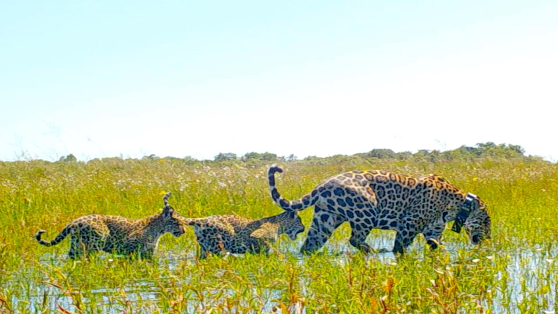
GIS-powered apps help researchers in Argentina reintroduce jaguars to Iberá National Park decades after the species went locally extinct.
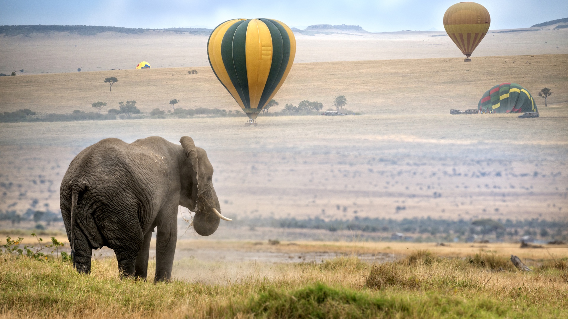
Researchers in Kenya’s Maasai Mara are working to create global awareness of the threats to the survival of Africa’s majestic elephants.
With GIS, indigenous people's spatial knowledge is incorporated into digital maps for conservation planning.
Local Voices, Local Choices: The Tacare , Measuring Up: The Business Case for GIS, Volume 3,

New books from Esri include GIS Tutorial for ArcGIS Pro 2.8 and GIS for Science, Volume 3: Maps for Saving the Planet.
Explorers and leaders met online with Esri president Jack Dangermond to talk about how they are advocating for and creating a sustainable future.
By 2020, it will be feasible to find GIS data for any park or other protected area in the United States.