“This will be the next man on the moon for the Port of Rotterdam,” predicts Erwin Rademaker, the program manager charged with ensuring that Europe’s largest port can accommodate autonomous ships by the year 2030.
In a world where autonomous cars already navigate the roads in several countries, Rademaker’s goal is to be ready when similar transportation technology takes to the water.
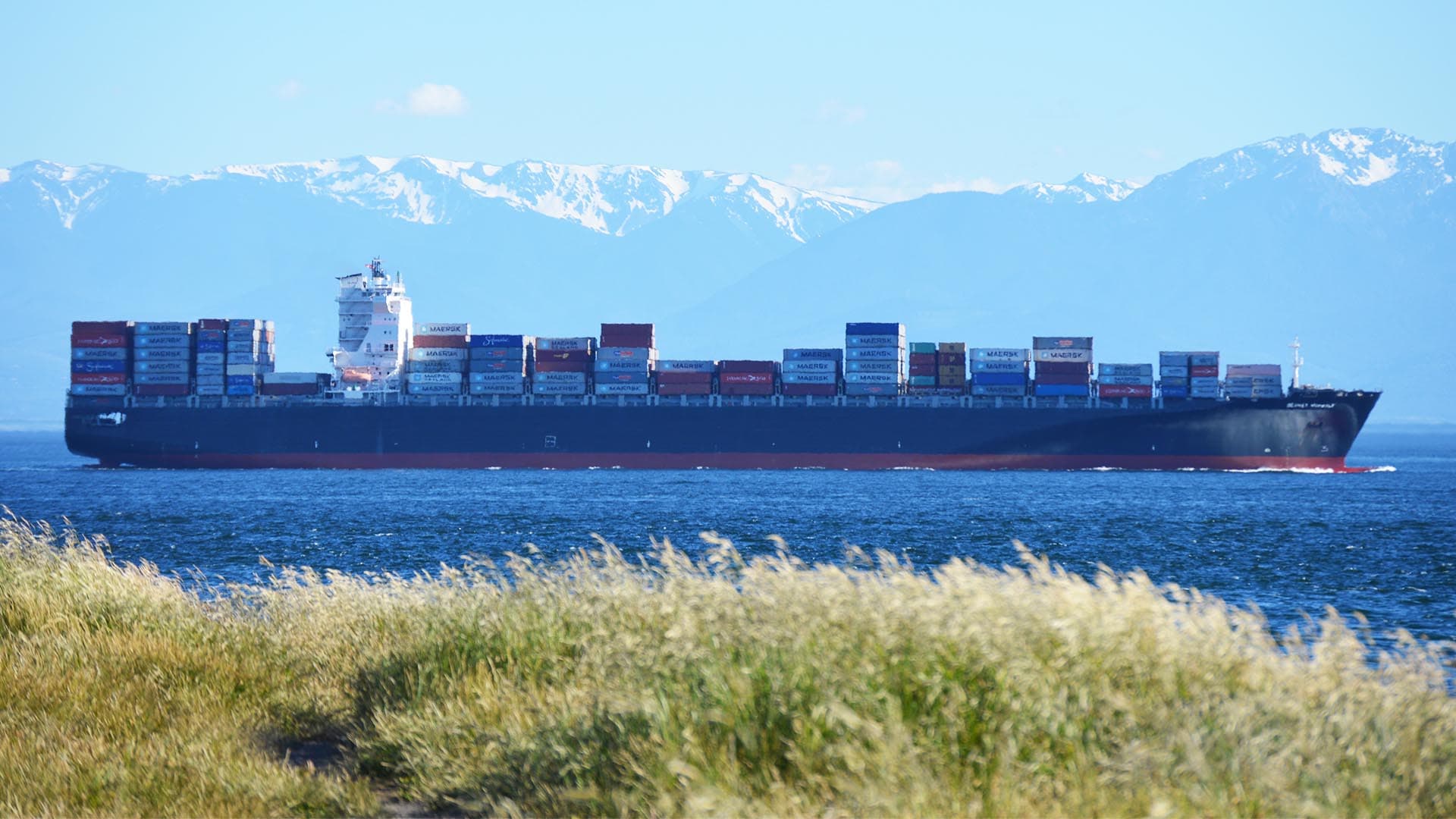
The Dutch city of Rotterdam is home to one of the oldest and largest ports in the world. The Port of Rotterdam stretches 26 miles near and along the River Maas, docks more than 140,000 vessels each year, and handles 461 million tons of cargo annually. The largest port in Europe, Rotterdam trails only a few Asian ports, including Shanghai and Singapore, in terms of traffic worldwide.
With roots tracing to the year 1340, the port is preparing for a future when heavily laden ships will sail into port sans pilots, their movements orchestrated by a fusion of high-tech applications ranging from artificial intelligence to location intelligence powered by a modern geographic information system (GIS).
“Speed and efficiency are essential to our business, and require us to use all of the data available to us,” says Paul Smits, CFO of the Port of Rotterdam Authority. “Thanks to real-time information about infrastructure, water, air, and more, we can enormously improve the service we provide to everyone who uses the port, and prepare to embrace the connected, autonomous shipping of the future.”
Rotterdam stays at the forefront of international shipping by consistently investing in infrastructure, typically spending as much as $230 million each year. But the captainless-ship venture is unlike anything the port has tackled before, Rademaker says.
Right now, every ship must have a captain onboard, regardless of how automated its operations. But in the near future, humans will not be required to captain ships, and the port needs to be ready, Rademaker says.
Norway Testing an Autonomous Ship
Automation has disrupted the automotive industry, and also promises big changes for shipbuilders and ports. Two Norwegian companies have built a $25 million ship that could navigate the seas on its own by 2020. Using location technology, sensors, and cameras, the ship—which costs about three times as much as a conventional vessel—would set sail initially with a pilot, much like the experimental autonomous cars venturing out on American roads now.
The agency that regulates water-borne shipping, the International Maritime Organization, could issue rules for crewless ships as early as 2020.
Others jumping into the movement include Rolls-Royce, the European Union’s Maritime Unmanned Navigation through Intelligence in Networks (MUNIN), and China’s Maritime Safety Administration and Wuhan University of Technology. All are fast-tracking autonomous ships.
One of Rotterdam’s sister ports, Singapore, recently announced its intentions to partner with a private company to build autonomous ships that would work in its harbor on operations such as towing, berthing, mooring, and channeling.
The logic is pretty simple: While fully automated ships are expensive to develop and build, they will become cheaper than conventional vessels over time because of reduced personnel costs and more efficient operations.
Developments in autonomous technologies have put all ports on notice that the future is fast approaching, and they’d better be ready. Rademaker compares the new wave of autonomous ships to the transition decades ago to color televisions.
“It’s like owning a TV shop right now that only sells black-and-white televisions and wondering why everyone is going to the shop next to you that is selling color TVs,” he says.
Rotterdam Undergoing Total Digital Transformation
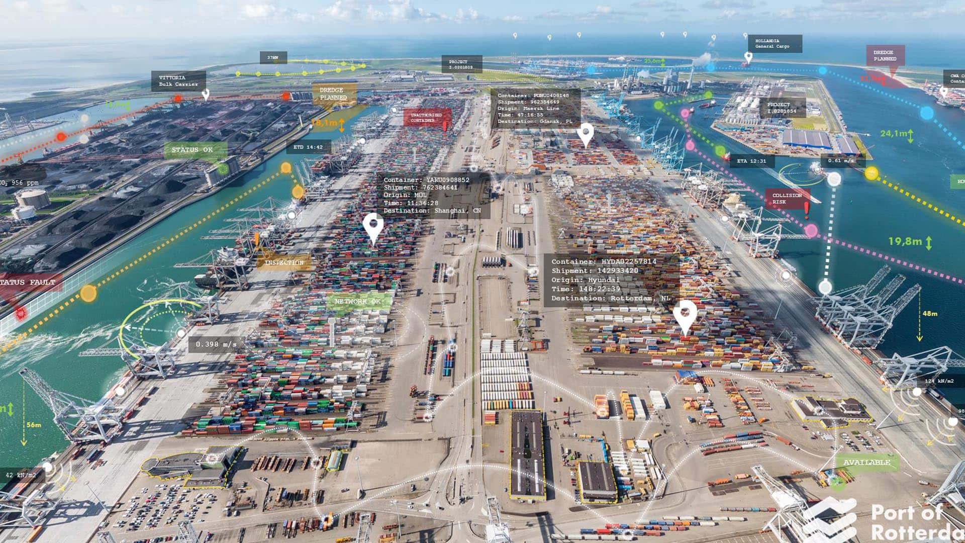
What Rademaker is overseeing is a total digital transformation of the Port of Rotterdam, with crews already installing sensors throughout the complex on land and in the water. Locations include berths, quay walls, roads, workstations—anywhere that might affect the efficiency and safety of the port.
The real-time devices, powered by the Internet of Things (IoT), will take in all types of data, including water temperatures, tidal conditions, the salinity of the sea, water currents, wind direction and speed, loading and unloading operations, and what berth space is available and when.
The information will be parsed by a program capable of real-time, big data analysis. Central to that examination will be a GIS that gathers, manages, and analyzes the port’s data, providing critically needed context. Through maps and simulations of the port’s assets and conditions—for instance, where its gantry cranes are located at a particular moment, or how close a ship is to a quay wall—GIS reveals insights that raw data might not provide, including patterns and relationships in real time. That not only helps port managers run more efficient operations today, it will also serve as a pillar of tomorrow’s world of autonomous ships.
GIS, Rademaker says, will provide what amounts to a 4D perspective, using both 3D localization (x, y, z) and dimensions (height, weight, width) of objects, plus time. When it is operational, there will be no room for error.
“What the maritime industry of the future will demand is hyper-precise, standardized, secure, and reliable port data with real-time information about the conditions in the port, whether it is the water heights, tidal streams, or wind conditions,” he says.
These up-to-the-second capabilities are similar to what is going on in the realm of autonomous cars. Driverless vehicles need real-time information to keep their passengers safe under changing driving conditions—just as an arriving or departing ship must know exactly what’s happening around it at all times.
Rademaker uses the example of a simple tumbler of water to underline the importance of GIS to the port. Place the glass on the middle of a table and it is safe. But move it to the edge and it is in danger of falling off, even though its dimensions and contents remain unchanged. He then suggests the glass is filled with boiling water and sitting on the edge, with a baby crawling beneath it on the floor. “Then we know this glass of water in this context becomes a big risk,” he explains.
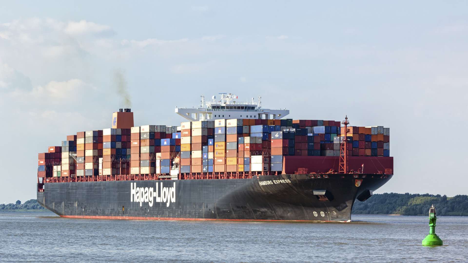
Replace the glass of water with a 1,200-foot-long container ship holding some 21,000 TEUs, or 20-foot containers of cargo, and place it in the Port of Rotterdam with dozens of similarly sized vessels—all of them moving in different directions. Then the enormity of the project and the importance of geographic context comes into focus, Rademaker says.
The stakes are high for every venture Rotterdam takes on because the port acts as a gateway to more than 500 million European consumers and a global supply chain, and accounts for 3.3 percent of the Dutch GNP.
Creating a Digital Twin
To reach the ultimate goal of being the first port in the world to accept autonomous ships, the Rotterdam team is working to create a digital twin of the port.
Rotterdam’s GIS-powered digital twin would allow port managers to view the operations of all the primary players (see sidebar for more on a port’s operations). It would provide an accurate, current picture of what is going on in the port, everything from the weather to how many ships are sailing about, their speed, and where they are headed. Simulations would be run digitally to improve efficiency and save money in the real port.
Rotterdam officials anticipate being able to pinpoint the best times for ships to berth and offload or take on cargo, because the digital twin simulations will give them the optimal water depths and berth vacancies, among other variables.
Rademaker says an autonomous ship will be able to digest all types of information once it enters the port. For instance, the ship will contact a berth about availability and be told whether there is a vacancy. Included in that virtual conversation will be details such as ship speed and water conditions, factors which could determine whether the vessel should slow down or go faster. “This,” he says, “is the future way of communication for fully autonomous vessels.”
Restructuring the port, while enormously difficult, is not unprecedented for Rotterdam. Officials spent $1.8 billion expanding and enhancing the port during a project dubbed Maasvlakte2, which reclaimed land from the sea. Another major improvement was updating the existing GIS to improve efficiency and accurately map the port’s total land area for decades to come.
The previous setup was too slow to communicate, which would be a fatal flaw in a port catering to autonomous ships. The various systems used to manage operations could not talk easily to each other. Eventually, the new GIS was tied to all the other apps, greatly reducing redundancy and speeding up workflows. In fact, the port stipulated that finding any port asset in the GIS should take no more than three mouse clicks or touchscreen taps.

The new approach allowed the port to phase out 49 systems and centralize access to asset information and administrative records and finances, with overlays of maps. That gave everyone involved with operations the same picture at the same time—the canvas on which to build the port’s digital twin.
Sailing into the Future
Every move made at the port, Rademaker says, is about keeping the place viable well into the future. He compared the previous port expansions, Maasvlakte and Maasvlakte2, to an oil refinery, where a company makes a major investment with the idea that the facilities will last 25 to 50 years. “This is why we focus on the long term,” he says. “It’s in our genes.”
Budgetary considerations aside, the stakes are high for every venture Rotterdam takes on because the port acts as a gateway to more than 500 million European consumers and accounts for 3.3 percent of the Dutch GNP.
The idea, Rademaker says, is to get ahead of the competition and stay there by using all the technology available. It’s also about survival. “When autonomous ships come in to ports that can’t handle them,” he says, “you’re out of business.”
(To learn more about how leading businesses are leveraging the IoT and location intelligence, visit this eBook.)
The Esri Brief
Trending insights from WhereNext and other leading publicationsTrending articles

December 5, 2024 |
November 18, 2025 |
November 12, 2018 |

July 25, 2023 |

January 6, 2026 |

December 22, 2025 |