Golf, a favored pastime of the C-suite, is a game of perspectives. To win requires inch-perfect precision on short putts, explosive power on long drives, and the wisdom of seeing each swing, even bad ones, as part of an 18-hole story.
“It’s not one shot,” says Steve Anderson, senior vice president of technology enablement at design and engineering firm VHB. “It’s the overall game that makes a difference.”
Anderson began playing golf at age five, won his first tournament by nine, and placed second in the NCAA championship as a college freshman. He even contemplated going pro.
Instead, he parlayed the patience and perspective he learned on the links into a larger professional goal: pushing the envelope on digital innovation in the architecture, engineering, and construction (AEC) industry.
At VHB, the senior vice president has become an influential advocate for enterprise mapping and analytics—using geographic information system (GIS) technology to power data sharing and produce insights. Across the many services VHB offers its clients—including land development, infrastructure planning, engineering design, and energy installations—maps are a common language for problem-solving and complex analysis.
How Spatial Analytics and AI Are Speeding Up Solar Solutions
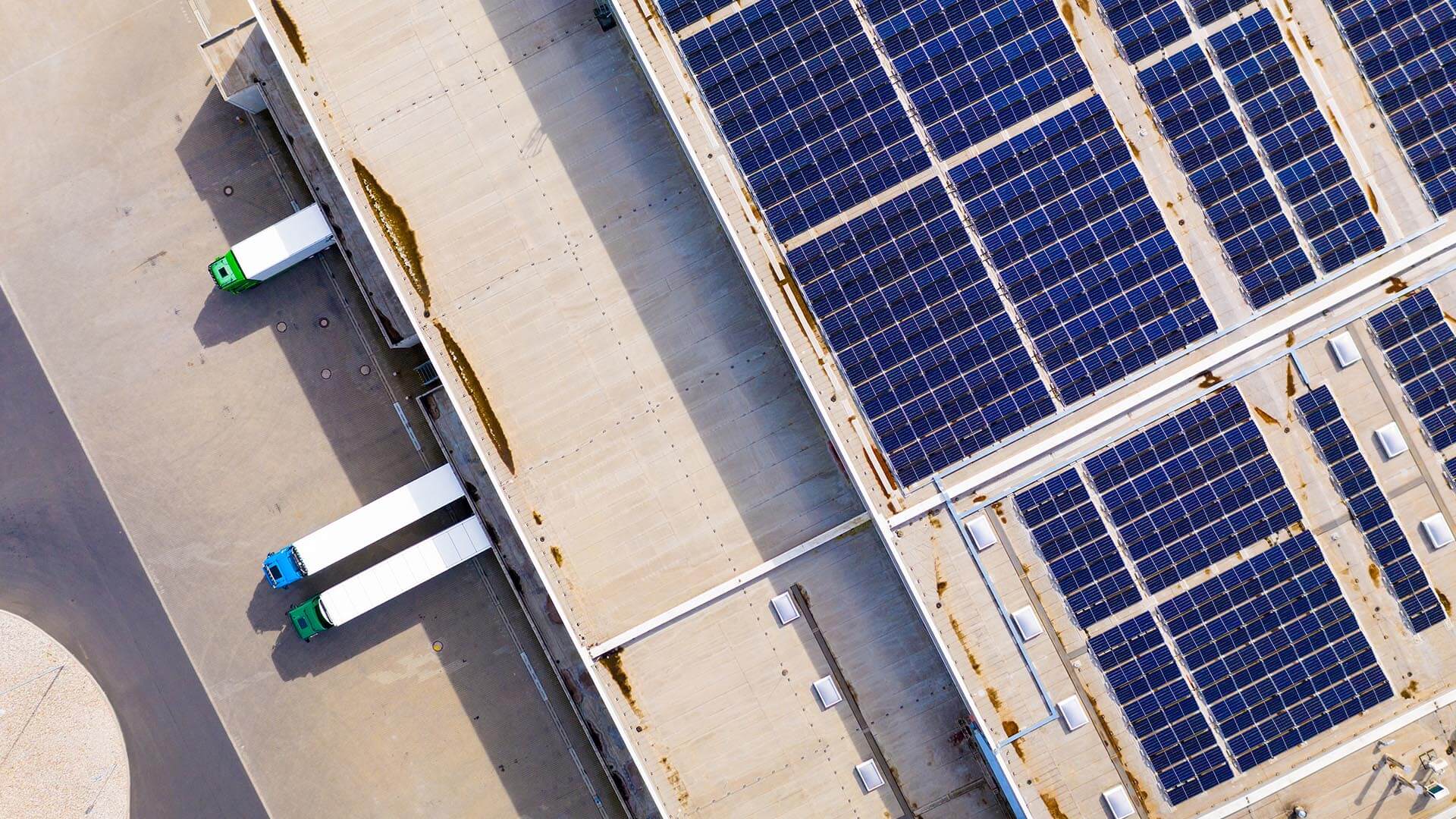
Anderson recently oversaw the rapid development of a tool that’s become a new source of strength for the firm: planning and building on-site solar systems.
The program, Net+, accelerates the process of solar system site selection for clients like Tier 1 research universities, healthcare corporations, transit agencies, and others seeking the highest, best use of their landholdings.
Through spatial analytics, AI, and predictive modeling, the application identifies parcels with the highest solar potential across large real estate portfolios—even entire cities or states. Using historic data to estimate the power production and ROI of solar array installations, Net+ shaves weeks off traditional feasibility assessments. The solar systems themselves, which typically provide lower costs of delivered energy than utilities, can add up to millions in savings for organizations that install them.
“The ability to run that process on every single parcel that you own in a very reasonable amount of time provides a lot of value,” Anderson says. “Now you have the data to actually make a decision.”

When we have these tools, it makes it easier just to walk in the door and say, ‘This is how much solar you can produce.’
Innovation Fueled by an Enterprise Approach to GIS
On the greens, Anderson excels at solo competition. On the job, his métier is connection and collaboration. Assembling Net+’s technological tools and team—GIS analysts, software programmers, energy experts, engineers—required an intuitive feel for building a technology product. Anderson also brought an intimate understanding of VHB’s market opportunities and ways of working.
“He’s one of those unique people who understands business processes,” says Joel Serface, VHB’s director of energy innovation, who helped envision and build Net+. “He connects the dots between things that need to be correlated, and he identifies ways to go and develop solutions.”
For Anderson, a former surveyor with a background in computer science, GIS was a natural fit for organizing and analyzing data about the built environment, which factors prominently in VHB’s work. In addition to consulting on energy installations, the firm’s 2,300 employees apply engineering expertise to transportation planning projects, land development, environmental studies, and infrastructure planning and design.
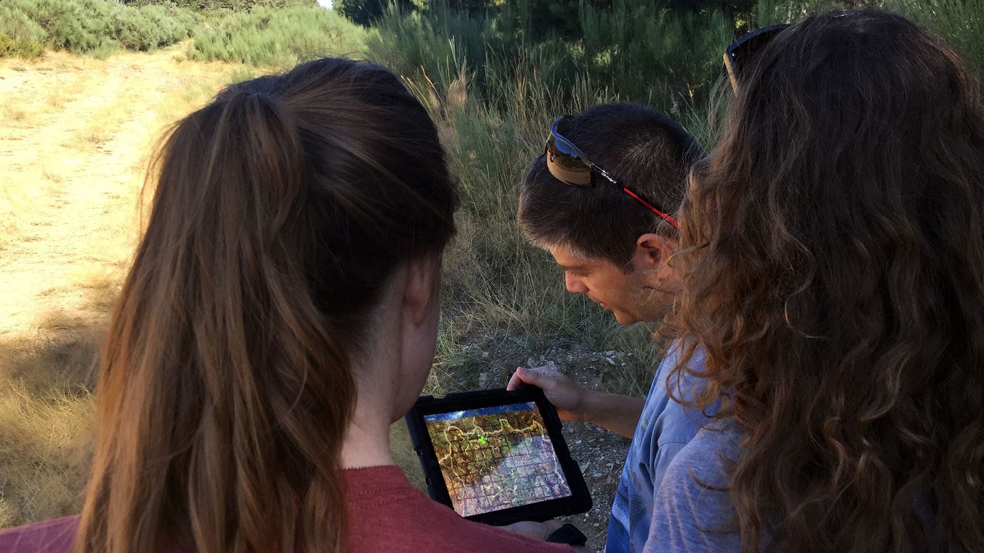
At the core of several critical VHB applications is GeoVHB: a geospatial library that integrates thousands of datasets from local, state, and federal government agencies. VHB engineers and designers build tools on top of GIS hubs like GeoVHB to speed the pace of analysis and communication. For instance, teams in the field collect data on wetlands and soil types through mobile GIS apps, while VHB’s geomatics team uses GIS dashboards to manage projects and monitor company vehicles.
GIS has become the enterprise mapping and analytics system for around 1,600 employees. “We try to really embed it in everything that we do and treat it as a true enterprise system, an enterprise platform,” Anderson says.
For Net+, Anderson and Serface took advantage of the deep learning models embedded in advanced GIS systems—a capability also known as geospatial AI. By integrating additional AI technology and building information modeling (BIM) software, VHB’s team brought more accurate information and visuals to client conversations than had ever been possible before.

[GIS] is embedded into business systems where some of the people don’t even realize that’s what they’re using. It’s just giving them the answers they’re looking for.
Training Deep Learning Models to “Read” the Landscape
In the past, a company might be approached by a solar developer who would site the panels and reap the revenue of any extra production. Alternatively, an agency might issue an RFP for solar feasibility studies and wait for AEC firms to submit proposals and reports. Both scenarios could be inefficient.
With Net+, clients see 3D simulations of a solar installation as it would look on a given property. That analysis is the result of the VHB team’s work training geospatial AI to “read” the land data in GIS. After countless iterations, the tool can now recognize which parcels of land have the correct traits—sun exposure, elevation, land type—to support solar power generation.
Anderson and team further trained the deep learning models to match parcels with the most suitable types of solar installations: a ground system for a grassy right-of-way off a major highway; a canopy system for a hospital’s converted parking lot; a rooftop installation for a real estate developer’s downtown condominium.
“Using that modeling tool made it so much faster to be able to say, ‘This is how you can transition your system from an energy user to an energy producer,’” Serface notes.
The AI tools also save time by recognizing disqualifying features like floodplains, wetlands, and rooftop air conditioning units. The Net+ application can even account for shadows in urban areas, calculating their effect on solar generation.
“We’ve modeled the way [a] system could operate in the future,” Serface says. “And the only way to be able to do that and go through that entire complexity and the entire life cycle is by having advanced systems go do the analytics. Those are all geospatial, 3D, AI types of approaches.”
If It’s Worth Doing Once . . . It’s Worth Doing a Thousand Times
Anderson was part of the hiring team that brought on Serface—an energy entrepreneur and veteran of the venture capital world. The two men bonded over a belief that if someone can do something special or unique, the organization should find a way to do it “a thousand more times” through automation.
Solar feasibility studies were an undertaking ripe for this approach. Serface proposed the idea of a tool that would replicate the thought process of an engineer who could site solar panels and calculate power potential. Anderson coordinated the talent and resources within VHB to get the project running, and orchestrated the app’s development.
Within six weeks, they had mapped out the project’s workflows. Within nine months, they had completed research and begun building prototypes so they could gather feedback from engineers. By the end of the year, they were starting to introduce the tool to clients. Without Anderson’s unique blend of talents, “this probably would not have gotten off the ground,” Serface says.
The Joy of Complex Problem-Solving
For Anderson, a technology challenge like Net+ and a round of golf both satisfy an innate urge: to solve difficult problems. At times, lessons from golf have informed his work—like keeping his cool when nothing seems to be going right.
At other times, he approaches a tough hole with the eye of a GIS analyst—evaluating the topography of the fairway, the direction of the wind, the height of the grass, the weight of the club. In a way, Anderson replicated the process of “reading” the greens when he used geospatial AI tools to create Net+.
“It’s like a mental challenge for me,” says Anderson of what draws him to golf. “Like technology innovation, it’s a pretty complex problem to solve, and when you do it all right, it’s like, oh—that was pretty fun.”
The Esri Brief
Trending insights from WhereNext and other leading publicationsTrending articles

December 5, 2024 |

March 3, 2026 |

June 23, 2026 |

March 17, 2026 |

April 7, 2026 |

June 9, 2026 |