March 18, 2025 | Alexander Martonik | Sustainability & Risk Designing for Resilience in the Corporate Sector
October 10, 2023 | Multiple Authors | New Analyst A Location-Savvy Group behind the Construction Boom
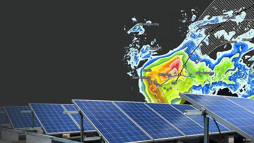
March 21, 2023 | Alexander Martonik | Data and AI NextTech: Predicting Storm Impacts with Location Analytics, AI
October 4, 2022 | Alexander Martonik | Sustainability & Risk 9 in 10 Large Companies Have Assets Located in Path of Climate Hazards
September 15, 2022 | Chris Chiappinelli | Webcasts How Experts Spot Risks and Build Resilience for Their Companies
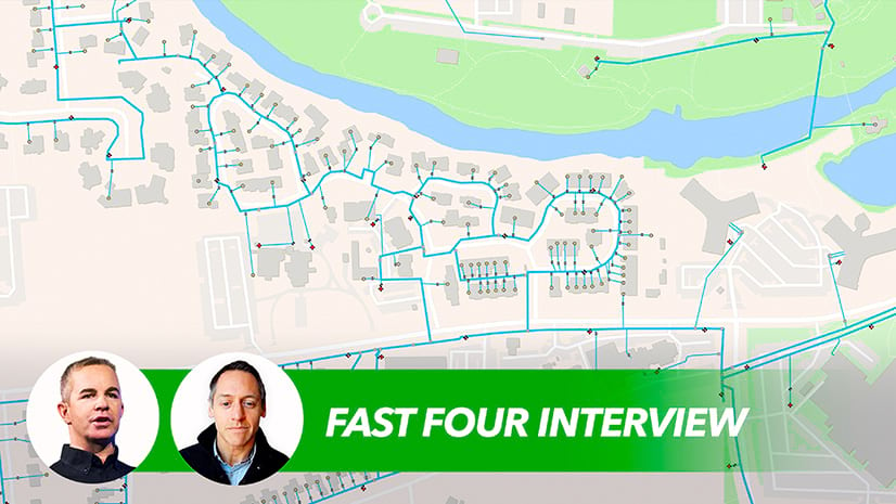
May 24, 2022 | Multiple Authors | Emerging Technologies Fast Four: Utilities Juggle Resilience, Net-Zero Goals
September 23, 2021 | Chris Chiappinelli | CXO Priorities An Executive View of Sustainability—Resilience and Reduction