Farmers and sailors once relied on weather vanes for rudimentary predictive insights. A sudden swing of the arrow from east to west, for instance, could signal pressure changes that foretold a coming storm.
Today, a sophisticated blend of location technology and AI gives business leaders a next-level capability: to predict not only where weather might strike, but the probability that certain conditions will cause damage to specific assets.
Utilities, telecommunications firms, oil and gas operators, insurance companies, and others already use geographic information system (GIS) technology to map and analyze weather impacts.
With the predictive powers of geospatial AI, they’re moving beyond reactive damage assessment to proactive risk mitigation, enabling organizations to protect critical infrastructure and maintain operations even in the face of natural perils like wildfires or storms.
Seeing Weather Impacts Before They Arrive
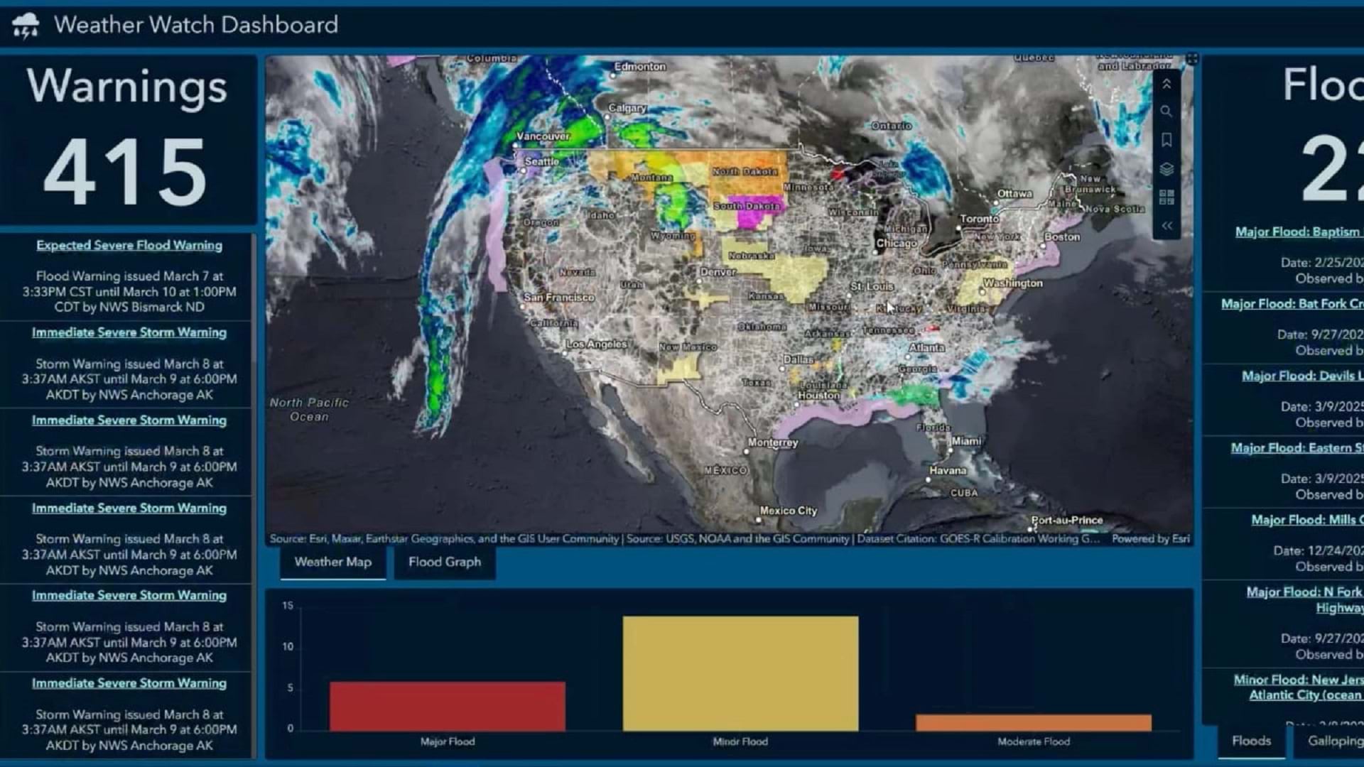
This video demonstrates how a utility company could draw on the analytical and visualization resources of geospatial AI to improve winter storm preparedness.
The faint white lines on the map represent North America’s transmission network—a vast, fragmented power grid comprising 500,000 miles of high-voltage lines.
Transmission lines deliver electricity to substations across long distances, and losing one to inclement weather is a major event, spelling power disruption for businesses and communities. Of all largescale power outages between 2000 and 2023, roughly a quarter were caused by winter storms, according to the nonprofit Climate Central.
As a storm gathers hundreds of miles away, an operations manager at a utility company could turn to a GIS dashboard to forecast where three weather patterns will intersect: below-freezing temperatures, precipitation, and high winds. The combination of these factors can produce an effect known as “galloping,” in which power lines laden with ice begin undulating in high winds. This can lead to outages or collapsed power poles.
Based on historical weather data and the geographic layout of the network, the AI algorithm predicts an 88 percent chance that galloping will occur in one section of transmission line in Walworth County, Wisconsin.
Utility managers could automate this search to find all transmission lines in the Upper Midwest with at least a 60 percent chance of sustaining damage. A GIS-enabled security operations center could share this location intelligence with local crews and have emergency response teams prepped for action, which can reduce outage times for customers.
In the aftermath of such an event, GIS professionals gauge the accuracy of predictions and use that information to teach AI systems, helping improve future assessments.
Risk Planning Through Predictive Analysis
AI-driven predictive capabilities are built into advanced GIS technology. For more specialized business challenges, some companies bring outside AI models into GIS. In this example, the winter storm analysis was aided by IBM’s Watson.
While the demo focuses on risks utilities face from winter storms, the same geospatial AI functionality is broadly applicable for many industries and hazards.
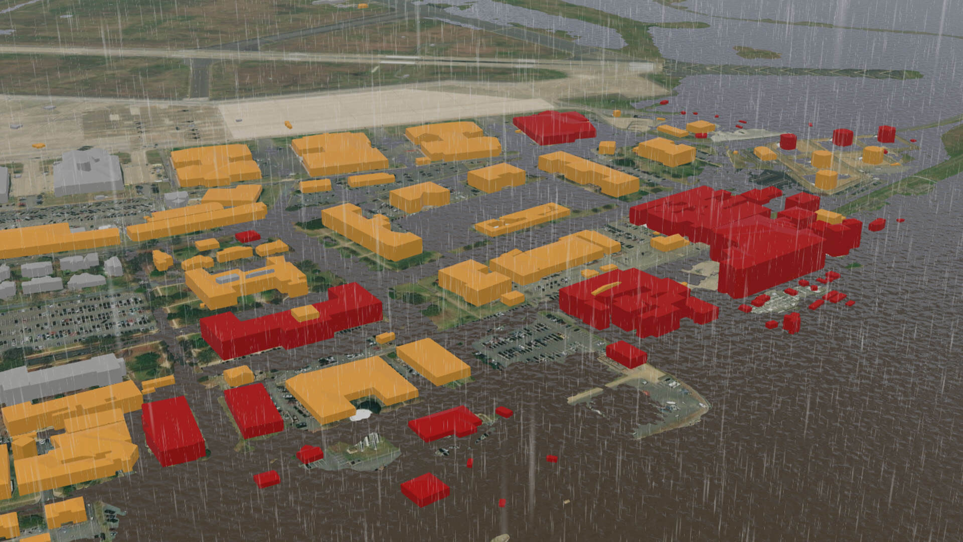
A forestry company can use predictive analysis to evaluate wildfire risk based on intersecting patterns of humidity, vegetation type, heat, and precipitation. For a real estate management firm with a coastal focus, a geospatial AI analysis of rainfall, high tides, erosion, and storm surges can help planners determine the probability of flooding throughout the portfolio.
If an ounce of prevention is worth a pound of cure, geospatial AI puts precision into weather preparedness, enabling leaders to protect their organization’s most critical assets. By identifying at-risk locations before disasters strike, businesses can shift from expensive emergency response to strategic, cost-effective preparation.
The Esri Brief
Trending insights from WhereNext and other leading publicationsTrending articles

December 5, 2024 |

June 23, 2026 |

March 3, 2026 |

April 7, 2026 |

March 17, 2026 |

June 2, 2026 |