displaying 71 results
Explore how ArcGIS technology empowers companies to grasp and navigate the impacts of rural broadband deployment.

Esri partners facilitate and streamline workflows and management of a variety of community management projects.

Water and Sewer Company of Thessaloniki S.A. (EYATH) integrated infrastructure and customer aspects of the business using GIS.
Learn how to leverage the power of enterprise GIS to engage with stakeholders and management to make key business decisions.

An AI-powered pipe inspection app, when paired with a dynamic tool built in ArcGIS, shows utilities a complete overview of their networks.
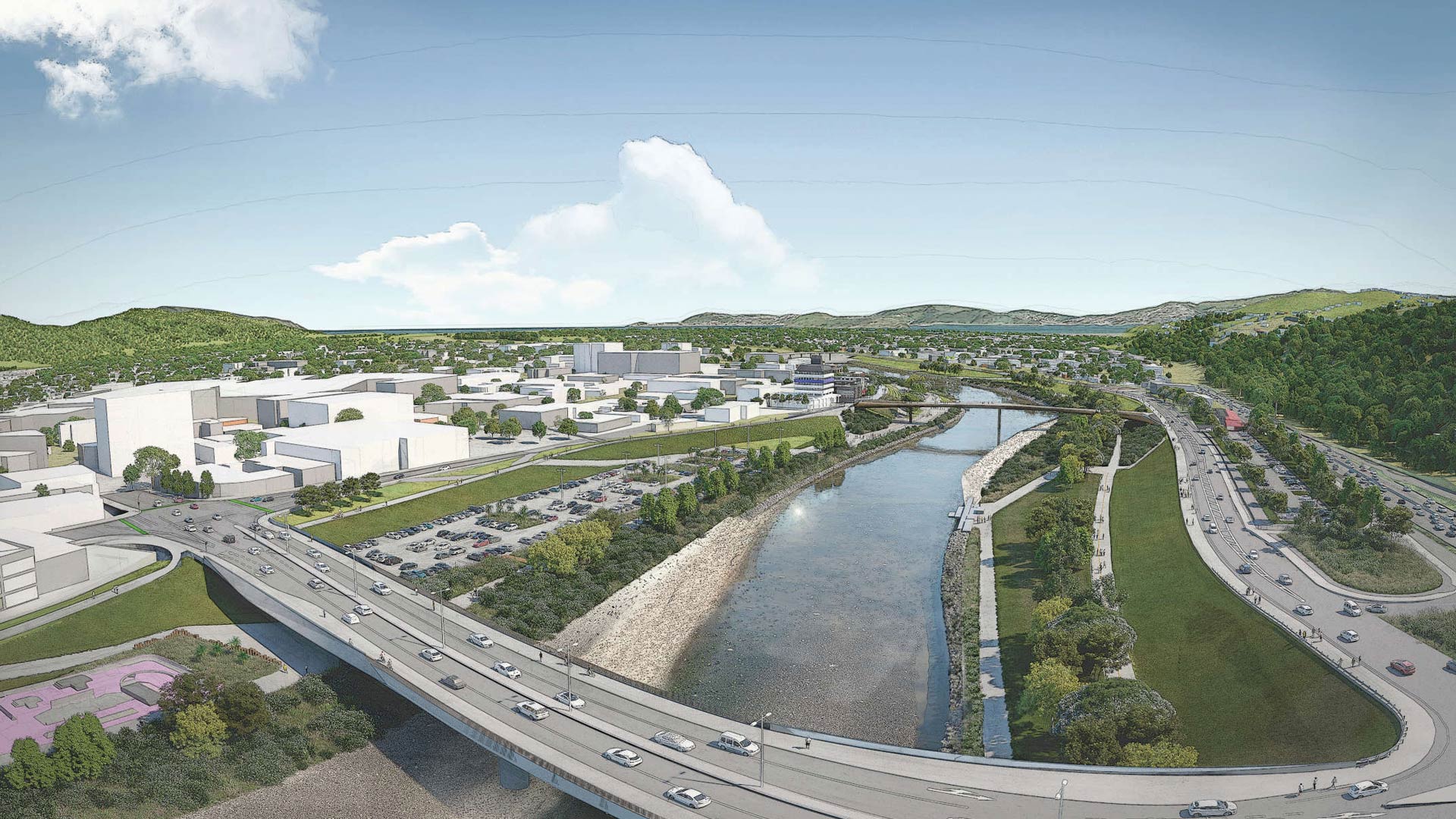
Esri startup partner Reveal helped a New Zealand community with flood protection, transportation upgrades, and urban revitalization.
Utilities are transitioning toward distributed grids to promote sustainable communities with renewable resources.

GIS is essential to helping utilities and governments replace lead service lines to comply with US Environmental Protection Agency regulations.

With Gilytics’ GIS-based platform, Pathfinder, companies can optimize design, routing, and stakeholder engagement.

To track assets and workflows along with customer billing information, Sunriver Utilities turned to Elements XS from Esri partner Novotx.

For utilities with robust GIS infrastructure, using ArcGIS Monitor to track system performance and resources keeps things running smoothly.
Energy usage in the US in 2021 was 100 quadrillion BTUs. 80% are from fossil fuels. Utilities will be busy decarbonizing. GIS will help them.