We all work with data. Whether our roles have “GIS”, “cartographer”, “analyst”, “data scientist”, or “developer” in the name, data is likely fundamental to what we do.
And while we often see examples of work that has perfectly curated data ready to be beautifully mapped, intricately analyzed, or turned into the perfect app, the truth is that there’s a messy part of our jobs that takes the most time: Exploring and preparing the data.
So… what if instead of hiding this messy part of our jobs, we highlighted it, made more tools for it, and made it productive and more fun?
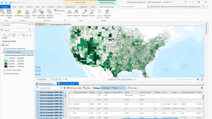
Introducing the Data Engineering view in ArcGIS Pro. An experience that makes exploration and preparation of your data much more productive and intuitive. It is a view that focuses on the fields in your data, giving options to see data quality metrics and see information about the attributes you’re working with. The following video shows you how to get started:
There’s also a ribbon that provides easy access to geoprocessing tools in four categories: clean, construct, integrate, and format.

It’s for every GIS user.
The data engineering view is not just for experienced data scientists: anyone that needs to work with data in ArcGIS Pro can use it. We designed it to work well in conjunction with your attribute table, fields view, and map views.
No additional licenses required.
You can access it in ArcGIS Pro 2.8 or later; no additional licenses required.
What’s next? A season of content.
Over the next few months, you’ll see a variety of videos and blog posts that will help you learn how to improve your data exploration and preparation workflows in the Data Engineering View. We hope you enjoy and learn a lot with us. Stay tuned for our next video!
View more resources about how to use Data Engineering


Article Discussion: