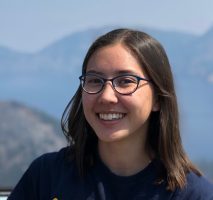
Elena Hartley
Science Illustrator. While studying geology and chemistry at Oberlin College, I spent a lot of time drawing cartoons. My interest in art and science got me involved with a science magazine on campus and from there, I decided to pursue a career in science illustration. After college, I earned a Certificate of Science Illustration from the California State University, Monterey Bay. During the summer of 2019, I interned with ESRI on the ArcGIS Maps for Creative Cloud © team as a science illustrator, using creative maps to tell interesting stories.

