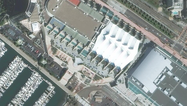
Over the last ten years, the GIS community has seen an explosion of beautiful, high-resolution multi-spectral imagery, with very rich color fidelity, and very high pixel resolution. Lawrie Jordan, Esri’s Director of Imagery, has called this platinum age of imagery: “The Dawn of a New Era.”
Still, with broad access to commercial high-resolution imagery now largely available, how do you purchase, store, manage, and update a global imagery map? More so, how do you appropriately budget for the purchase of global imagery updates each year in addition to the software, services, and staff needed to execute on your projects? As an ArcGIS user, Esri does much of this work for you.
Esri curates and hosts the World Imagery map, which is built with a variety of best-available imagery from both commercial sources and the ArcGIS users community, through the Esri Community Maps program. This is our primary foundation layer for extracting and monitoring the essential elements of GIS, such as terrain, elevation, buildings, roads, land use, land cover, boundaries, parcels, water, hydrology, etc. Imagery makes GIS current. So, the initial mapping of these features and their changes over time that comprise the consistent updates to your GIS would not be possible at the scale and accuracy that we expect today without this broad access to imagery and imagery-derived foundation layers.
Esri will soon update our World Imagery map with exquisite new content acquired through a new subscription to DigitalGlobe’s current and complete high-resolution satellite imagery mosaics for the entire world. This multi-year subscription represents more than 200 million square kilometers of imagery from DigitalGlobe’s Basemap +Vivid and Basemap +Metro products, which will start flowing into World Imagery map later this year. These updates will benefit all Esri users across state & local government, utilities, oil & gas, agriculture & forestry, insurance, asset management, and conservation & education.

For users who need to access an accurate, high-resolution imagery basemap as a backdrop for their GIS, the ArcGIS Online World Imagery map is the perfect solution, ideal for the imagery visualization needed to perform updates to parcel maps or validate insurance claims. For users that need to deploy this type of imagery on-premises, we have a solution for that too, the Data Appliance for ArcGIS.
Many other users, however, need access to raw imagery for more sophisticated analytic processing for land cover classification or change detection analysis. To help service this need, Esri and DigitalGlobe will work together over the coming months to explore new ways to connect Esri’s ArcGIS Online technology and marketplace to DigitalGlobe’s Geospatial Big Data platform, GBDX, to allow advanced users to perform sophisticated analytics against the world’s largest library of high-resolution commercial satellite imagery. We can’t wait to see what new products and applications the GIS community will create with these new tools at their fingertips.
Stay tuned for more updates and advancements over the coming months!


Article Discussion: