We are pleased to announce the beta of Drone2Map for ArcGIS is available from the Early Adopter Community.
With Drone2Map, you have the power to take imagery direct from a drone and create stunning imagery products the same day it was flown. No longer do you need to rely on imagery experts to process imagery for you. Gone is the long wait between imagery refreshes in your organization.
Camera parameters are automatically detected, intelligent defaults are set through the use of processing templates, and caching parameters applied all without having to know the specifications of your imagery. For the imagery professional, Drone2Map provides the right dials that can be turned to fine tune the results and produce the level of accuracy required for professional applications.
Drone2Map is a powerful easy to use App
Drone2Map for ArcGIS is a 64 bit desktop app that runs side by side with ArcGIS Desktop. It leverages your ArcGIS named user to streamline sharing of products throughout the ArcGIS platform. Drone2Map leverages multiple cores, RAM, and GPU to process your data fast.
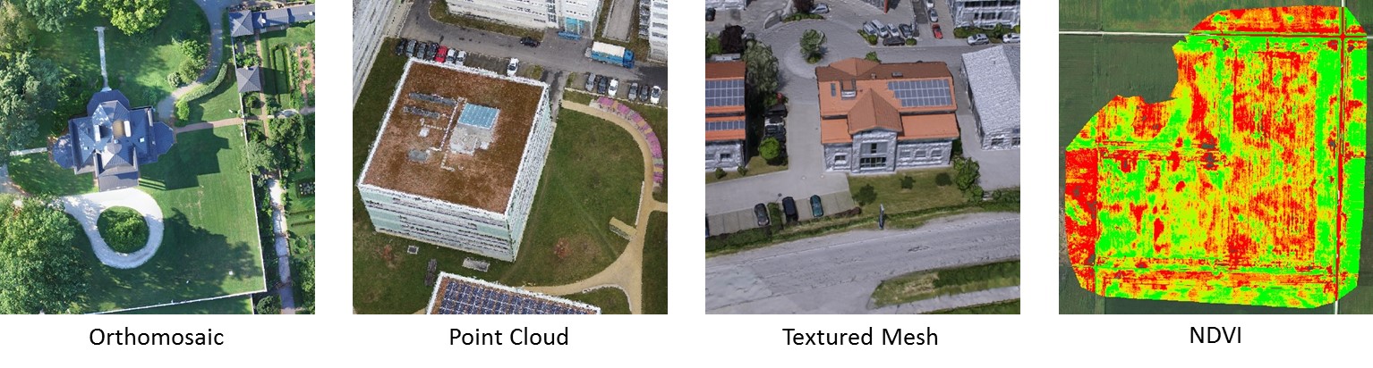
Produce stunning 2D and 3D Products
Drone2Map turns raw still imagery from drones into orthomosaics, Digital Surface Models, Point Clouds, 3D meshes, tile images, and more, in ArcGIS.
Share and Analyze Drone2Map Products
Drone2Map streamlines the sharing and analysis experience of drone captured imagery. Direct from Drone2Map, publish your 2D imagery as Tile layers in ArcGIS Online. Quickly add orthomosaics and point clouds to ArcGIS Desktop for further analysis.
Since Drone2Map is a part of ArcGIS, products just work throughout the platform.
Be a part of shaping the next release of Drone2Map
We are hard at work adding exciting new functionality to Drone2Map, and would love to hear your feedback on how we can improve this app. By joining the beta, you will have access to sample data to test Drone2Map, forums to share your experience and learn from other experts in your field, as well as log bugs and enhancements to make Drone2Map solid in its first commercial release.
So please join the thousands of others who have already joined the Drone2Map beta community by signing up at:
We look forward to hearing your feedback!

Article Discussion: