Esri World Elevation Layers are enhanced with more detailed void-free 1 arc-second (~ 30 meters) SRTM data (Version 3.0) from NASA for South America, Western Europe, Central America and Caribbean Islands. With this update, there is now 3 times more detail in these areas.
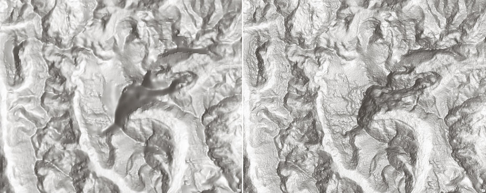 Aconcagua, Argentina—the highest peak in South America at 6,962 m (22,841 ft) above sea level (SRTM 90m vs SRTM 30m)
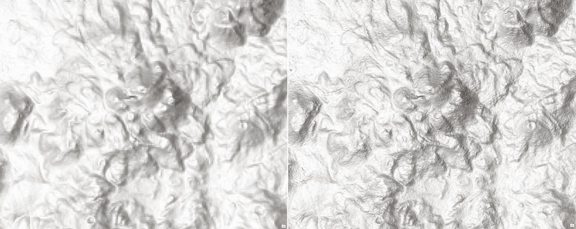 Ojos del Salado—the highest active volcano in the world at 6,893 m (22,615 ft) on the Argentina–Chile border (SRTM 90m vs SRTM 30m)
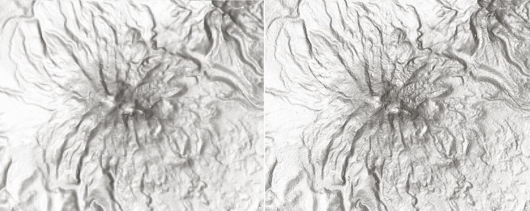 Chimborazo, Ecuador—an inactive stratovolcano and highest peak in Ecuador at 6,268 m (20,564 ft) above sea level (SRTM 90m vs SRTM 30m)
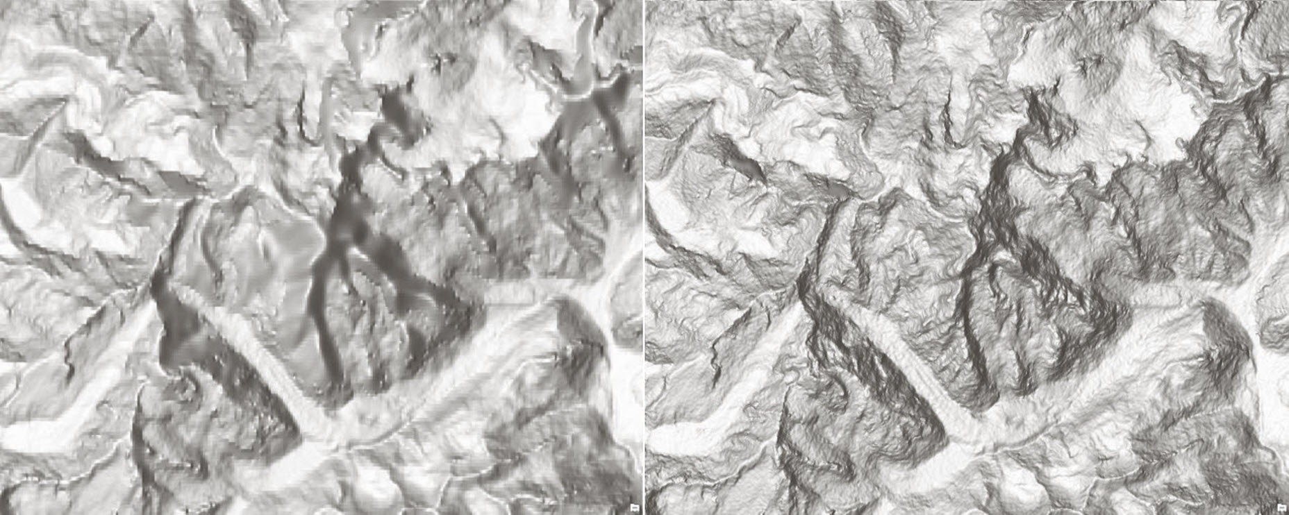 Mont Blanc—the highest peak in the Alps, Europe, at 4,810 m (15,781 ft) above sea level (SRTM 90m vs SRTM 30m)
Our dynamic world elevation image services (Terrain and TopoBathy) are not just for visualization (such as multi-directional hillshade, tinted hillshade) but provide access to raw elevation values and derivatives (such as slope, aspect) for analysis. Access to these global layers is free and does not consume any credits; all you need is an ArcGIS Organizational account. It’s that easy!
Previously released Africa is also refreshed with void-free SRTM 30m (Version 3.0) from NASA in this update. Stay tuned for updates on Asia and Australia.
For more information about the coverage of the World Elevation services please check out our Elevation coverage map.
by Rajinder Nagi, Lead Community Elevation


Article Discussion: