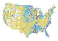
The Living Atlas is the foremost collection of authoritative, ready-to-use global geographic information ever assembled. The themed content in the Living Atlas is curated from the best content available in ArcGIS Online. We are excited to have NRCS participate in providing their content to the Living Atlas so it can be used by all users of ArcGIS.com for free.
The following map layers, hosted by Esri as part of the online content offerings, and also featured in the Living Atlas of the World, were recently updated.
- USA Soils Albedo
- USA Soils Available Water Storage
- USA Soils Bedrock Depth
- USA Soils Corrosion Concrete
- USA Soils Corrosion Steel
- USA Soils Crop Production
- USA Soils Drainage Class
- USA Soils Erodibility Factor
- USA Soils Erosion Class
- USA Soils Erosion Hazard Forest Roads
- USA Soils Farmland Class
- USA Soils Flooding Frequency
- USA Soils Frost Free Period
- USA Soils Hydric Classification
- USA Soils Hydrologic Group
- USA Soils Initial Subsidence
- USA Soils Range Production
- USA Soils Runoff
- USA Soil Loss Tolerance Factor
- USA Soils Total Subsistence
- USA Soils Water Table Depth
Since each of these updated data sources includes a greater extent than what was previously available, we had to change the spatial reference of each image service from North American Albers to Web Mercator Auxillary Sphere. This change is necessary due to the number of rasters with differing equal area projections within the mosaic dataset of each individual service. For example, the updated USA Soils Available Water Storage layer is now being fueled by 6 different rasters, one for each new geography (e.g. American Samoa) and each raster has an appropriate equal area projection based on their location. These six rasters are organized and published using one mosaic dataset, and that single mosaic dataset uses the Web Mercator Auxillary sphere projection. This change will not affect your workflows, tools, apps or webmaps already created, however the spatial reference has been updated, so we want to make you aware of this change. If you have any questions about the services above, or would like more explanation about the processing required to serve these global datasets, please leave a comment on this blog and we will reply ASAP.


Article Discussion: