Community Maps Imagery Updates
It is looking to be a very productive year for our Community Maps Program. Over the last two months we have updated our World Imagery basemap with high-resolution aerial imagery contributions ranging from 4 to 30cm.
A few highlights:
- 21 US Counties
- 9 Canadian City and/or County-wide contibutions
- Complete State/Province-wide contributions in Spain, Switzerland, and Germany
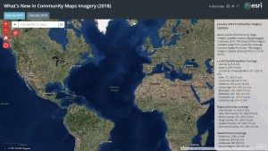
See What’s New in Community Maps Imagery (2018) to explore a series of bookmarked locations and a full listing of 2018 Community Maps Imagery publications by month.
DigitalGlobe Imagery Updates
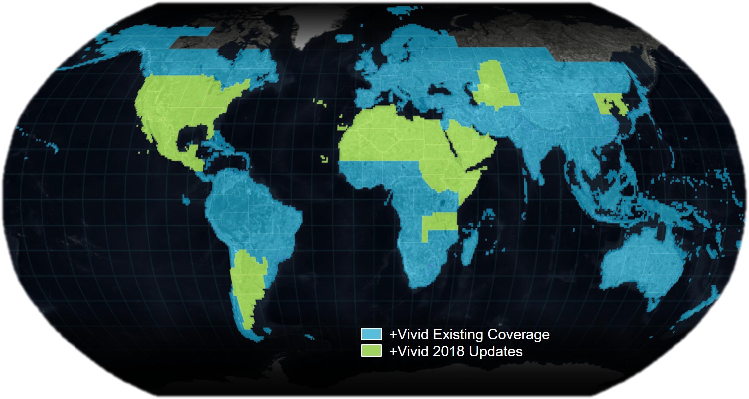
So far, in 2018, we have published more than 35 Million KM² of DigitalGlobe satellite imagery. Most recently we published 1m coverage of the following:
- Mexico
- Argentina
- Saudi Arabia
- Oman
- Yemen
- Egypt
- Ethiopia
- Libya
- Western Sahara
- Morocco
- Mauritania
- Tunisia
- Algeria
- Mali
- Niger
- Sudan
- South Sudan
- Somalia
- Tanzania
- Kazakhstan
- Turkmenistan
- Uzbekistan
- North Korea
- South Korea
- Azores
- Cape Verde
- Canary Islands


Article Discussion: