The latest releases of ArcGIS Earth expand how you can explore detailed 3D content across desktop and mobile environments. The enhancements in these releases support organizations that plan, build, and operate the places and infrastructure around us. From architecture, engineering, and construction to public safety and other industries, ArcGIS Earth provides new ways to understand projects, assets, and real-world conditions in their geographic context.
ArcGIS Earth now supports Local Scenes and 3D Building Layers across desktop and mobile, helping you explore project sites, infrastructure, and detailed building models in the office or in the field. ArcGIS Earth desktop also adds support for Gaussian splat layers, bringing photorealistic reality-capture content together with maps, terrain, buildings, and operational data. New ArcGIS Earth Projects and an in-app Welcome Screen provide a more organized way to begin, manage, and return to your work.
Here is a closer look at what is new.
Cross-Platform Enhancements
Support for Local Scenes
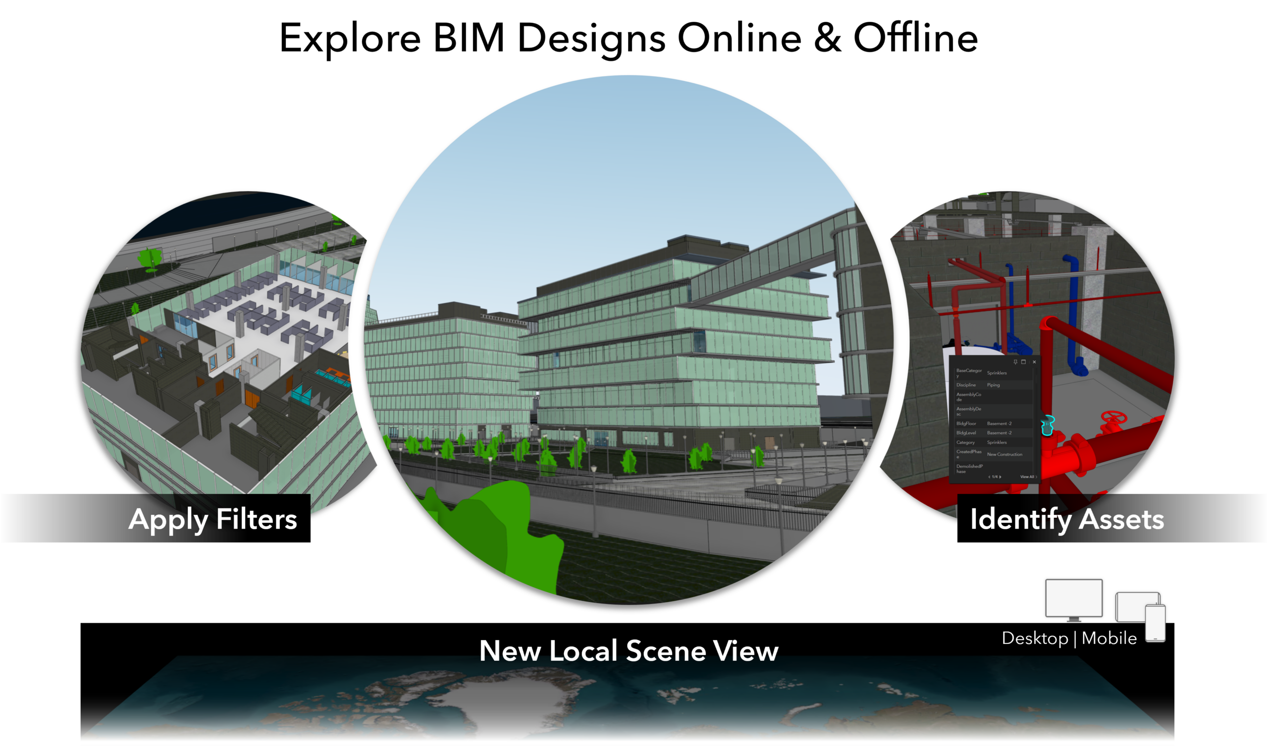
ArcGIS Earth now supports opening and exploring Local Scenes across desktop and mobile, extending locally referenced 3D workflows to mobile users in the field. Local Scenes preserve the coordinate systems commonly used for workflows in industries such as architecture, engineering, and construction, utilities, and transportation.
By retaining their original spatial reference, Local Scenes keep terrain, buildings, imagery, and operational data properly aligned without requiring data reprojection. This helps you work with spatially accurate project and operational content across ArcGIS experiences.
AEC teams, urban planners, and state and local governments can use Local Scenes to explore construction sites, campuses, facilities, infrastructure projects, and planned developments in context. Transportation, utility, and public safety teams can also access locally referenced environments while maintaining the accuracy of the underlying data.
View 3D Building Layers
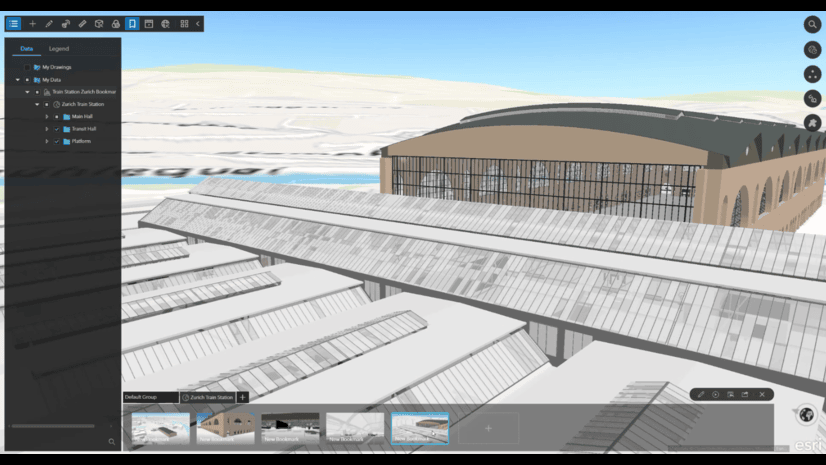
3D Building Layers can now be viewed and explored across ArcGIS Earth desktop and mobile, bringing detailed building and infrastructure information into field workflows.
You can control the visibility of building elements and apply building and floor filters to focus on relevant systems, disciplines, components, or floors. These controls reduce visual clutter and make complex models easier to navigate and understand.
Architects, engineers, facility operators, inspectors, and public safety personnel can use this information to support project coordination, facility operations, inspections, pre-incident planning, and situational awareness.
Desktop Enhancements
View Gaussian Splat Layers
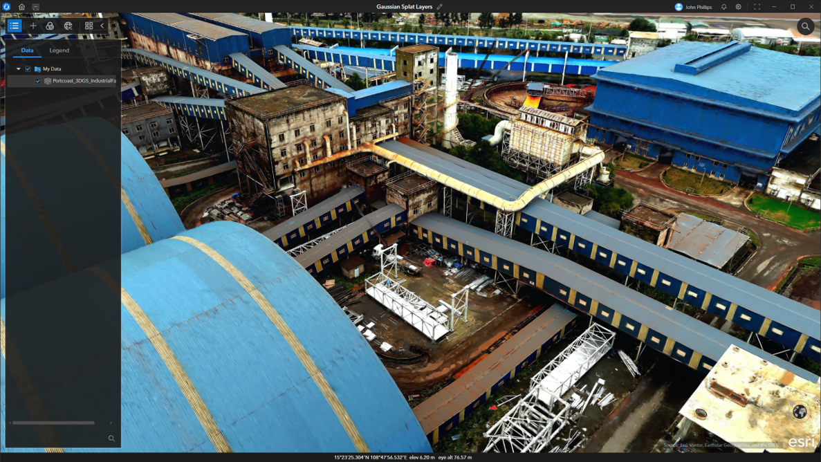
ArcGIS Earth desktop now supports georeferenced Gaussian splat layers, allowing you to explore detailed, photorealistic representations of real-world environments created through imagery-based reconstruction workflows.
Gaussian splats are especially effective at representing vegetation, thin structures, and surfaces such as glass and metal. You can explore them alongside maps, terrain, buildings, and operational data to better understand a site and its surroundings.
Gaussian splat layers are integrated into the existing ArcGIS Earth layer management experience. You can control visibility and transparency, review layer information, and compare Gaussian splats with other 2D and 3D content.
This can help AEC teams understand existing site conditions, public safety organizations review facilities and operational environments, and utility organizations visualize intricate assets such as power and telecommunications infrastructure.
ArcGIS Earth Projects
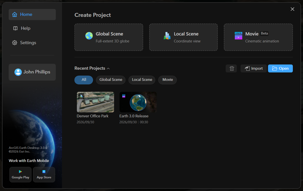
ArcGIS Earth desktop introduces ArcGIS Earth Projects, a new experience for creating, managing, and switching between Global Scene, Local Scene, and Movie Projects. Each project provides a dedicated environment for its data, settings, and context.
This approach helps you organize resources around a particular project or workflow and return to your work more easily. For example, a team could maintain a Local Scene Project for a development site while organizing presentation content in a separate Movie Project.
Projects also provide a more flexible way to manage the images, videos, audio, GIS data, and 3D models used in movie workflows.
ArcGIS Earth In-App Welcome Screen
ArcGIS Earth desktop now includes an in-app Welcome Screen that brings projects, learning resources, product updates, and community content into one centralized starting point.
The Welcome Screen helps new users get oriented and allows returning users to move more quickly into their work. It also makes learning and community resources easier to find.
Movie (Beta)
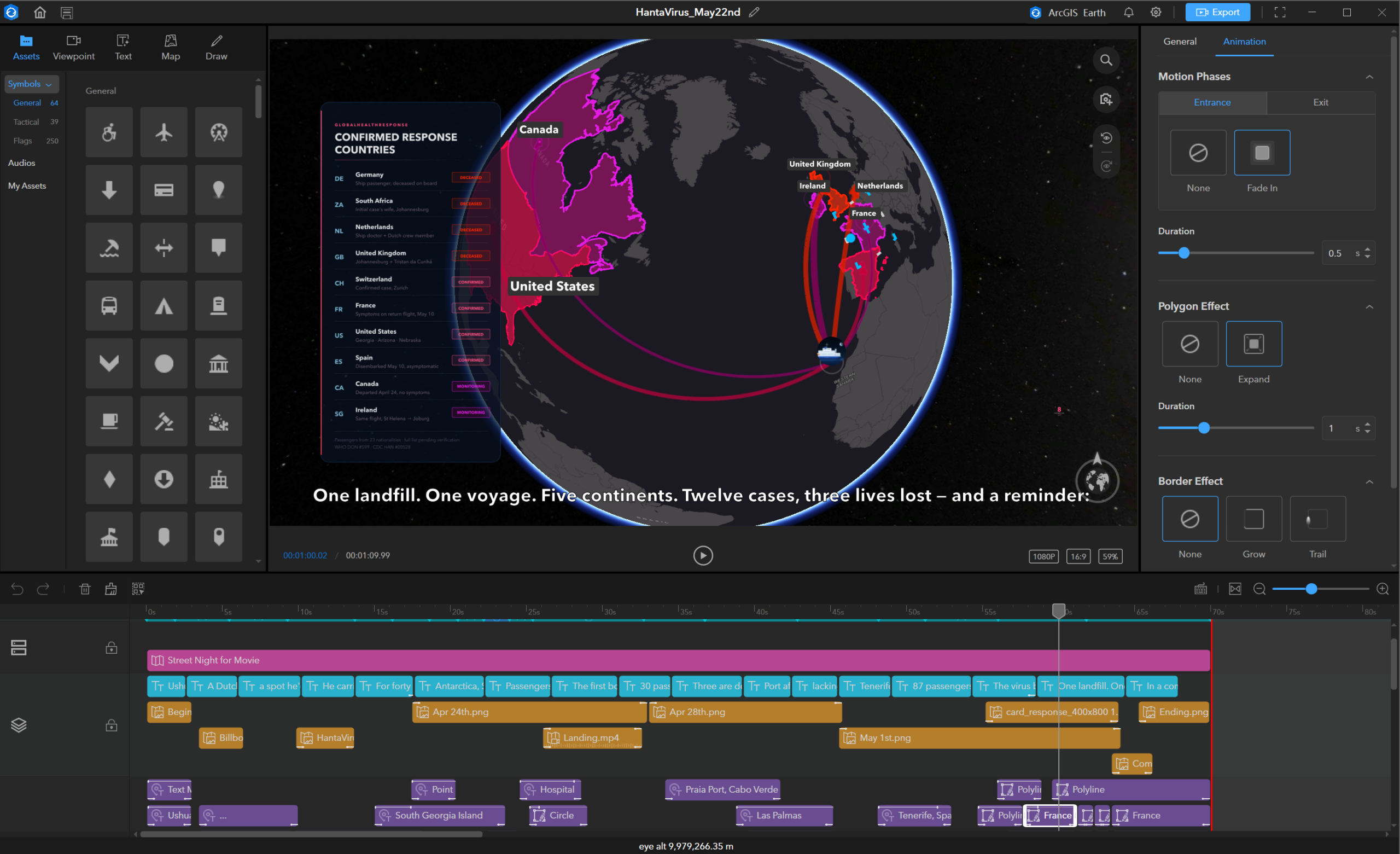
Movie (Beta) introduces a redesigned, timeline-based experience for creating animated stories in ArcGIS Earth. Add camera movements, text, drawings, and audio to bring geographic content to life, then preview and export your movie as an MP4 file. Combined with ArcGIS Earth Projects, the new Movie experience provides a more organized way to create, manage, and share presentation-ready content.
Learn More
Together, these enhancements expand the types of 3D content you can explore in ArcGIS Earth while providing a more organized way to manage your work. Whether you are reviewing a construction site, exploring infrastructure, examining a facility, or preparing for field operations, ArcGIS Earth helps bring 2D and 3D information together in a common geographic context.
To explore additional details about the release, visit What’s New in ArcGIS Earth on desktop and What’s New in ArcGIS Earth on mobile.


Article Discussion: