Working with detailed 3D data has traditionally meant desktop tools, specialized workflows, and limited ways to share results beyond GIS teams.
ArcGIS Enterprise 12.1 introduces new capabilities in Scene Viewer that make it easier to work with rich 3D content and use it as part of everyday workflows, from capturing real-world conditions to sharing and understanding them across team.
Making photorealistic 3D an everyday tool in ArcGIS
Scene Viewer now supports Gaussian splats in Enterprise 12.1, making it easier to add photorealistic reality capture to your 3D scenes. Gaussian splats capture the visual richness of real-world environments – lighting, texture, and fine detail – directly from imagery. While meshes provide structured geometry for analysis-ready surfaces, Gaussian splats offer a more detailed, photorealistic way to experience and communicate place.
Created from drone and aerial imagery, they’re especially useful when you need to see conditions as they exist on the ground, whether that’s inspecting equipment at an industrial plant, tracking project status at a construction site, or assessing damage for emergency response planning.
With Scene Viewer, this content extends to the web, making it easy to share and interact with photorealistic 3D content directly in a browser as part of ongoing team workflows.
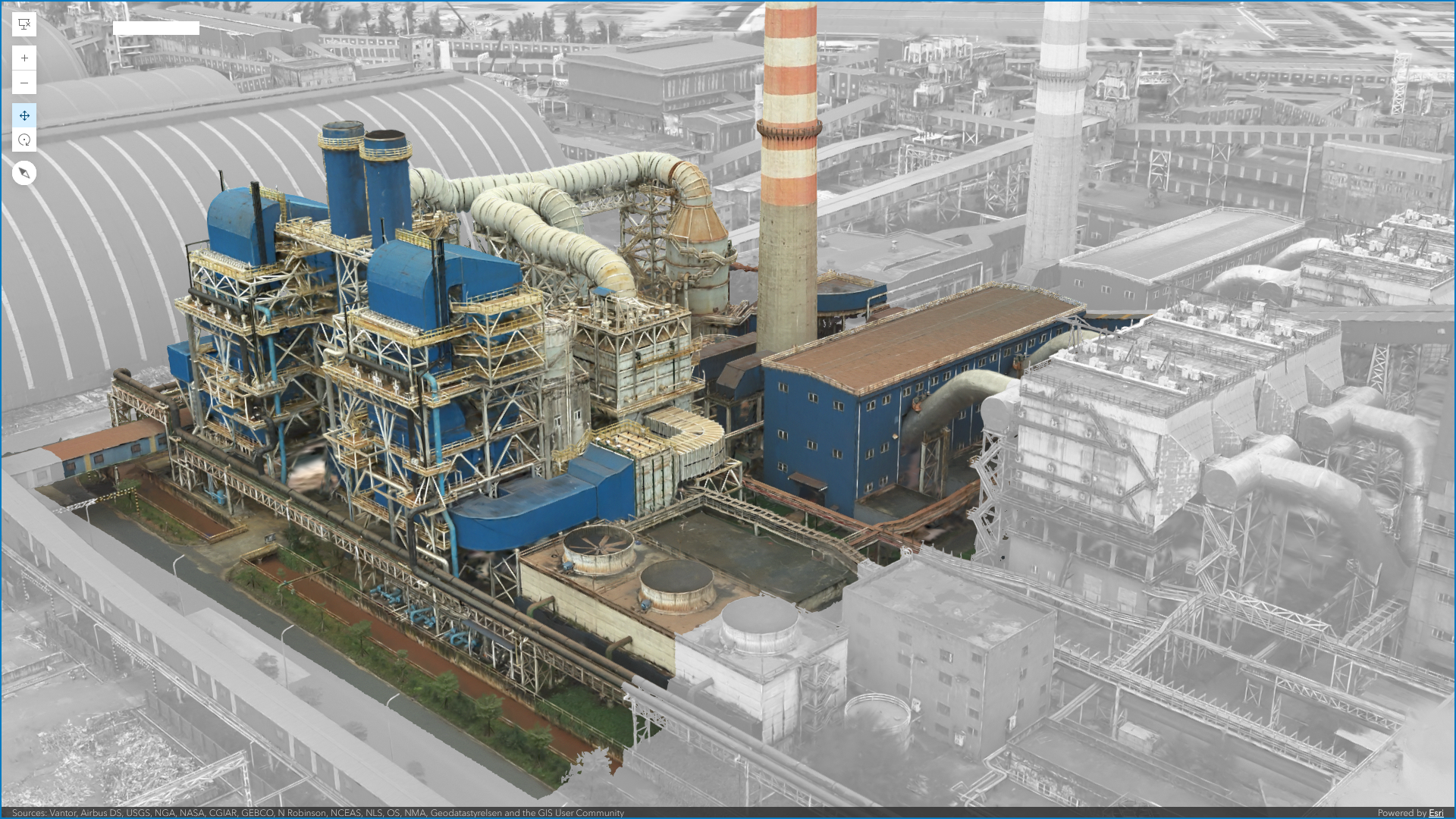
Learn more about Gaussian Splats and once created, how to publish them as a hosted layer and add them to a scene in Scene Viewer.
Visualize movement with Flow Rendering enhancements
Flow rendering in Scene Viewer enables dynamic, data-driven visualization of how things move through space, such as wind, ocean currents, and floods. Using high-performance WebGL rendering, these visual effects bring motion to life through techniques like animated flow lines and color gradients. Rather than relying on static or pre-rendered animations, flow rendering supports animated, data-driven visualization.
This makes it easier to understand where movement starts, how it flows, and where it concentrates or changes over time. For a real-world example of flood modeling, see Visualizing Flood Simulations: from ArcGIS Pro to the Web with Flow Rendering.
Additional enhancements that improve flexibility
This release also includes several additional updates that improve day-to-day workflows in Scene Viewer.
More powerful Arcade support
Use Arcade expressions directly when styling symbology to add more meaning to data with gaps or enriching datasets that need more context to tell their story. And don’t forget, you can also use expressions to power pop-ups in your scenes and when including elevation. The latest update takes things a step further with early support for AI-assisted workflows using Arcade expressions.
For more information, see the documentation.
Custom web-based analysis tools
Create custom analysis experiences tailored to their workflows directly in the browser. This is especially useful for:
- Standardizing repeatable analysis
- Supporting ArcGIS Enterprise–specific processes
- Guiding users through predefined workflows without requiring desktop tools
For more information, see the documentation.
Automatic Placement of 3D Models
Adding 3D building models to a scene becomes simpler with automatic placement capabilities, which reduce the manual effort required to correctly position models—helping users build scenes faster and with fewer adjustments.
Next steps & resources
From photorealistic site capture with Gaussian splats to improved visualization of movement, Scene Viewer continues to lower the barrier to working with 3D, so more people can explore, understand, and act on their team’s data. There are also a lot more features and enhancements to discover in the ArcGIS Enterprise 12.1 release. Head over to the What’s New in ArcGIS Enterprise blog for more details.
Questions? Connect with the team by joining the Esri Community. If you’re new to Scene Viewer, check out the tutorials for a brief tour and introductory workflow to help you get started.

Article Discussion: