This blog was originally published in November 2025.
With the June 2026 update, support has been expanded to include additional item types. See the table below for details.
There are people who love to create metadata (information about your content) because they understand why it is the behind-the-scenes magic that makes your data and content truly shine. For others, metadata might not be the first thing they get excited about, even though it is becoming more essential than ever.
Metadata is the key to unlocking the full potential of your geospatial content. It improves searchability, supports data governance, and ensures your data can be reused effectively. By adding metadata to your layer, map, or app, that information travels with your content wherever it goes. Investing an hour to improve your item’s metadata can save every user an hour of searching. For example, if 10,000 people use your layer, that’s thousands of hours saved.
In platforms like ArcGIS Online, Enterprise, and Hub, where millions of spatial items are shared across organizations and the public, metadata helps the right people find the right content at the right time. It also builds trust and transparency in the data and analysis you’ve invested time and effort into—making it easier for others to understand, validate, and confidently use your work.
What’s more, Artificial Intelligence (AI) is breathing new life into metadata. Natural Language Processing relies on high-quality metadata, including item information and each attribute field’s alias or display name, description, and value type, to interpret your content and deliver meaningful insights.
At Esri, we’re committed to making metadata creation and management easier and more intuitive because metadata is valuable for your work.
Item Details assistant
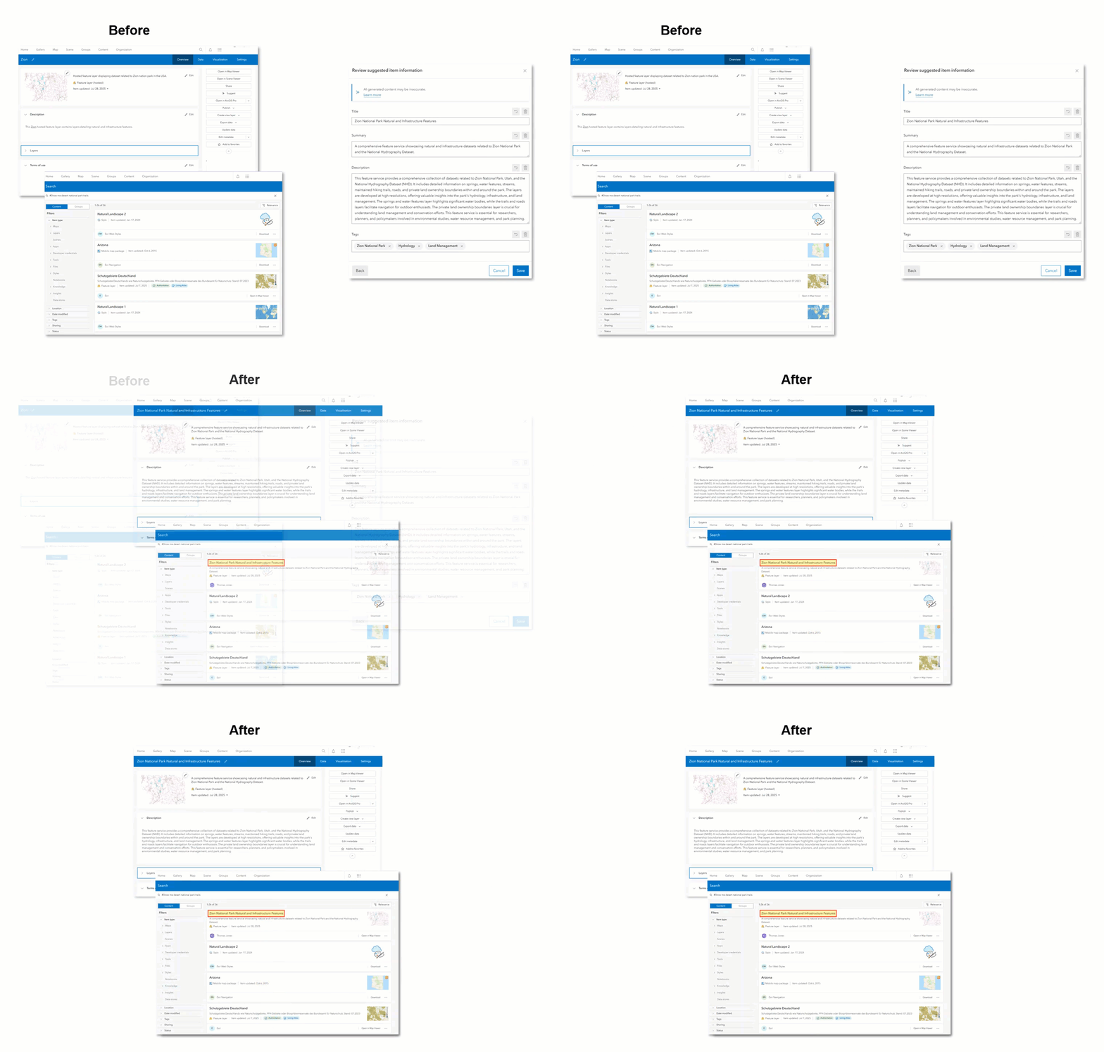
Enter the Item Details assistant. The Item Details assistant leverages AI to make metadata more complete and ready to use. Users interact with generative AI to receive suggestions for completing or further enriching their metadata directly on the item page. You can create or improve your item’s title, summary, description, tags, and attribute field information. This assistant has now been integrated into the item page of ArcGIS Enterprise 12.0 and ArcGIS Online!
Let’s make metadata creation smarter, faster, and more impactful — together.
Item Details assistant Early Access Community!
Join the Early Access Community to explore the Item Details assistant in ArcGIS Online today to help shape the future.
This community is your space to:
- Explore the Item Details assistant workflows
- Share feedback and ideas
- Connect with Esri and other participants
- Help shape the future of metadata in ArcGIS
Join the Early Access Community AND keep reading below to learn more!
Pre-requisites
AI assistants must be configured for the organization. Administrators or those with administrative privileges will need to configure AI assistants for members of their organization to access the Item Details assistant. For ArcGIS Enterprise, you will need to store your ArcGIS Online credentials, like how you would when using the World Geocode Service or other utility services that require stored ArcGIS Online credentials.
With AI assistants enabled for your organization, the Item Details assistant becomes available on the item page. Look for the Suggest button!
However, access depends on your user privileges, and to use the assistant you must be the owner of the item, a member of the default administrator role, a member of a shared update group with which the layer is shared, or a member of a custom role with the set of privileges to manage all content owned by organization members.
The table below identifies which item types are supported in ArcGIS Online and ArcGIS Enterprise and outlines the suggestions currently supported for each item type.
| Item types supported | ArcGIS Online | ArcGIS Enterprise 12.0 | Supported metadata suggestions |
|---|---|---|---|
| Elevation layer | ✅ | Item information | |
| Feature layer | ✅ | ✅ | Item information |
| Geoprocessing service | ✅ | Item information | |
| Hosted feature layer | ✅ | ✅ | Item information, layer (sublayer), and attribute fields |
| Hosted imagery layer | ✅ | Item information | |
| Hosted table | ✅ | ✅ | Item information, layer (sublayer), and attribute fields |
| Hosted tiled imagery layer | ✅ | Item information | |
| Hosted tile layer (raster) | ✅ | Item information | |
| Hosted view | ✅ | ✅ | Item information, layer (sublayer), and attribute fields |
| Imagery layer | ✅ | Item information | |
| Map image layer | ✅ | Item information | |
| Web tool | ✅ | Item information |
Workflows
Use the Item Details assistant to create and enhance information about…
The item
On the item page, click the Suggest button. This will launch the Item Details assistant. Enhance the item’s title, summary, description, and tags!
The layers (sometimes referred to as the sublayers of an item)
Click the layer or sublayer on the item page to suggest layer information to further enrich the title, summary, and description.
*Only supported for hosted feature layers, hosted tables, and hosted views.
The attribute fields
From the item page, click the Data tab, and if necessary, click the drop-down to choose the layer you would like field suggestions for. Create and enhance the field display name, description, and value type.
*Only supported for hosted feature layers, hosted tables, and hosted views.
Why are we excited for the Item Details assistant?
- Instant momentum—Ever find yourself staring at an item page, unsure how to begin writing a summary or description? You’re not alone. Now, with helpful suggestions and quality examples, you can hit the ground running. It’s a little boost to get your creative and cognitive juices flowing!
- Saves time!
- Support your standards-based metadata
- By default, the metadata you create on the item page automatically syncs with the standards-based metadata (e.g. ISO, FGDC CSDGM).
- Sync your attribute fields and field details using the metadata editor. Check out the Sync Attribute Fields Using the Metadata Editor blog to learn more!
- More, high-quality metadata…
Why are we excited for more, high quality metadata?
- Supporting FAIR Principles —Ensure that data is Findable, Accessible, Interoperable, and Reusable for both humans and machines.
- Understand, Reuse, Govern — Better metadata makes it easier to understand and trust content, reuse it confidently, and support strong data governance practices.
- Enhanced search and content discovery— High-quality metadata improves how users find and explore relevant content in ArcGIS and beyond.
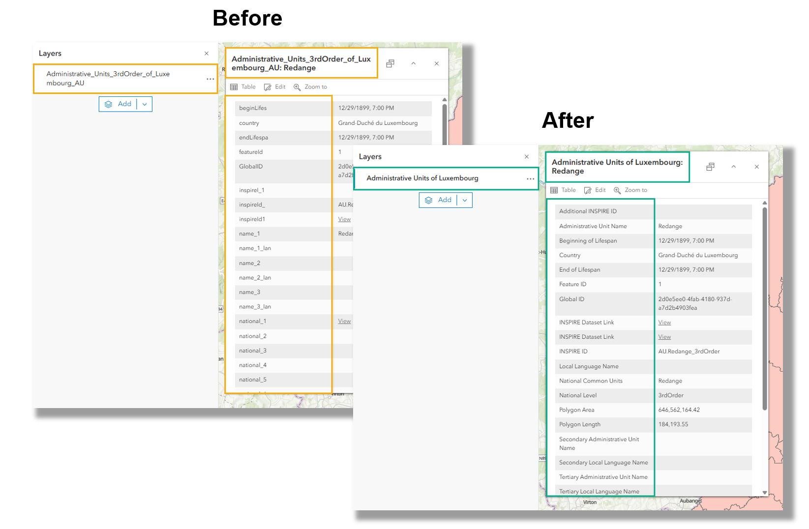
- Improve the user experience in ArcGIS — Labels, pop-ups, and charts in maps and apps become clearer and more meaningful for you and for those consuming your data.
- AI ready— Want to prepare your organization for AI? Start with metadata. High-quality metadata will set your data up for success to be used in exciting new AI assistants such as the Data Explorer Instant App and ArcGIS Hub assistant.
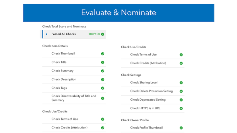
- More contributions to ArcGIS Living Atlas of the World — Use the Item Details assistant to jumpstart your contribution of trusted data to Living Atlas, helping share valuable knowledge with the geospatial community.
- Don’t miss the “Living Atlas Evaluate and Nominate” App release blog to learn more.
- Sharing trusted data and building the geospatial nervous system
FAQs
- Will this assistant consume credits or require any additional licensing?
No. Using the Item Details assistant will not consume credits.
- Will this assistant work in a disconnected environment?
No. The Item Details assistant currently requires access to ArcGIS Online. However, Esri is actively exploring ways to remove this dependency and make it available in disconnected environments for future releases of ArcGIS Enterprise.
- Does the Item Details assistant depend on ArcGIS Online?
Yes. The Item Details assistant requires an ArcGIS Enterprise administrator to enable AI assistants and provide credentials to an ArcGIS Online organization that has also enabled AI assistants.
- Where can I learn more about Esri’s AI development and security?
Please find more information about how Esri is developing and using AI in ArcGIS, Trusted AI in ArcGIS.
- Can the Item Details assistant be automated?
No. The Item Details assistant currently cannot be automated, and human review is necessary to ensure metadata accurately reflects the data it describes.
- Will the metadata I create sync to the metadata editor and my standards-based metadata?
Yes! By default, item page metadata syncs with standards-based metadata (such as ISO and FGDC CSDGM). To align attribute fields and details, use the metadata editor—see the blog Sync Attribute Fields Using the Metadata Editor for guidance.
- What does the assistant use to create suggestions?
The Item Details assistant creates metadata suggestions by analyzing existing item metadata, along with table schema, geometry, extent, and field statistics.
- Does the Item Details assistant support various languages?
Yes. Suggestions can be generated in any of the 40 Esri‑supported languages based on the user profile language setting.
- Can I configure which members or roles in my organization can access the Item Details assistant?
Yes. There is a new role-based privilege, giving administrators direct control over who can use AI assistants in their organization.
- Is Item Details Assistant (beta) available in ArcGIS Enterprise 12.1?
No. Beta features are only available in ArcGIS Enterprise short-term support releases. Because ArcGIS Enterprise 12.1 is a long-term support release, the Item Details assistant (beta) is not available in 12.1.
At this time the Item Details assistant beta is available in ArcGIS Enterprise 12.0, which is a short-term support release.
Stay in touch!
We want to hear from you! If you haven’t yet, JOIN the Item Details assistant Early Access Community today to shape the future. And connect with us on Esri Community! We look forward to working with you to continue making metadata more impactful – together.




Commenting is not enabled for this article.