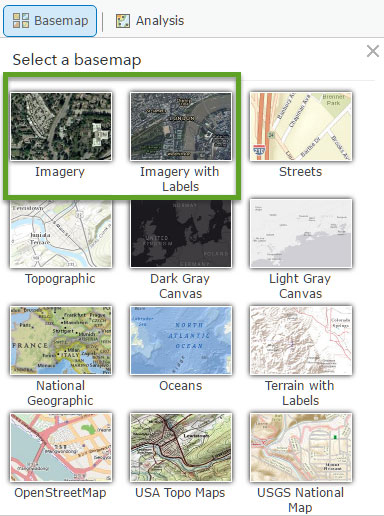
The World Imagery and Imagery with Labels basemaps contain satellite imagery for the world, with high-resolution aerial imagery added for many areas. These basemaps are part of the default basemap gallery, and are among the many basemaps you can choose from to make your own maps.
*
Viewing imagery metadata
You may want to learn more about the imagery—learn its acquisition date, resolution, and source—and there’s an easy way to do that using the World Imagery layer (instead of just viewing the World Imagery basemap). This is the same imagery used in the basemap, but the layer is configured to display the imagery metadata via pop-ups when you click on the map, and delivers the metadata for various scales.
To view World Imagery metadata, follow these steps.
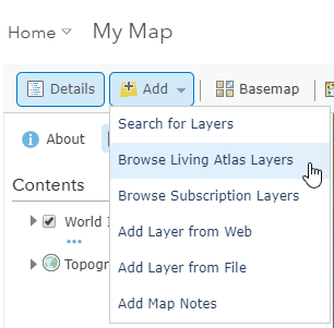
Step 1. Using the Map Viewer, click Add, then Browse Living Atlas Layers.
Step 2. Search for World Imagery.
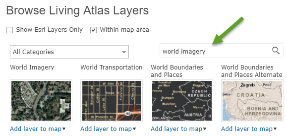
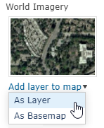
Step 3. Once located, add World Imagery as a layer to your map.
Step 4. Click the World Imagery layer to learn more.
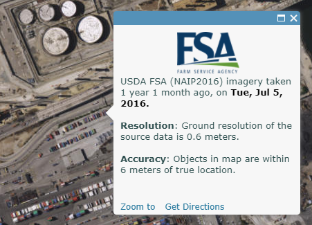
To view the metadata, zoom to your location of interest and click. The pop-up includes the source, acquisition date, resolution, and accuracy.
*
Using the World Imagery layer
Note that the metadata will vary across geography and scales. Depending on where you navigate, the boundaries around the image sources are visible on your map. As you explore, you’ll note differences in the metadata because the basemaps represent a seamless compilation from a variety of different sources.
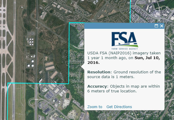
For example, below on the right of the boundary is imagery obtained from the USDA NAIP imagery program:
On the left of the boundary is imagery obtained from Loudoun County, Virginia:
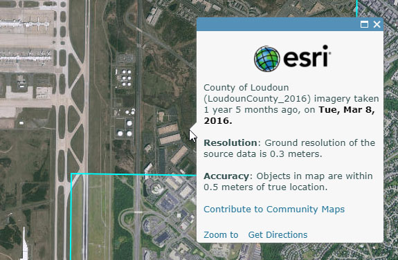
You’ll see differences not only in the data source, but also in the acquisition date, accuracy, and resolution as you move from place to place, or zoom in or out.
*
Other imagery info
Other places you can obtain additional information about the imagery are the item details for the World Imagery and Imagery with Labels basemaps. The item details also include links to the component imagery (and other) services they are composed of, with more information detailed in the service description.
*
Contribute
Esri is always looking for ways to improve the imagery basemaps. If you have recent imagery you’d like to contribute, see the Living Atlas contributions help topic for more information.
*
For more information
This post was originally published on January 23, 2017, and has been updated.

Article Discussion: