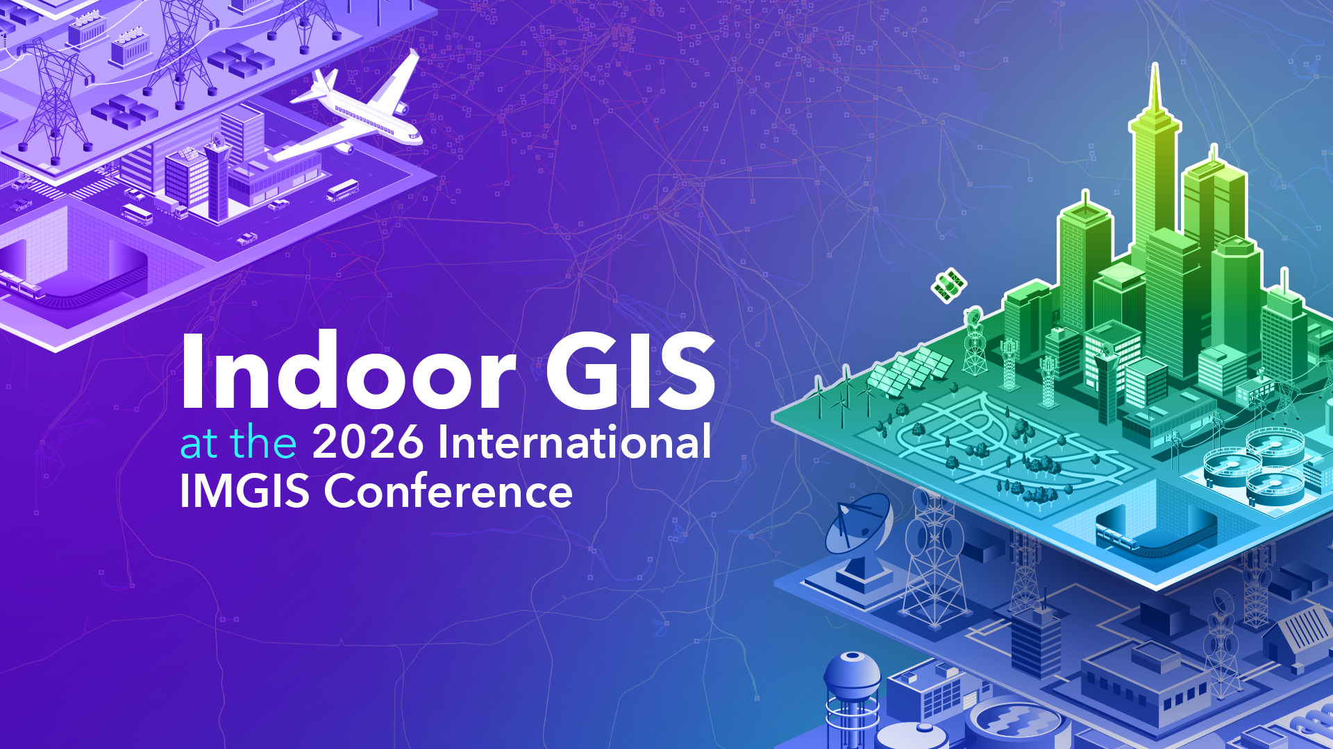
The Esri International Infrastructure Management and GIS Conference takes place in Frankfurt, Germany from April 15-17, 2026. The event brings together professionals from architecture, engineering, and construction (AEC), utilities, telecommunications, transportation, and more industries to explore how geospatial technologies support the planning, operation, and maintenance of complex infrastructure systems.
Through technical sessions, workshops, industry presentations, and special interest group meetings, attendees learn about the latest innovations in ArcGIS and related technologies, including digital twins, real-time GIS, indoor GIS, spatial analytics, and artificial intelligence. The conference also provides opportunities for networking and knowledge exchange among industry experts, solution partners, and GIS practitioners working to improve infrastructure resilience, efficiency, and sustainability through location intelligence.
Indoor GIS, a foundational layer for living digital twins, is growing ever more important for infrastructure lifecycle management. It empowers organizations with location awareness inside facilities to improve facility operations and maintenance, asset and space management, safety and security, and the occupant experience. Indoor GIS allows organizations to build an indoor system of record with ArcGIS Indoors, overlay live positioning through ArcGIS IPS, and connect to the full ArcGIS platform for comprehensive indoor workflows.

We are excited to share that this year’s conference features a robust indoor GIS agenda packed with information and insights. Dive into the details below.
Esri Plenary
Wednesday, Apr 15 | 10:00 — 13:00 | Harmonie | C2 Congress Center
Hear the latest vision and industry trends from Esri thought leaders and learn from your peers as they share compelling stories that highlight how ArcGIS, including indoor GIS, is transforming infrastructure management within their organizations. NATO HQ will provide interesting insights on how indoor GIS enables the large building in Brussels to be operated more efficiently and economically and to obtain an operational picture—their journey from reactive to predictive maintenance.
Sessions
Transportation Keynote
Industry Keynote| Level: All Attendees
Thursday, Apr 16, 9:00 AM – 10:00 AM CEST | Conclusio 1-2 | C2 Congress Center
Effective management of facilities comprising transportation hubs such as airports, maritime ports, rail and urban transit terminals requires the management of extensive indoor and outdoor area and spaces. In addition to managing a complex campus of multi-level buildings, these organizations are using geospatial technology to manage extensive portfolios of built and natural areas, as well as real-estate holdings for assured security, revenue generation, and environmental stewardship. This session will address a range of key topics that transportation infrastructure managers have in common.
Indoor GIS and Facilities Management Special Interest Group Meeting
Thursday, Apr 16,10:15 AM – 11:15 AM CEST | Spektrum 2 | C2 Congress Center
Join this special interest group to meet peers who work with indoor GIS and face similar challenges in managing complex facilities, campuses, and indoor spaces. This informal session is your chance to connect with others, share experiences, and discuss common obstacles in implementing indoor mapping and workflows. The session will feature contributions from representatives of NATO Headquarters, CERN, ETH Zurich, DB Systel, and SBB Immobilien, who will share their perspectives on using indoor GIS within large and complex organizations. Use this opportunity to exchange ideas, build relationships, and strengthen a community that supports each other beyond the conference.
PolyMaps: Indoor Navigation and Positioning for the Accessible Smart Campus
User Presentations | Level: All Attendees
Thursday, Apr 16, 4:00 PM – 5:00 PM CEST | Harmonie D-E | C2 Congress Center
One of the user presentations on digital twins we would like to highlight is ETH Zurich. PolyMaps brings the blue dot to ETH Zurich: The central indoor GIS integrates indoor navigation and positioning. It is integrated into ETH Zurich’s own native mobile app. Discover how these new technologies mark a significant advancement in campus navigation within the education sector, ensure better accessibility for all, and offer a unique user experience. The system enables users to find the fastest and accessible route within the complex buildings.
ArcGIS Indoors: Extending CAD, BIM, LiDAR Data to Indoor Maps for Operations
Esri Technical Session | Level: All Attendees
Friday, Apr 17, 10:15 AM – 11:15 AM CEST | Fantasie 2 | C3 Congress Center
Join Esri staff to hear how you can extend the life of your CAD, BIM, LiDAR and other floorplan data into operations of your facilities. In this session, you will get an overview and learn how to create and share interactive floor aware indoor maps of your facility. You’ll also learn how to leverage them for:
- Asset mapping for maintenance and inspections
- Space planning and workspace reservations
- Indoor navigation, and more.
Live Guided Indoor Positioning System Demos
SEPARATE REGISTRATION IS REQUIRED!
Conference Activity | Level: All Attendees | Frankfurt Main Station
- Train Tour 1: Wednesday, Apr 15, 2:00 PM – 2:45 PM CEST
- Train Tour 2: Thursday, Apr 16, 1:30 PM – 2:15 PM CEST
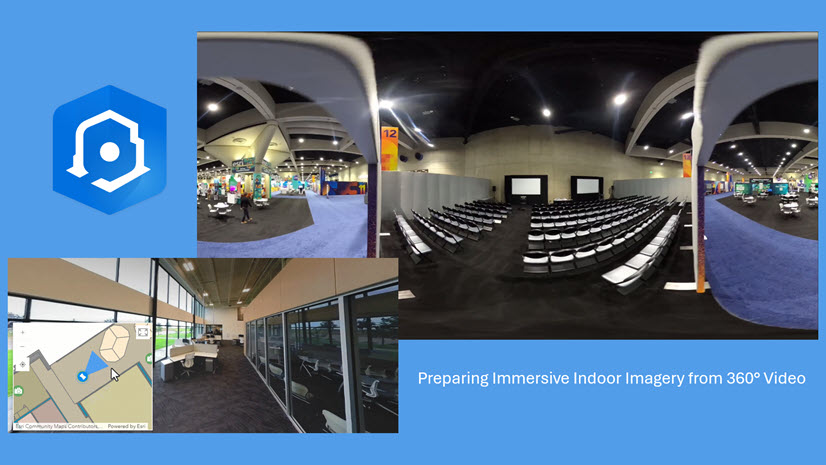
Join us for a live ArcGIS IPS demonstration at Frankfurt Main Station to experience the indoor blue dot in a real-world environment. During this guided session, our indoor GIS team will demonstrate how to enable indoor positioning inside the train station, locate your own live position on the digital indoor map, and navigate through the station in real time. This hands-on tour allows you to experience firsthand how ArcGIS IPS supports intuitive wayfinding and location awareness within large transportation hubs.
Registration is limited for this event. Please reach out to confregis@esri.com with any questions.
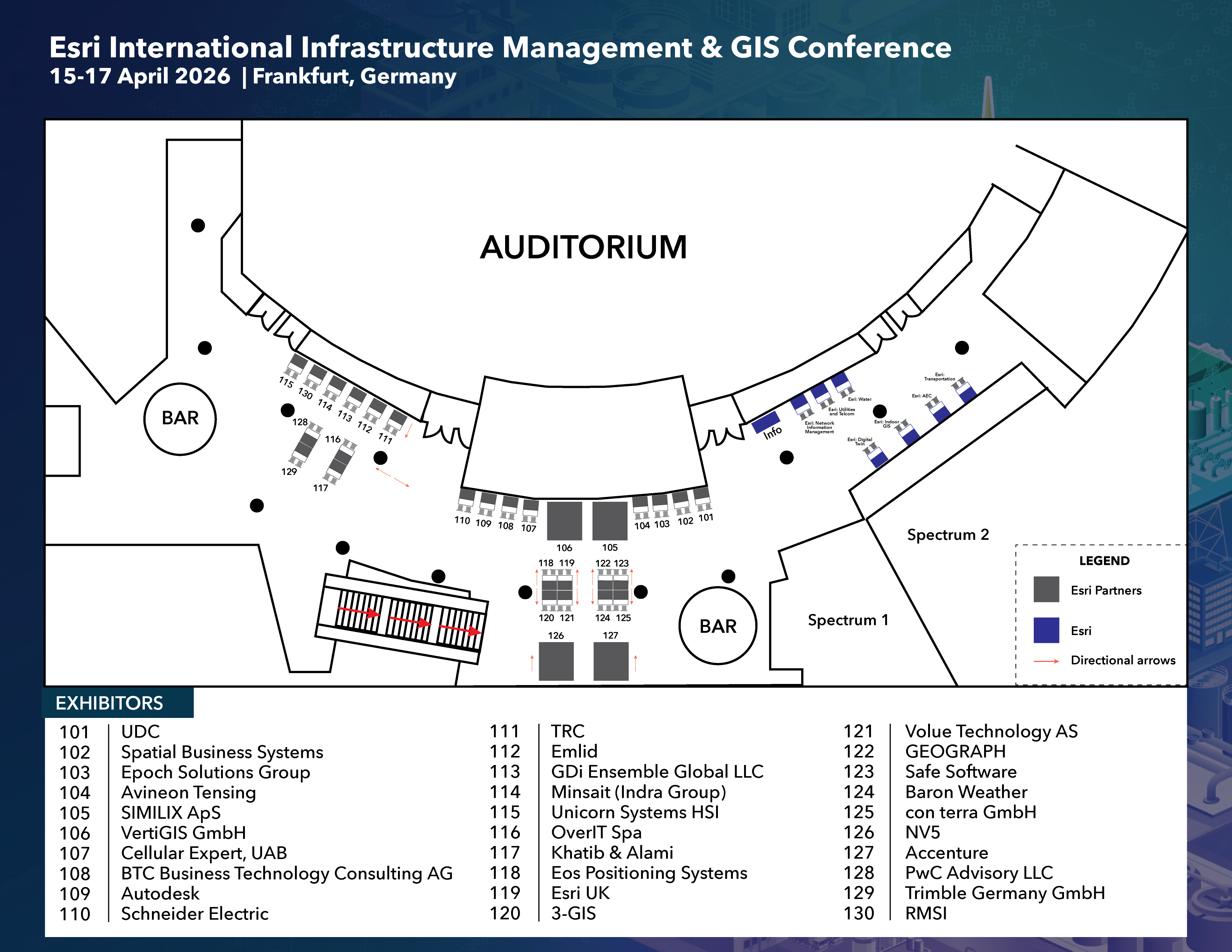
Esri Showcase
Congress Center – Messe Frankfurt
Come by the expo to explore opportunities to meet with technical experts, discover solutions, and get the latest product and technical information provided by Esri and our partners. We will also have an “Indoor GIS” kiosk in the exhibit area where you can view demos, get your questions answered, and learn about the latest advancements in indoor GIS.

The expo is open during the following dates and times:
| Date | Time |
| Wednesday, April 15 | 08:30 – 10:00 | 13:00 – 17:00 |
| Thursday, April 16 | 08:00 – 17:00 |
| Friday, April 17 | 08:00 – 12:45 |
We look forward to meeting you at the conference!
For more information about the products, visit the indoor GIS, ArcGIS Indoors, and ArcGIS IPS websites.


Commenting is not enabled for this article.