
A Health Professional Shortage Area (HPSA) is a geographic area, population group, or health care facility that has been designated by the Health Resources and Services Administration (HRSA) as having a shortage of health professionals. There are three categories of HPSAs: Primary Care, Dental Health, and Mental Health.
Over 92 million Americans live in a Primary Care HPSA, according to the Kaiser Family Foundation. Having a regular primary care provider is associated with many benefits, above all is lower mortality.
The National Health Service Corps (NHSC) created shortage designations over 50 years ago, and the designations are reviewed and updated periodically. Many federal programs use these HPSA designations to distribute resources. For example, loan repayment programs, Medicare bonus payment programs, visa waiver programs, and Nurse Corps have incentives in place to retain and attract providers to serve these areas.
Use-case: Rural Health Transformation Initiatives
One recent program is the Rural Health Transformation Program. The financial stability of the few hospitals and clinics in these communities is top of mind for many. By leveraging HPSA layers in ArcGIS Living Atlas, states can expand upon their Rural Health Transformation Initiatives, which include providing care as well as investments in technology, training, and more. HPSAs are an indicator of how investments are targeted, prioritized, and justified. For states’ initiatives and implementations, HPSAs serve as a foundational planning layer, highlighting rural geographies with documented workforce shortages and informing data‑driven decisions around access, recruitment, and care delivery.
Use-case: State-level planning
The United States has an aging population, which comes with growing healthcare needs and challenges. Additionally, the workforce providing healthcare is also aging. Many states’ Health and Human Services departments do projections to see how drastic the gap will be between the demand for healthcare services relative to the supply. This helps to inform where to target preventative public health interventions to try to decrease demand, as well as workforce interventions to stimulate supply. For example, a recent report from Texas Department of State Health Services projects their dental workforce out to 2030. The report shows which regions have will an ongoing shortage vs. a worsening shortage.
Use-case: Program and policy evaluation research
Additionally, many state health departments and academic researchers use HPSAs to study public health outcomes, workforce effects, and even to evaluate the incentive programs that HPSA designations provide. For example, this study examined differences in healthcare utilization and spending between populations in HPSAs and demographically-matched populations in non-HPSAs.
ArcGIS Living Atlas value-adds
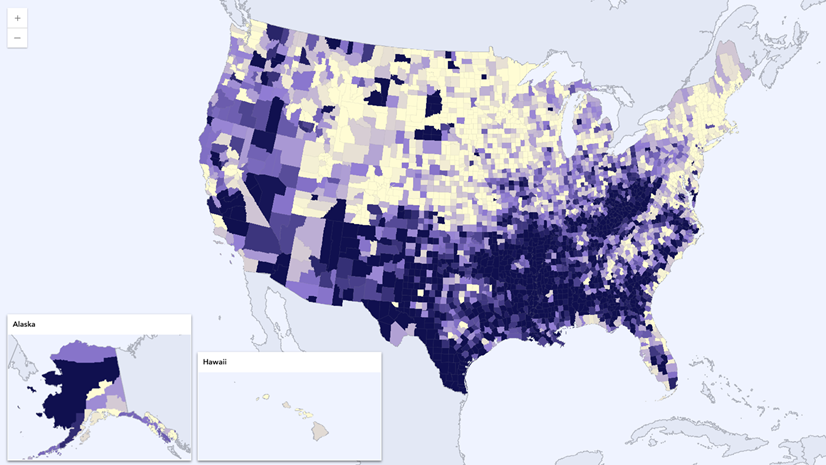
These widely-used boundaries are now available at your fingertips within both ArcGIS Online and ArcGIS Pro. Just search “HPSA” or “Health Provider Shortage Area” in Living Atlas. You can access the three categories – Primary Care, Dental Health, and Mental Health – as three different feature layers.
The HPSA layers in Living Atlas are a high-quality starting place, saving data processing time for GIS analysts and health analysts all over the country. The benefits you have come to expect from Living Atlas show up in these items:
- Simple symbology and the text-based legend communicate the different priority tiers.
- The pre-configured pop-up explains some of the most used attributes in natural language.
- The metadata behind each field comes across when working with these layers in Map Viewer.
- Monthly checks for updates from its federal source ensure you are working with the most up-to-date boundaries and designations.
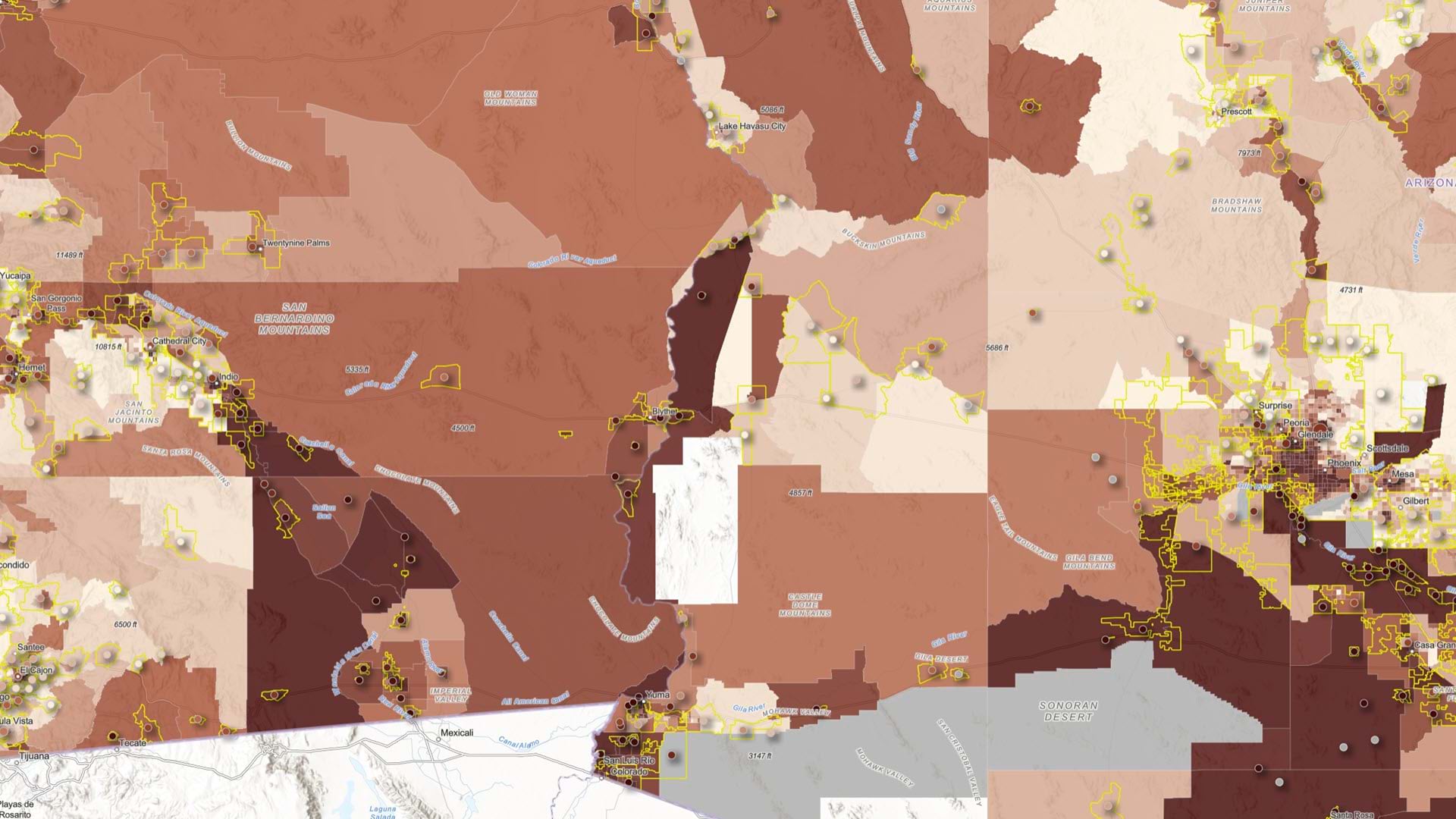
 has a score of 16 (medium priority for assignment of Clinicians). The number of full-time equivalent (FTE) practitioners needed in this HPSA is 4.28. There are currently 1.00 practitioners providing ambulatory patient care. In this area, 12.30% of the population is below the poverty level out of a designation population of 105,534.\"")
Get started using HPSA boundaries in your work
- Filter the nationwide layers to your state, and see how many of your facilities or centers fall within a HPSA.
- Add HPSA boundaries to maps of your community as a supporting layer to show additional context.
- Perform analysis by doing a spatial join to see where HPSAs and other service area boundaries intersect to inform programs to address multiple community needs.
- Summarize your patient populations with specific needs within HPSA boundaries, such as veterans.
- Overlay the mental, dental, and primary care HPSAs to see areas with multiple needs.
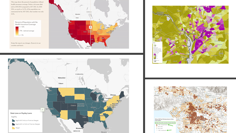
These HPSA layers are just a small fraction of what’s available in ArcGIS Living Atlas of the World. Living Atlas is the foremost collection of geographic information from around the globe. It includes maps, apps, and data layers to support your work.


Article Discussion: