A lot has happened with World Imagery since UC 2017. With UC 2018 now upon us, let’s take a moment to reflect on the past year and highlight some of the most recent updates.
Breadth of Coverage
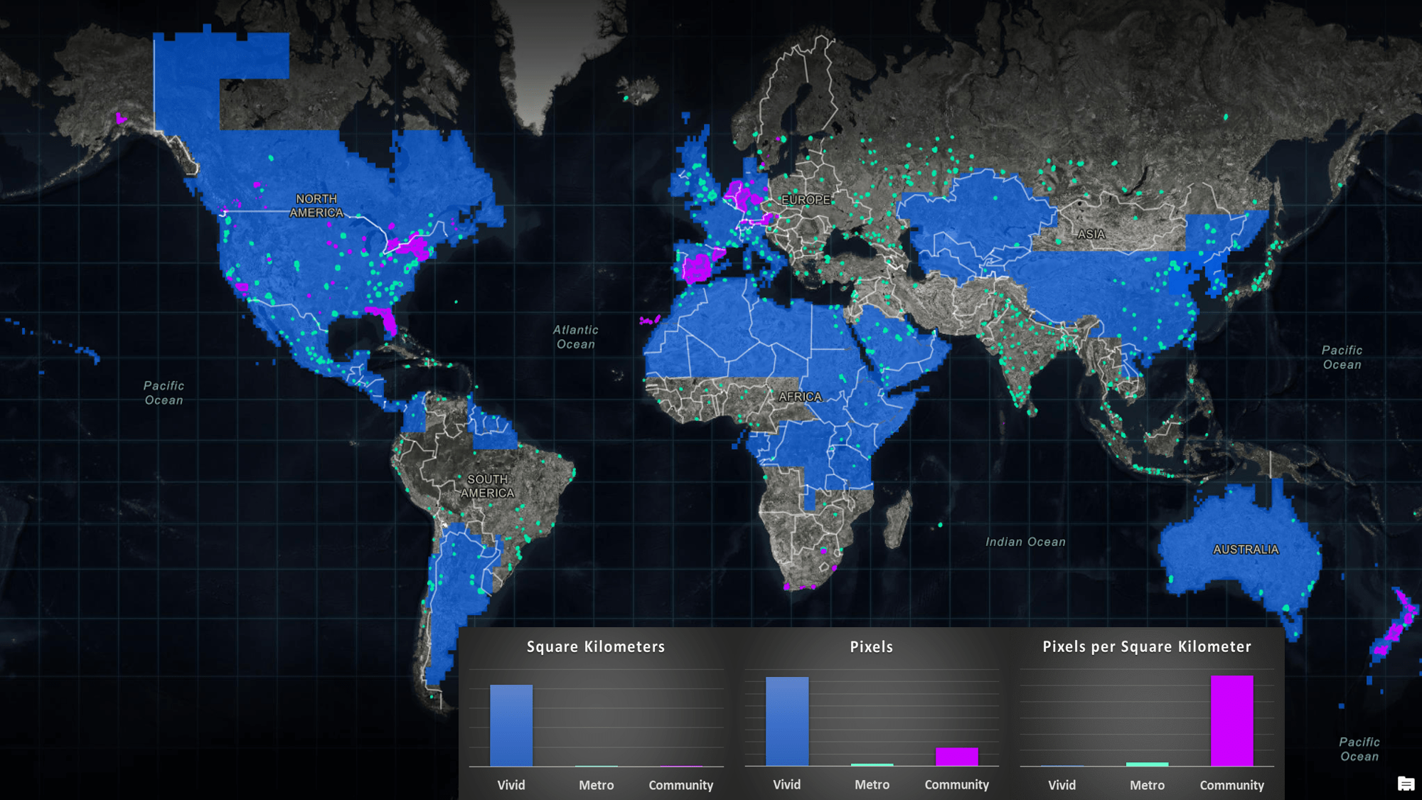
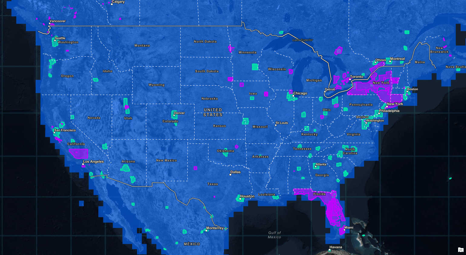
These days, wide area coverage in World Imagery is synonymous with DigitalGlobe EarthWatch Vivid imagery. With Vivid updates this past year totaling nearly 85 million square kilometers, we are bringing expanded coverage and more frequent updates to more communities and markets around the globe.
Most recently, we completed our second update of the Continental US in the past six months. January 2018 was our initial release of Vivid in the US, bringing a much needed improvement on the currency of the US imagery. The June update came with improvements on the overall visual quality of the imagery, including significant reductions in cloud cover.
Depth of Coverage
With a focus on urbanized areas, along with an annual refresh cycle, DigitalGlobe EarthWatch Metro imagery continues to bring great value, in both detail and currency, to cities and metropolitan areas around the globe. Over the past year, more than 800 cities have been updated with the latest available 30-50 centimeter Metro imagery.
Offering some of the most detailed imagery that our World Imagery basemap has to offer, our Community Maps Program continues to expand. Ranging from campuses and cities, to entire provinces, counties, and states, Community Maps Imagery has accounted for nearly one million square kilometers of imagery updates. Thirty percent of this coverage is at a spatial resolution of 15 cm or better, and 95% of it at 30 cm or better.
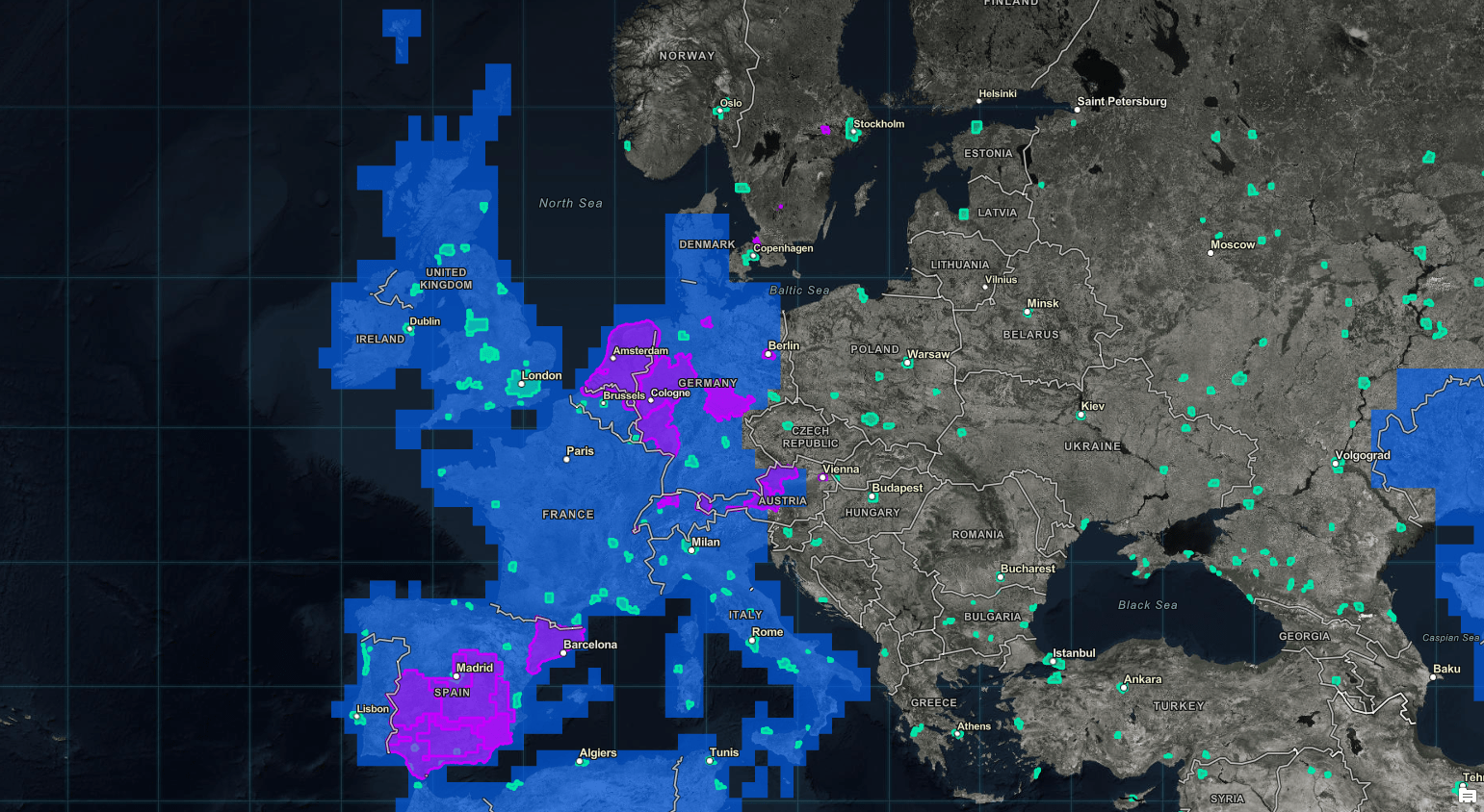
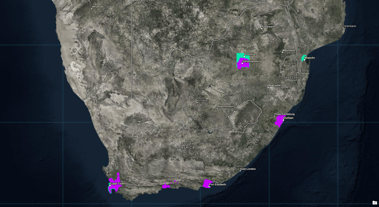
Special thanks to our international distributors and Community Maps contributors in North America, Europe, New Zealand, and South Africa. Thank you for your continued efforts and outstanding contributions to the World Imagery basemap.
Coverage Overview and Highlights
-
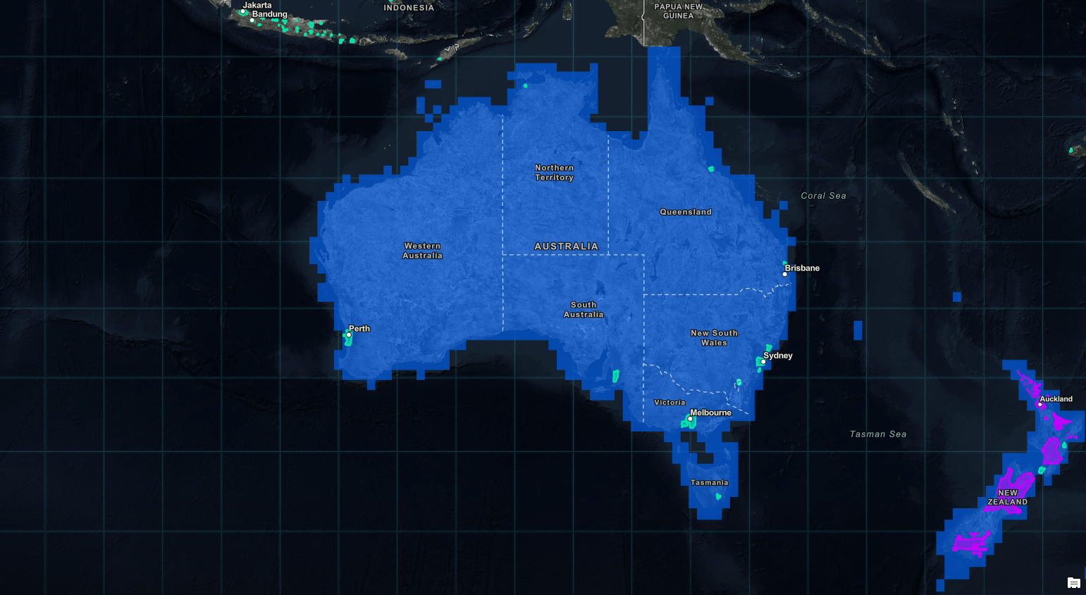
Vivid, Metro, and Community for Australia and New Zealand
In Case You Didn’t Know
If you ever find that a recent imagery update does not meet your needs, and you prefer the previous imagery, then World Imagery (Wayback) may be just what you need. Wayback is the latest addition to our family of World Imagery offerings, which also includes Clarity and Firefly, in addition to our default World Imagery basemap.

Commenting is not enabled for this article.