The World Imagery basemap continues to be a widely used global imagery service across the Esri platform. The World Imagery basemap is frequently updated with newly acquired high resolution satellite imagery from Maxar’s Vivid product line and aerial imagery through Esri’s Community Maps Program. Every release of the World Imagery archive is discoverable through the Wayback Application.
What’s New topics for 2025 include:
- Content updates, including improved quality and capacity with the addition of Maxar’s WorldView Legion satellites.
- Geospatial AI workflows that utilize World Imagery as a source for automated feature extraction.
- Updates Mode in the Wayback App, which enables subscribed users to see where recent and pending updates occur.
World Imagery Content Updates
Over the past year, 1000 metropolitan areas have been published or are pending publication with updated Maxar’s Vivid Advanced 30 cm imagery and Vivid Advanced 15 cm HD imagery for select cities. This imagery covers over 1.4 million square kilometers and encompasses most to the global population.
Regional updates are supported in resolutions ranging from 30 – 120 cm. with Maxar’s Vivid Standard imagery. 116 million square kilometers of regional imagery has been published in the past year with another 24 million km2 pending publication.
Maxar’s constellation currently has 4 of its 6 WorldView Legion satellites contributing imagery to Maxar’s Vivid product line, which is making its way into World Imagery basemap releases in 2025. When fully operational the constellation will more than triple Maxar’s imaging capacity of 30 cm. class imagery. This increased capacity will help drive improvements to the World Imagery basemap in 2025 and beyond.
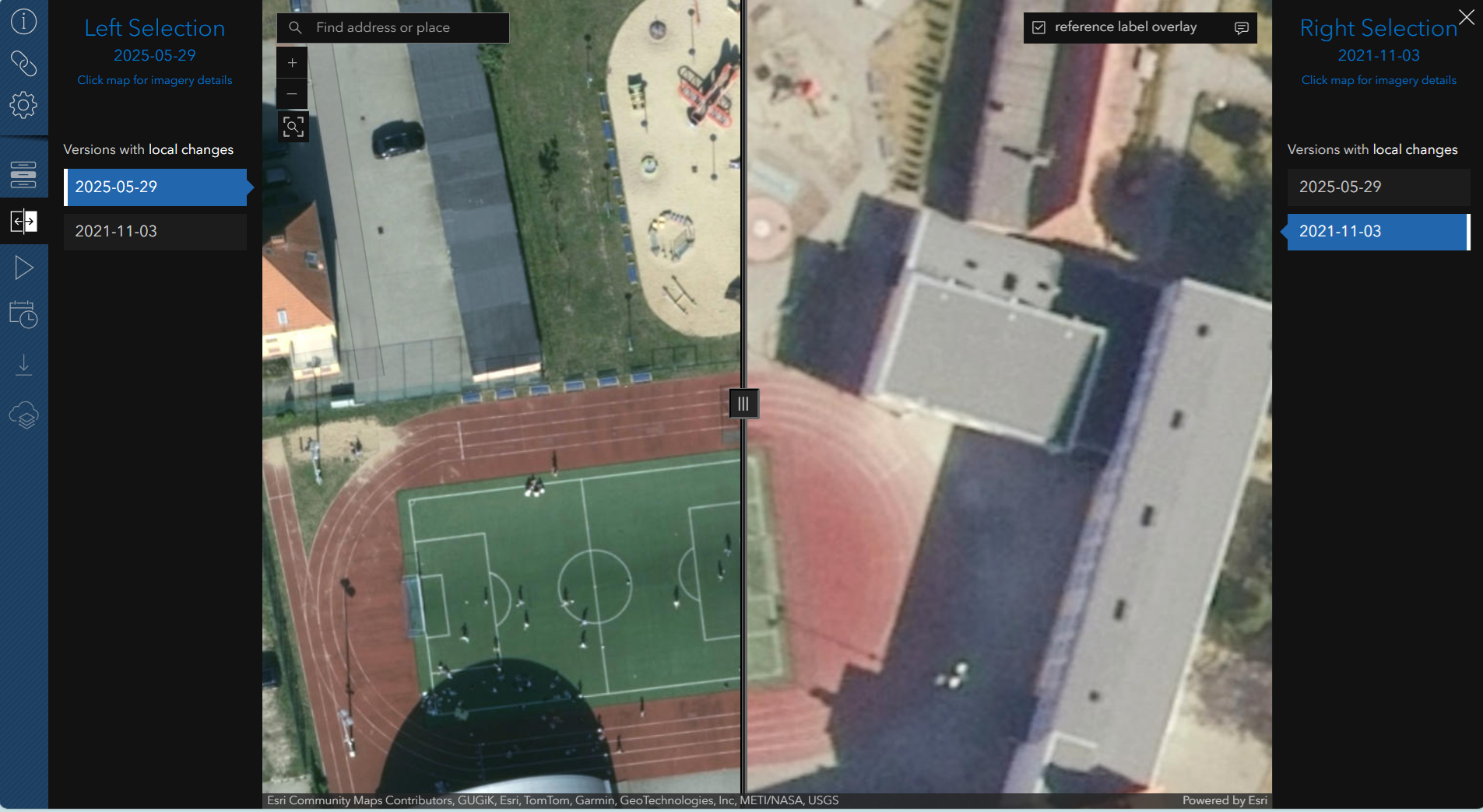
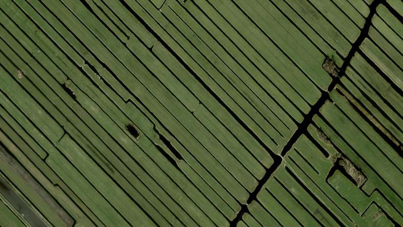
Esri’s Community Maps Program supports the World Imagery basemap with ongoing authoritative, highly detailed aerial imagery contributions from local and national mapping agencies around the world and through Esri distributors and partnerships. 2025 has seen significant contributions for communities in New Zealand, Canada, Estonia and elsewhere. A highlight has been the addition of 5 cm. aerial imagery for over a hundred and forty sites throughout Poland, with more sites pending release soon. See the incredible clarity of this upgraded imagery by leveraging the swipe tool in the Wayback App to compare it against the previous version of imagery.
World Imagery for Geospatial AI Feature Extraction
ArcGIS Living Atlas of the World offers pretrained deep learning models and high-resolution World Imagery for automated feature extraction. A learning tutorial guides users through using these resources to detect and extract building footprints in ArcGIS Pro. A success story of this workflow in action is featured in this Summer’s ArcNews.
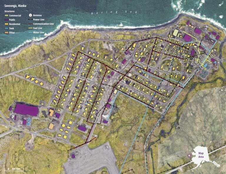
Geospatial AI Helps Map 64 Remote Communities in Alaska
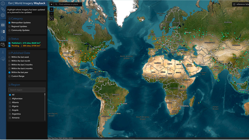
Updates Mode in the Wayback App
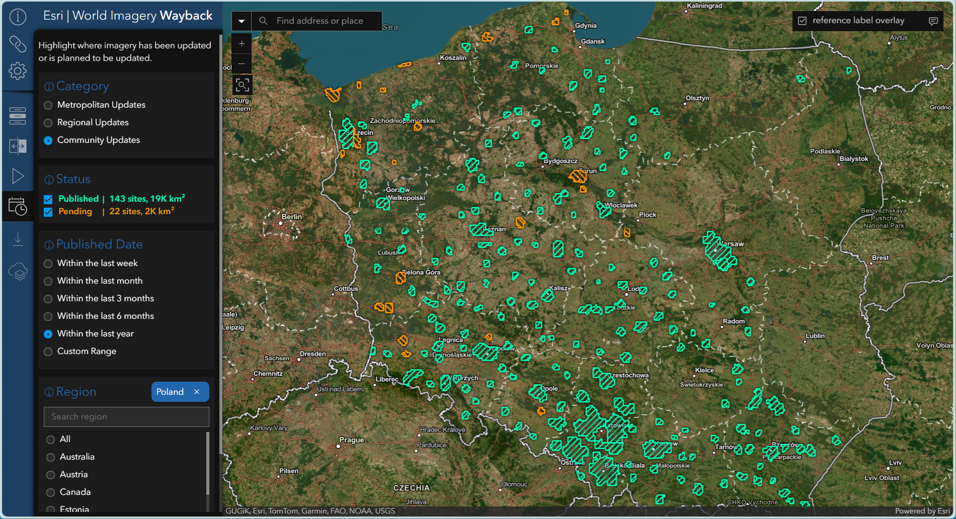
The World Imagery basemap releases new content approximately once a month. Now subscribed users can see just how frequently, and where, the World Imagery basemap is being enhanced using the Updates Mode in the Wayback App.
This mode allows subscribed users, who login to the Wayback App, to see where published updates have taken place in the last year, as well as where updates are pending, for the World Imagery basemap. Users can sort by imagery category, status, published date and region of interest. Read more about this exciting new feature in the Esri Blog World Imagery Wayback – 2025 Enhancements
In the following image, the Updates Mode highlights all the newly published and pending areas in Poland that have been, and will soon be, enhanced with stunning 5 cm. imagery through Esri’s Community Maps Program.
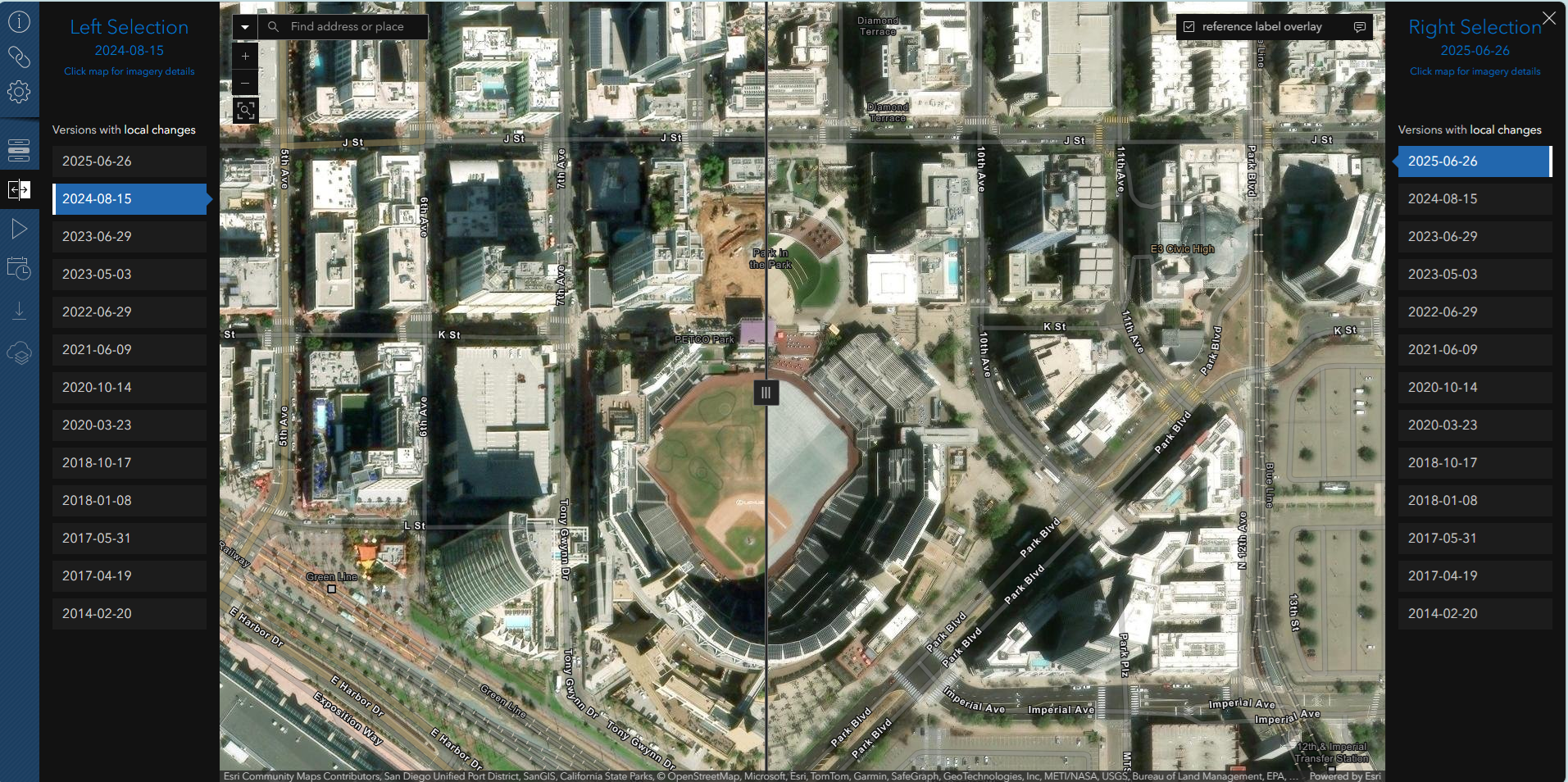
World Imagery is ready to party!
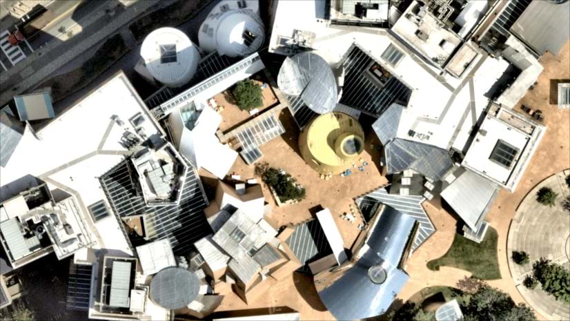
The 2025 UC Party hosted by Esri will take place in The Park at the Park in Gallagher Square by The Petco Park Stadium. The park and stadium have both undergone extensive renovations that have enhanced both venues. The Esri World Imagery basemap for San Diego has also received a major upgrade, with the addition of new Maxar’s Vivid Advanced 15 cm. HD imagery. Maxar’s proprietary high-definition (HD) technology enhances the visual clarity of the company’s high-resolution satellite imagery. Visit The Park in the Park in the Wayback App to explore the renovation results, then visit again in person on Thursday Night July 17th, 2025 to party with the greater Esri User Community.
Additional Resources
Geospatial AI Helps Map 64 Remote Communities in Alaska
ArcGIS Living Atlas of the World Deep Learning Packages
Credits
World Imagery Production and Curation: Jim Mason, Chris Egle, Atif Zafar, and Team
ArcGIS Living Atlas Imagery Team Lead: Rob Waterman
Wayback System Architecture: Dr. Lucian Plesea
App Development: Jinnan Zhang
AppUI/UX: John Nelson


Article Discussion: