In the news
Here’s what’s in the news on Friday, March 12, 2021.
- Severe weather, historic snowfall and flash flooding are forecast for the next few days in areas of the central United States, from the Rockies to the Mississippi River Valley.
- The Colorado National Guard has been activated ahead of the major winter storm that could dump 2 feet of snow, making travel difficult to impossible.
- Parts of Wyoming could also see two or more feet of snow by Monday.
Explore the storms
ArcGIS Living Atlas of the World includes authoritative live feeds and other content that helps you learn more about severe weather and where it’s happening. Follow the links and examples below to explore Living Atlas content for upcoming storm events.
Note that current events are dynamic, time-dependent, and change rapidly, so your maps may show different results.
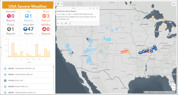
USA Severe Weather Reports Dashboard
Created with ArcGIS Dashboards, the dashboard displays severe weather reports from the National Weather Service for the past 24 hours.

The National Weather Service collects reports of severe weather events and weather-related damage and continuously updates this information each day. The dashboard displays local storm reports from the 122 forecast offices across the U.S., which are consolidated and served in ArcGIS Online by the State of Georgia’s Emergency Management and Homeland Security Agency.
For more information on ArcGIS Dashboards, see the Dashboards overview and What is a dashboard. For more information on this dashboard, see the USA Severe Weather Dashboard description.
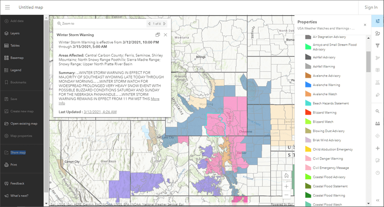
USA Weather Watches and Warnings
This layer is a live data feed from the National Weather Service containing official weather warnings, watches, and advisory statements for the United States. Open the layer and it will be added to a new map using your default basemap.

You can save your own weather map and use it in configurable apps. See Map winter storms using ArcGIS Online and ArcGIS Living Atlas.
View all ArcGIS Living Atlas authoritative weather content.
About ArcGIS Living Atlas of the World
ArcGIS Living Atlas of the World is the foremost collection of authoritative, curated, geographic information from Esri and the GIS user community from around the globe. It includes maps, apps, and data layers to support your work. To learn more, visit the ArcGIS Living Atlas website.


Article Discussion: