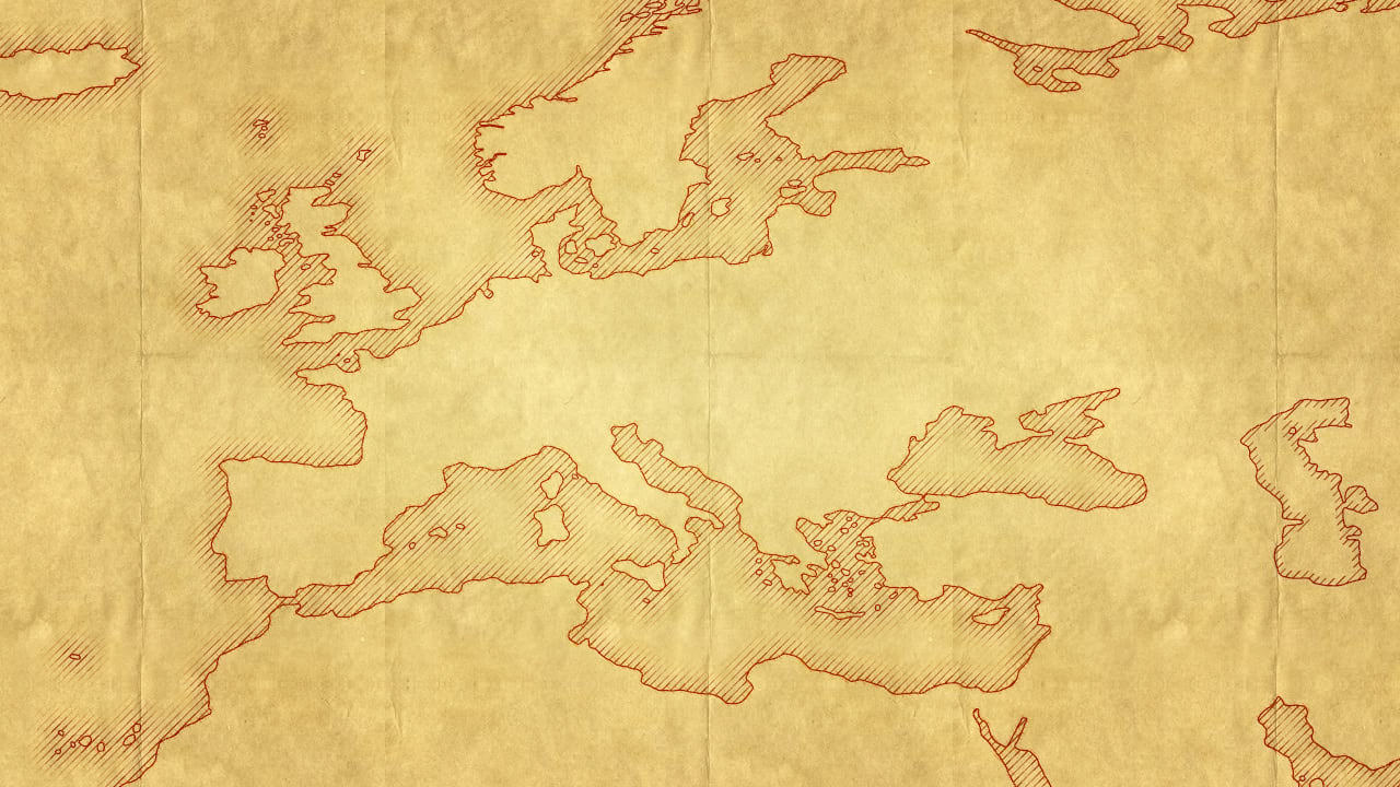
Have you ever been making a map and you want to add in that technique of our forebears who illustrated coastal areas with an exquisite hand hatching where the line thickness fades out, away from the coast? I sure have. And I used to use a multiple ring buffer to create areas of consecutive distance from the coast, and then fill them with a hatched effect. But each polygon has a slightly different extent and the hatching doesn’t line up well. Also, when you zoom in or out you still have a coastal effect that is too small or too large because it uses a true geographic distance. Geoprocessing tools and additional actual geometry layers for a purely visual effect? Nah, let’s try symbol effects!

You can stack up all sorts of wonderful symbol layers for a single map layer, and you can give then sizzling hot effects. In this example we’ll use the “offset” and “donut” effects. Hang on, have to go grab a snack.
Ok, I’m back. This video is dressed up as a One Minute Map Hack, which normally we reserve for five-pack blog posts. But this one is interesting, and simple, enough that it warrants its own post.
0:00 Check out this glorious historic example by Cheysson from the 1880s. Ken Field is making a sharable style for that.
0:06 Set the fill type to hatched.
0:10 In the structure tab (wrench) add two effects: Offset and Donut.
0:18 Make those offsets and donuts round and accurate!
0:26 Donut distance of five or so, and offset of 0.
0:31 Duplicate that symbol layer a few times, giving each a bigger negative offset and thinner hatch line width.
0:58 It re-renders at your preferred effect size at all scales instead of too-big or too-small buffers.
1:05 Stop watching this video.
…
1:40 Adding some paper textures from Living Atlas.
2:30 Giving the paper texture a blend mode so the map stays vibrant.
3:13 You know, lets give these hatched lines a Leonardo da Vinci sort of look.
3:58 Giving the hatching a blend mode so it looks inky and real.
5:00 Look, a vintage map with a charming coastal rake effect!
Happy Coastal Mapping! John


Article Discussion: