ArcGIS Living Atlas of the World provides foundation elevation layers to support analysis and visualizations across the ArcGIS platform. In this release, world elevation layers (Terrain and TopoBathy) are updated with following elevation datasets:
- Lidar derived 1 meter DEMs covering partial areas of the conterminous United States from USGS 3D Elevation Program (3DEP)
- Lidar derived 0.5 meters DEM covering Canton of Zurich, Switzerland from Geoinformation Kanton Zürich
- DEMs at 0.2 arc second (approx. 5 meters) resolution covering partial areas of Japan and at 0.4 arc second (approx. 10 meters) resolution covering entire Japan from Geospatial Information Authority of Japan (GSI)
- Updated 2 meters coverage of England & Wales
Let’s see a few areas that exemplify these improvements.
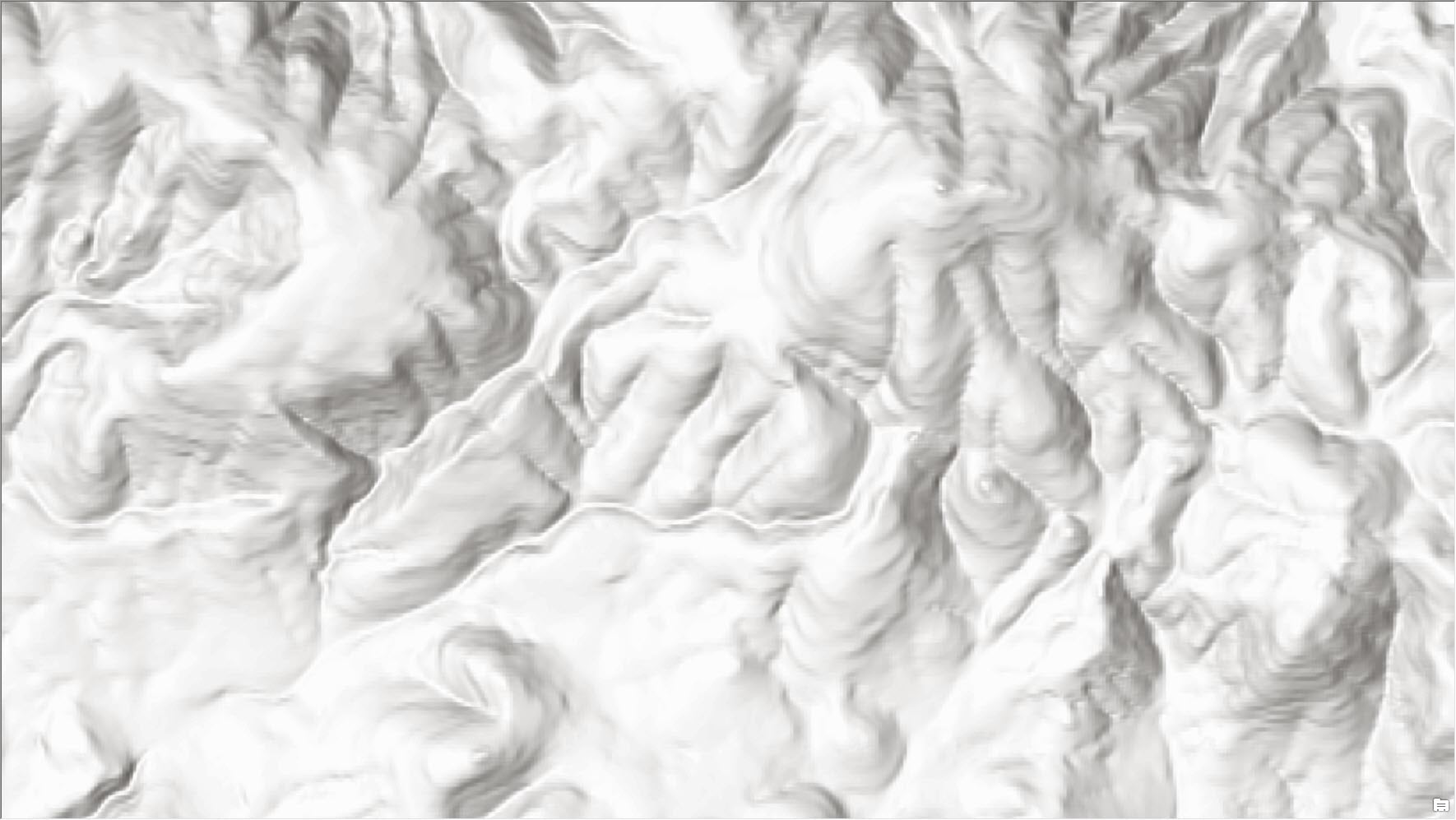
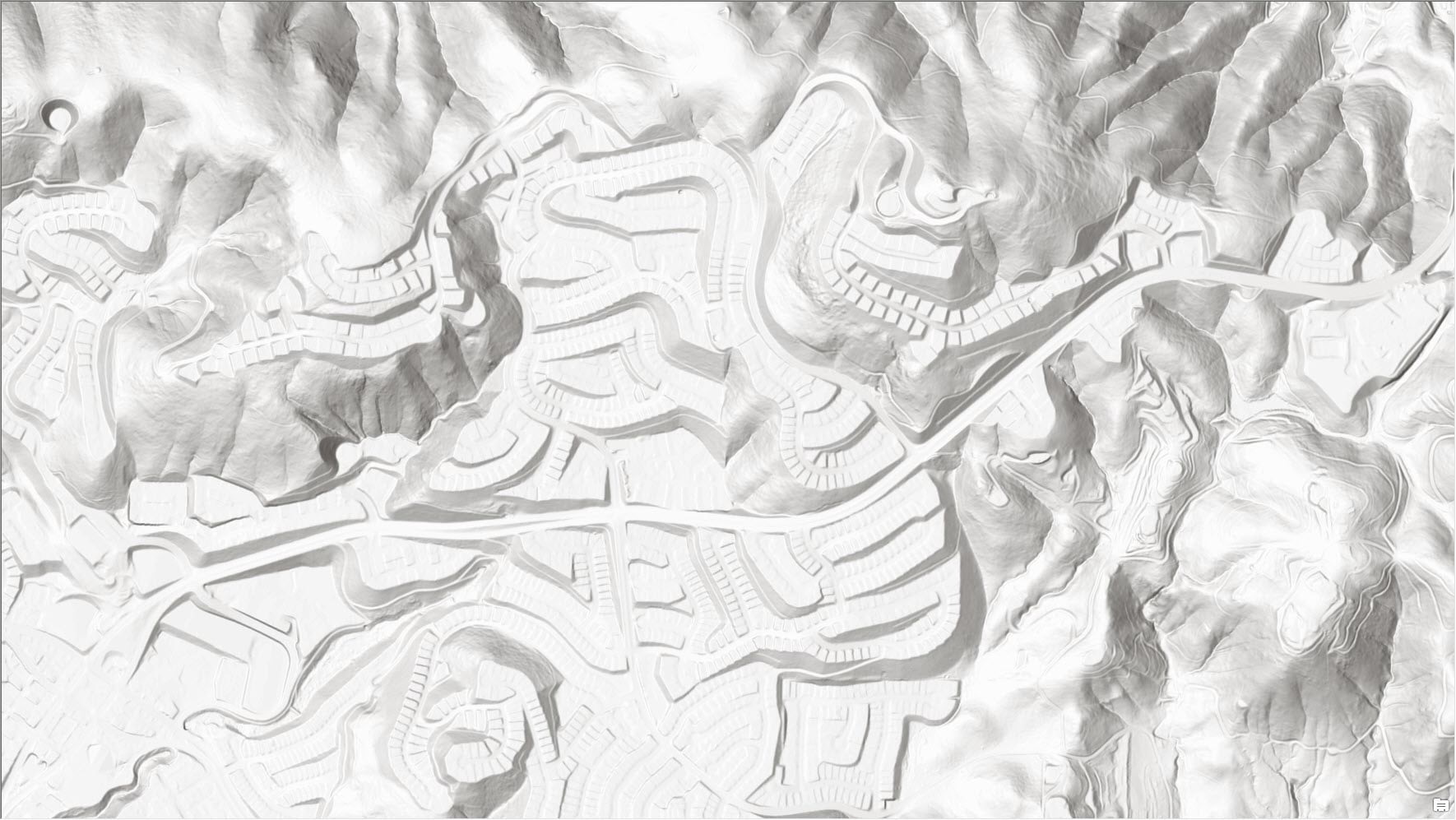
San Elijo Hills, San Marcos, CA – depicting the change in landscape with USGS 3DEP lidar derived 1 meter (bottom) in comparison to USGS 10 meters (top)
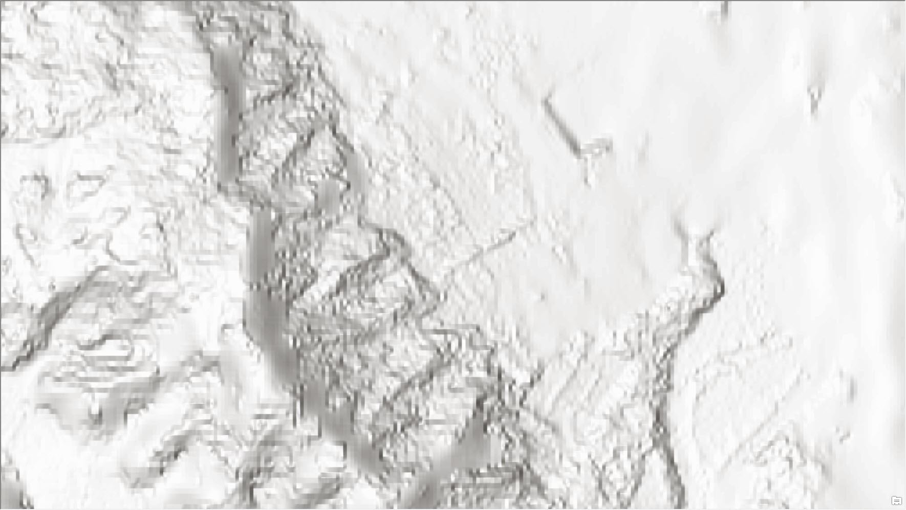
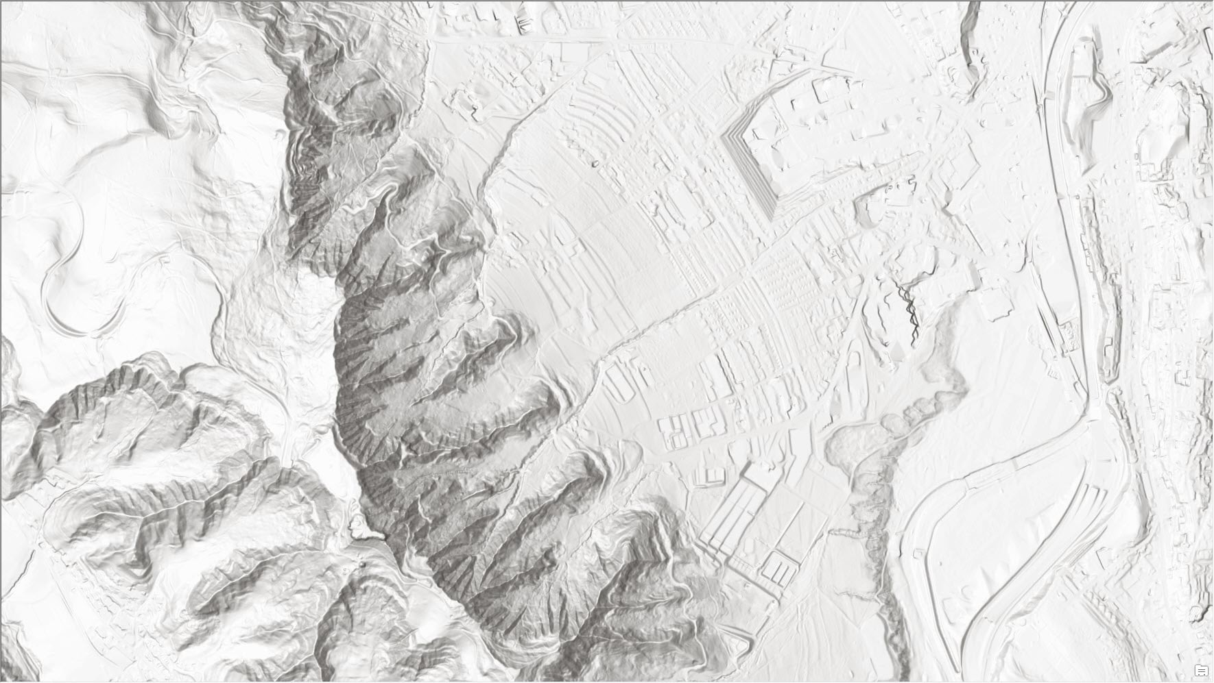
Zurich, Switzerland – showing 48x more details with 0.5 m lidar derived DEM (bottom) in comparison to 24 m WorldDEM4Ortho (top)
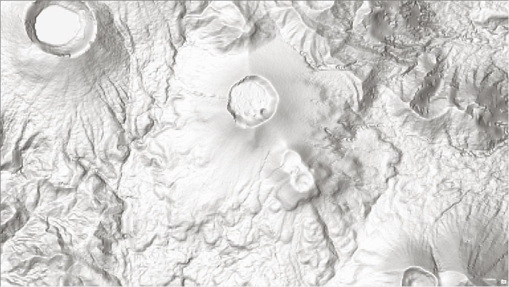
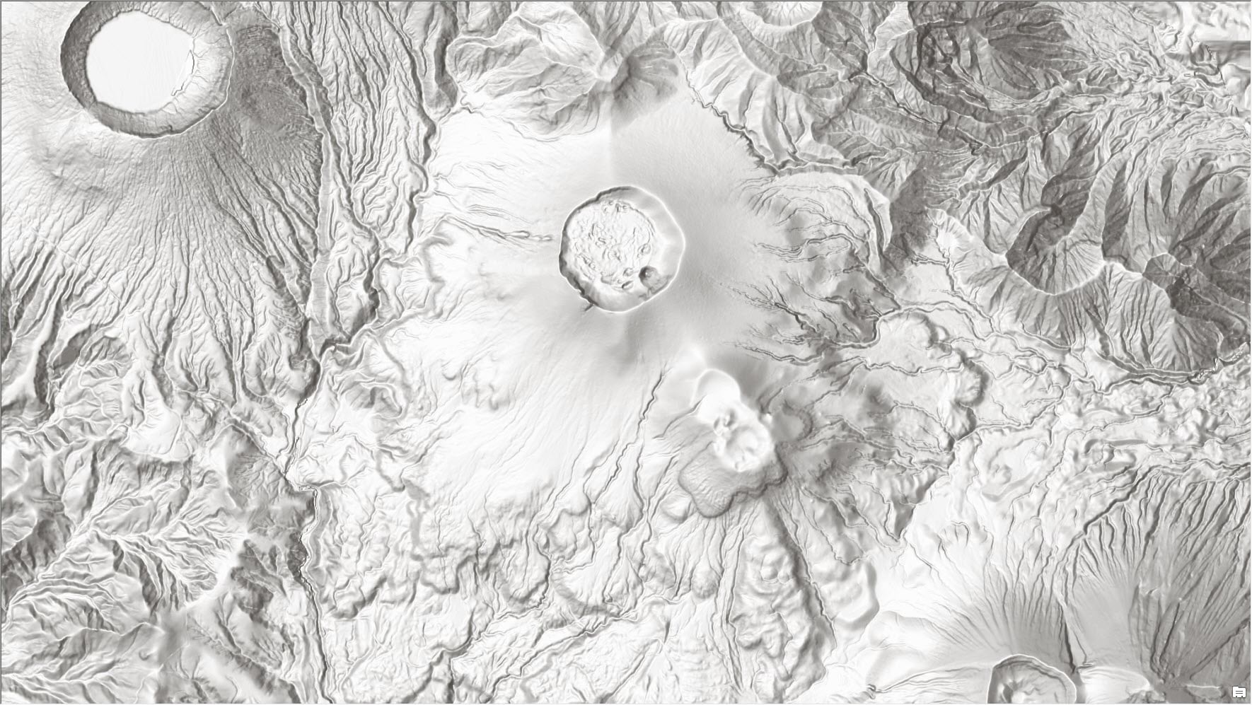
Shinmoe-dake, Kyūshū, Japan – an active stratovolcano (part of the Mount Kirishima) last erupted in June 2018, depicted with GSI’s 5 m DEM (bottom) vs 24 m WorldDEM4Ortho (top)
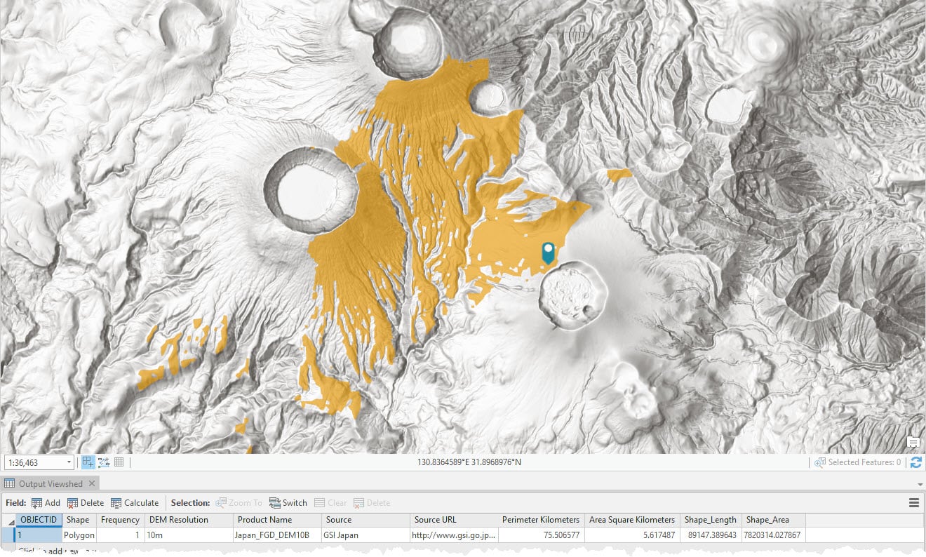
In this release, Elevation Analysis Tools (Profile, Viewshed and Summarize Elevation) also got support of 10 meters data from GSI, Japan. On running these tools using desktop (ArcGIS Pro, ArcMap) with 10 m DEM resolution selected, the analysis will be performed using 10 m Japanese data.
Shinmoe-dake, Kyūshū, Japan – Volcanic eruptions visibility areas calculated (orange) with viewshed service tool using GSI’s 10 meter elevation data
The elevation profile web application template available via ArcGIS Online configurable apps uses the ‘Finest’ DEM resolution as default and will automatically use 10 m data in Japan.
These updates will also be rolled out to other world elevation derivative products – Elevation 3D (Terrain3D and TopoBathy3D) and World Hillshade by the next quarter.
For more information about the various data sources available in World Elevation services, check out the Elevation coverage map. Esri will keep improving World Elevation Services, Tools and derivative products by including high resolution data from open source and the Esri Community Maps program. Additionally, to contribute high-resolution elevation data to the Living Atlas of the World, check out the Esri Community Maps for Elevation program.


Commenting is not enabled for this article.