The Natural Resources Conservation Service (NRCS) produces one of the world’s largest collections of natural resource information. The Soil Survey Geographic Database (SSURGO) maps hundreds of soil attributes in over 70 tables and contains more than 36 million mapped features. SSURGO represents over 100 years of work by many soil scientists. The database contains information ranging from the chemical and physical properties of the soil to derived interpretations used in engineering, natural resource management, disaster response, and climate science.
The ArcGIS Living Atlas Environment Team uses this rich data source to produce 21 imagery layers, a map image layer, a feature layer and a downloader web application. NRCS produces an annual data snapshot that is used to update our resources. This release updates our SSURGO-derived layers to the 2019 snapshot.
New attributes
With this release we added 18 new agriculture related fields to the feature layer and map image layer. The attribute tables now include estimates of yield for four major crops (corn, cotton, soybeans, wheat). Values for both irrigated and nonirrigated farming systems are provided in units of bushels/acre (pounds/acre for cotton).
Five new fields provide access to the National Commodity Crop Productivity Index (NCCPI) Version 3. The NCCPI provides a standardized value for the entire nation and allowing comparisons between regions. The NCCPI ranks soils on a scale of 0-1 with larger values indicating more productive soils. The five new fields provide NCCPI values for corn, soybeans, cotton, small grains, and an overall value.
Other new fields include: Root Zone Depth, Root Zone Available Water Storage, Droughty Soil Landscapes, Potential Wetland Soil Landscapes, and Saturated Hydraulic Conductivity.
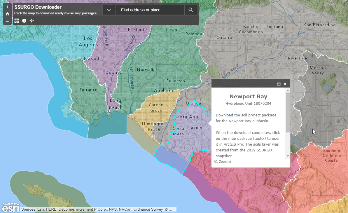
Downloader
Now with 173 attributes ready for you to use, the SSURGO downloader provides quick access to key SSURGO variables. The downloader update includes the 18 new attribute fields added to the feature layer and updates the data to the 2019 snapshot. The downloader now provides data in Project Packages that open directly into ArcGIS Pro.
Look for us at the Users Conference. We will be in the Environment area of the Data and Location Services showcase and available to answer your soils questions.

Commenting is not enabled for this article.