ArcGIS Mission 12.1 delivers targeted enhancements that strengthen command and control, improve situational awareness, and reduce operational friction during active missions. This release focuses on usability at scale—helping mission owners, analysts, and responders act faster and with greater confidence.
Here’s a look at what’s new.
Video and Media Files Integrated into Mission Workflows
ArcGIS Mission now brings video directly into the mission experience when ArcGIS Video Server is configured with your portal. Mission managers can view live and recorded video layers alongside maps, tasks, and tracks, helping teams correlate what they see with where events are happening.
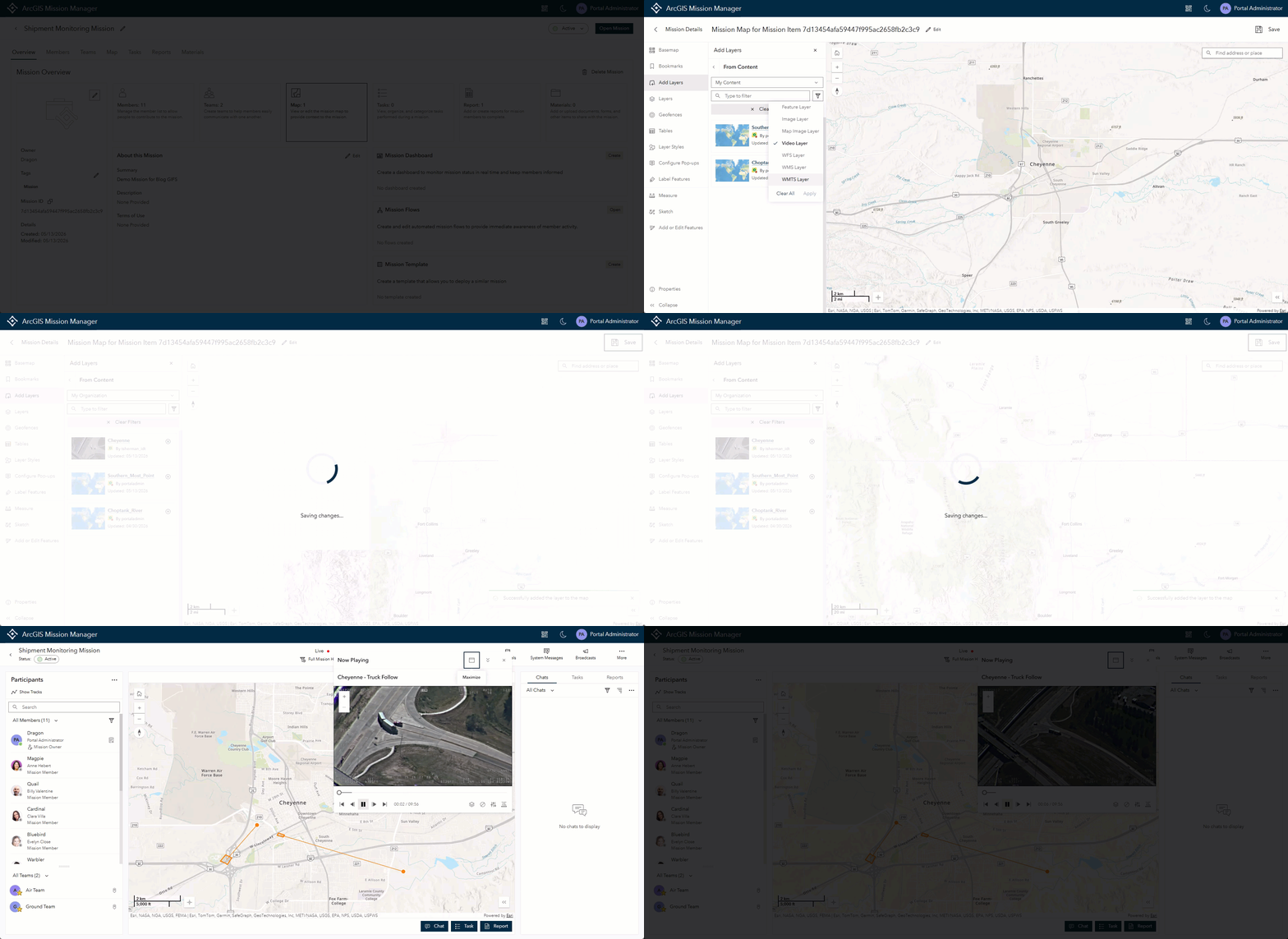
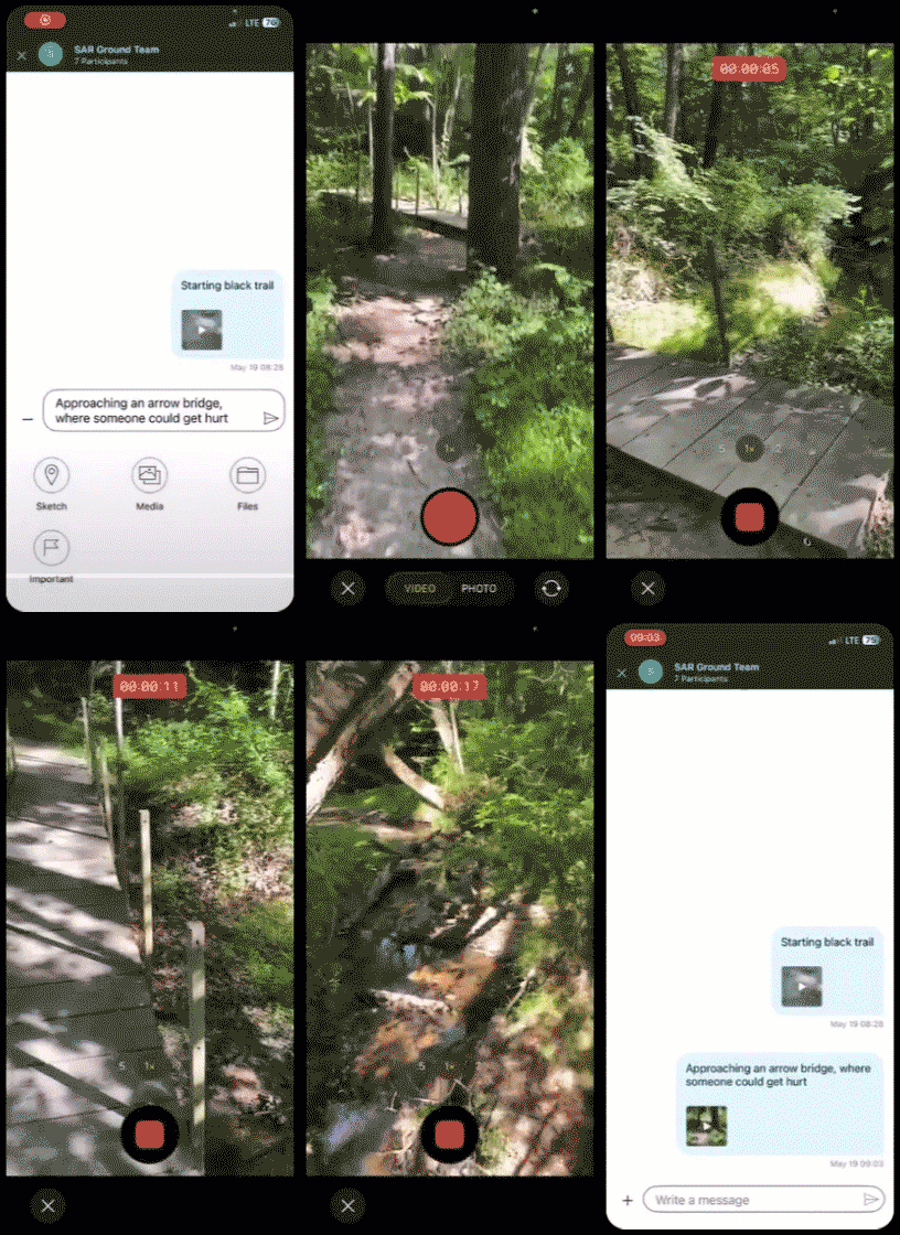
In addition, audio and video attachments are now supported across chats, tasks, and reports. Field users can share richer context, and command staff can review media inline—without leaving Mission. Mission Manager and responder users can easily view these attachments in Mission. To send and view these attachments, ArcGIS Video Server is not required.
Improved Identification with Call Signs
Mission 12.1 enhances how personnel are identified and engaged during operations.
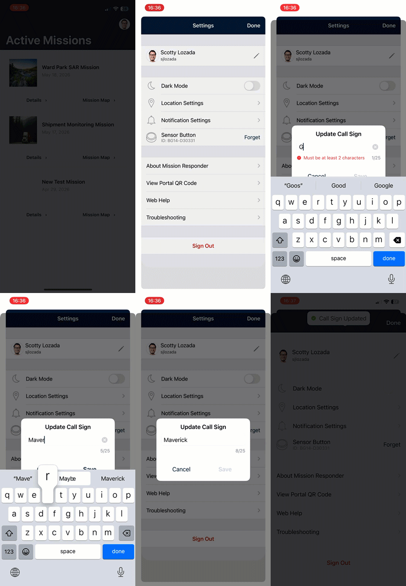
Responders can assign or update their own call signs directly from the mobile app, enabling flexibility across shifts and roles. Once set, call signs are visible across Mission Manager and Responder.
Mission Manager also supports searching, chatting, and tasking by call sign, aligning Mission workflows with real‑world dispatch and public safety practices.
Smarter Tasking and Personnel Visibility
To support faster coordination, Mission 12.1 introduces new participant and task‑focused tools:
- Mission Member filtering by task status, allowing leads to quickly identify who is available or already tasked
- A Mission Participant Counter that provides an at‑a‑glance view of mission size and engagement
- Bulk management of Mission Leads, enabling administrators to promote or demote multiple members at once
These enhancements simplify decision‑making in large or fast‑moving missions.
Mission Map Editing Enhancements
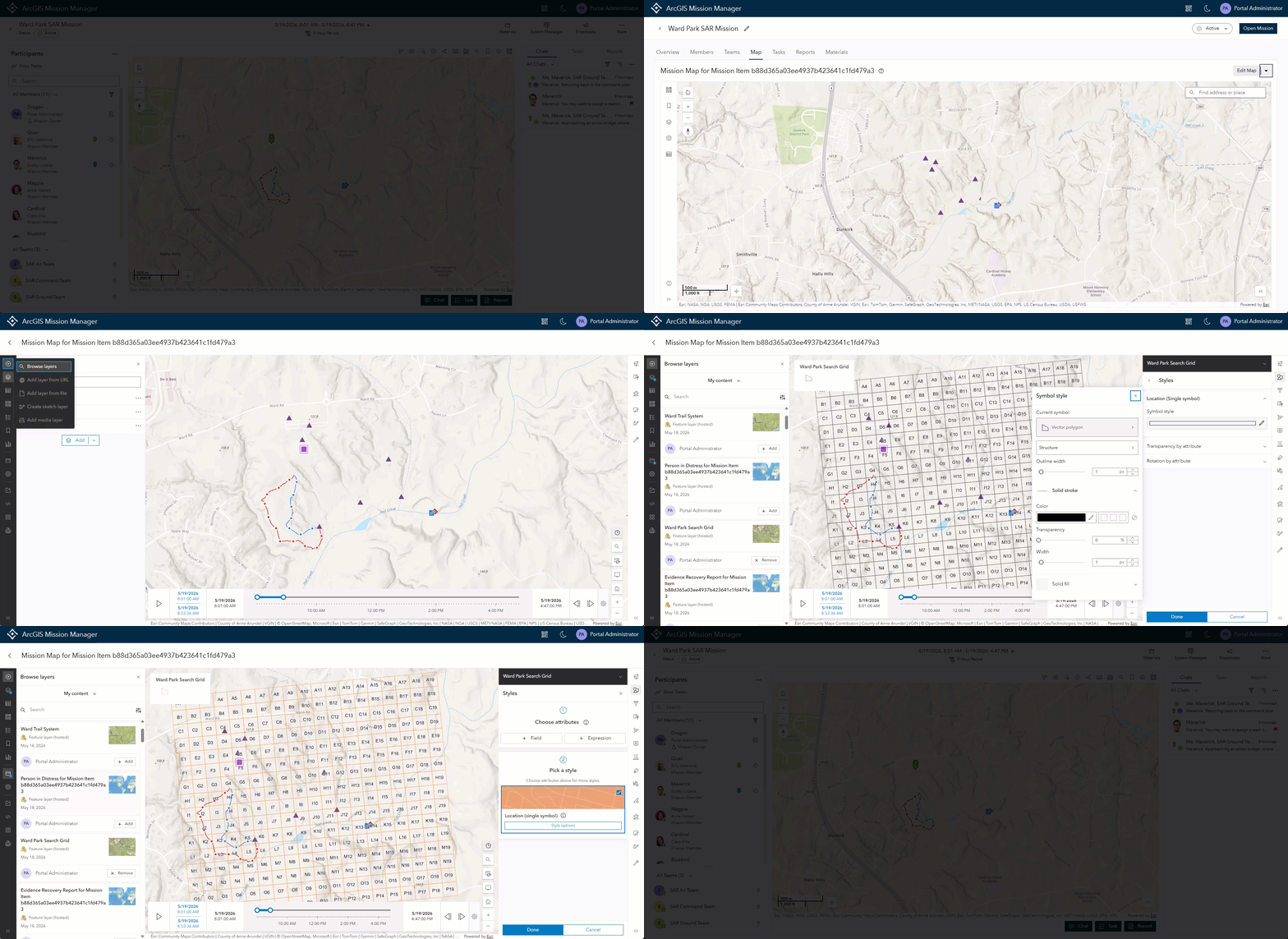
Mission owners and leads can continue to edit mission maps during operations, with improved flexibility through Standard and Advanced Map Editing options. When deeper configuration is required, maps can be opened directly in the traditional ArcGIS Map Viewer—without breaking mission context.
This ensures the operational picture stays accurate as conditions change.
Team Avatars for Faster Visual Recognition
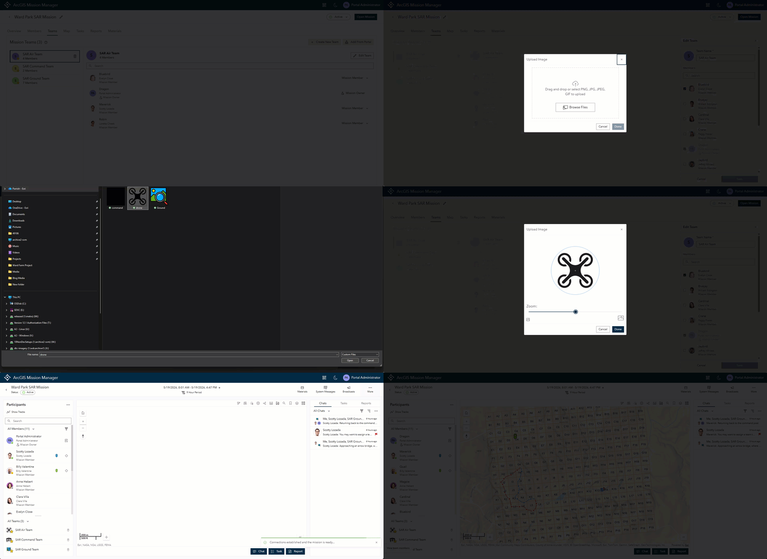
Teams can now be assigned custom avatars, such as icons or images, that appear throughout the Mission interface. Avatars make it easier to visually distinguish units in participant lists, chats, and map views—reducing cognitive load during high‑tempo operations.
Report Overview with Bulk Caching
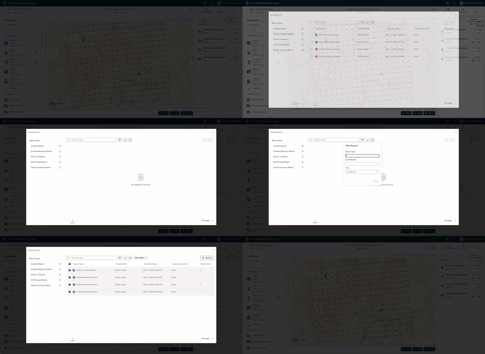
Mission 12.1 introduces a Report Overview table that summarizes reports by type and count. Authorized users can bulk cache or restore reports, temporarily hiding less‑relevant information from the map and feeds while preserving it for later review.
This helps teams stay focused on what matters most during live missions.
Mission Dashboard Enhancements
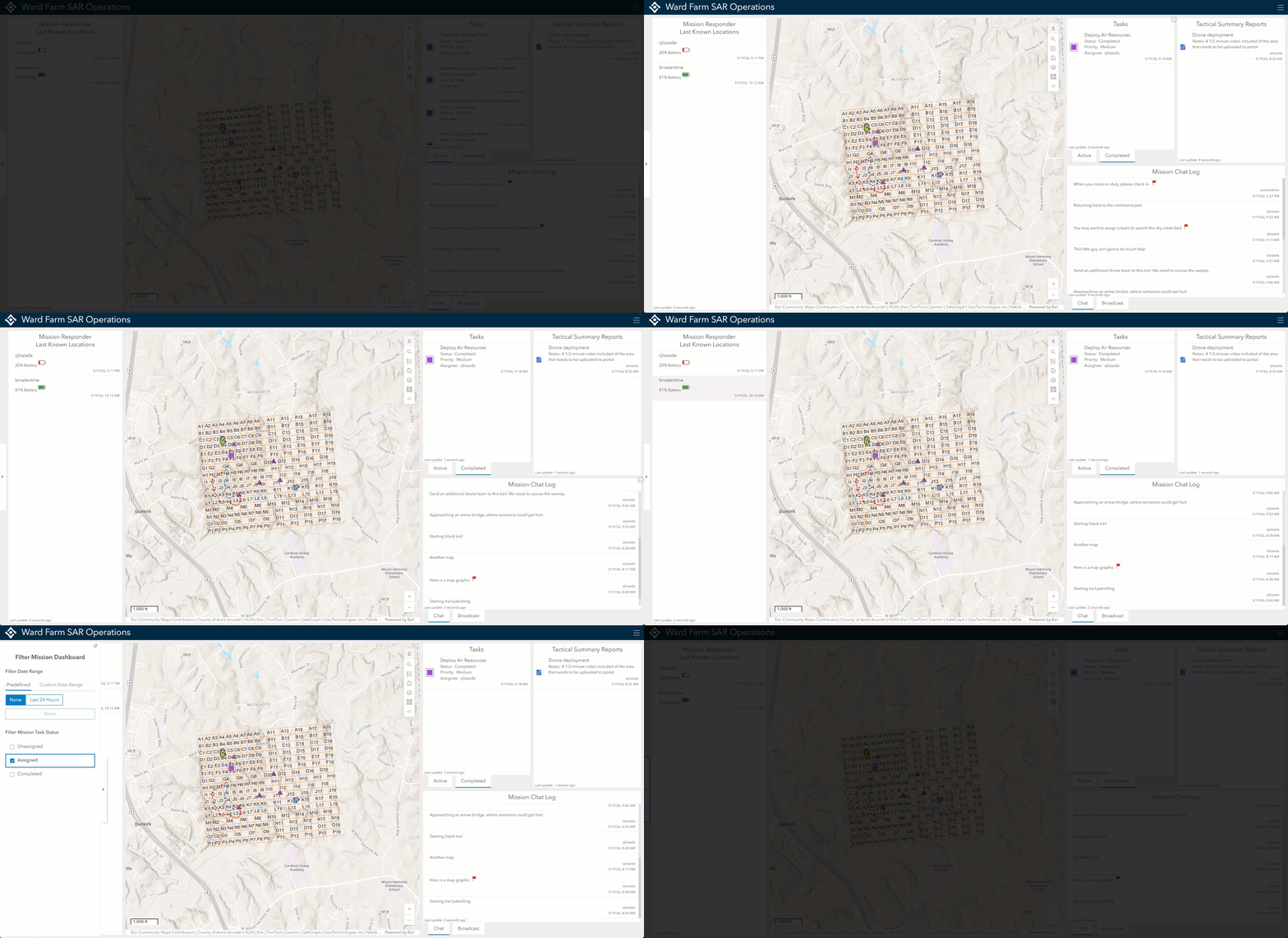
Mission Dashboards now feature a new expanded default layout designed for clearer, high‑level awareness. Dashboards stay tightly aligned with mission data, making them ideal for command centers and executive briefings.
To improve efficiency, users can instantly open the Mission Dashboard using the new keyboard shortcut (ALT + J) from Mission Manager.
More Reliable Location Presence Synchronization
Behind the scenes, Mission 12.1 improves location presence status synchronization across Mission Manager, Mission Responder, and Mission Server. Server‑level handling reduces issues like stale or duplicate location indicators and improves confidence that participant presence and last‑known locations are accurate during long‑running missions.
A Focused Update for Operational Excellence
ArcGIS Mission 12.1 strengthens the platform where it matters most—real‑time operations. By improving clarity, reducing clutter, and enabling faster interaction, this release helps teams plan, execute, and oversee missions with greater effectiveness.
To learn more, explore the ArcGIS Mission documentation or see these capabilities in action through upcoming demos and videos.






Article Discussion: