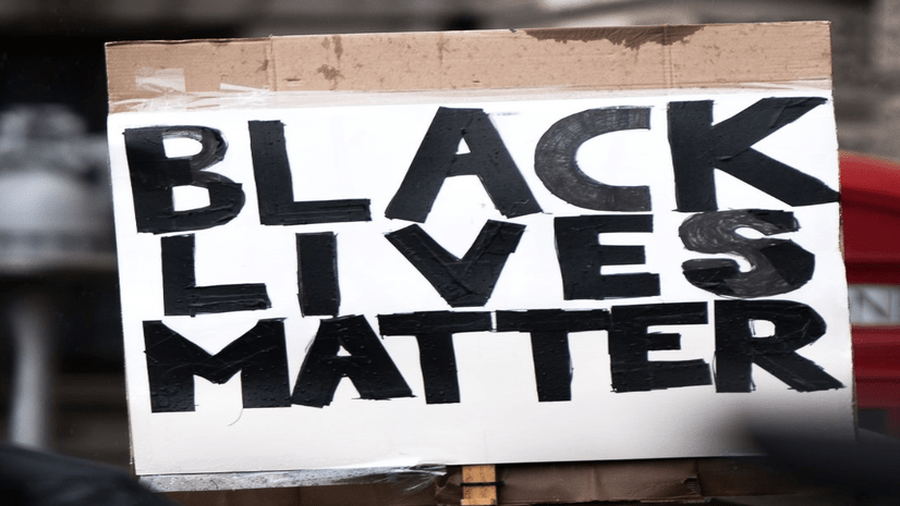
Esri’s Federal GIS Conference is an opportunity for leaders from across federal government agencies to share how GIS powers a deeper understanding for effective government solutions. This year, in the midst of a national call for racial justice and a pandemic that has exposed long-standing health, economic, and other societal inequities, the federal government has made racial equity a top priority.
Esri and our users recognize the role of geospatial technology in helping organizations address longstanding racial injustices and develop more equitable policies and programs. Listed below are opportunities at the FedGIS conference where attendees can come together as a geospatial community to hear from leaders, gain insight, and discuss solutions to these pressing issues.
Monday, February 22nd
Racial Equity and Social Justice in Federal Agencies – How Does Data Help?
4:00 – 5:00pm EST | Breakout Session
Description: How can Federal agencies/programs apply GIS to identify and address disparities? This Breakout session will explore data-driven approaches that Federal agencies take with their stakeholders and partners, and how they can apply to advance equity in policies and programs. More important, we will have an open discussion and brain-storming session to generate ideas on how attendees can apply these approaches in their agencies.

Tuesday, February 23rd
NorthStar & Blacks in GIS – Careers & Leadership in GIS
8:30 – 9:30am EST | Breakout Session
Description: Community building and collaboration for professional and entrepreneurial growth in GIS and geography for Black people / people of the African diaspora. Email racial_equity_team@esri.com to request an invite to the breakout session.

Creating Inclusive Spaces for Women of Color in Government Technology
3:30 – 4:30pm EST | Breakout Session
Description: It is critical to the advancement of GIS and other technologies to have a diverse set of technologists and science communicators that reflect the diversity of the populations that we serve. This panel will present perspectives of women of color in the GIS community and discuss ideas on how to be more inclusive and to make a more supportive and diverse climate for everyone. All conference attendees are encouraged to attend. Email racial_equity_team@esri.com to request an invite to the breakout session.

Wednesday, February 24th
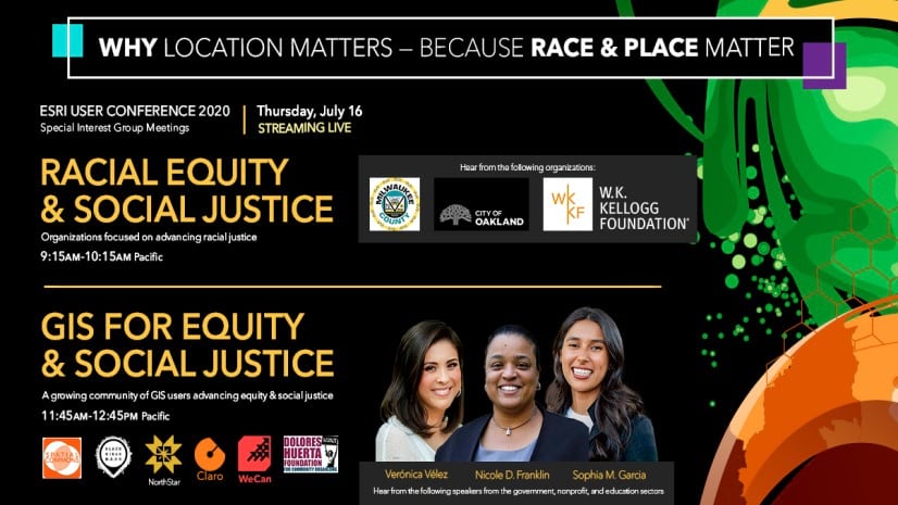
Advancing the Biden Administration’s Racial Equity Priorities
12:00 – 1:00pm EST | Special Interest Group (SIG) Meeting
Description: The President’s Executive Order On Advancing Racial Equity charges each agency to assess its impact on systemic barriers to opportunities and benefits for people of color or other underserved communities, ultimately to develop more equitable policies and programs. GIS can help organizations map and analyze inequities and manage performance of initiatives, engaging the right stakeholders all along the way. Advancing equity requires strong collaboration between the constituents, community leaders, nonprofits, and all levels of government. In this session, gain insight from social justice and technology leaders to inform your organization’s efforts to address inequities along intersections of race, ethnicity, religion, income, gender identity, sexual orientation, disability, and geography.

A Framework for Sustaining Our World: The Role of National, Local, and Global Stakeholders in Achieving the SDGs
12:00 – 1:00pm EST | Special Interest Group (SIG) Meeting
Description: To address the epic challenges we face as a global society, we need to understand where we are today, what we are trying to collectively achieve, and how we are making progress. This understanding is necessary to catalyze action across all stakeholder groups – government (both national and sub-national), private sector, academia, civil society, and citizens. In this SIG, we will explore how various stakeholder groups are confronting these issues, from food insecurity to racial inequity, and applying the power of GIS to develop local to global solutions, share information, and champion global responsibility to advance the U.N. Sustainable Development Goals (SDGs) by the year 2030.

Gender Inclusiveness
4:00 – 5:00pm EST | Breakout Session
Description: In this presentation and discussion, we will look at how nonprofits, NGOs, and global organizations are using Esri technology to elevate Gender Inclusiveness. Email racial_equity_team@esri.com to request an invite to the breakout session.

Register Today
Don’t forget to register for the conference to attend these and other events! See you there.


Article Discussion: