Explore the planet more deeply with Esri’s new Landsat Explorer web app! Use the app to both visualize our planet and understand how the Earth has changed over time. Now you can instantly analyze more than 500,000 Landsat 8 and GLS scenes, offering global coverage with over 500 new scenes added every day. The app is free, with no download or installation required.
Landsat Explorer enables you use different spectral bands to go beyond what the eye can see. But the Landsat Explorer app isn’t just about viewing images using different band combinations or enhancements. The analysis tools enable you to perform change detection, create custom masks, make your own indexes, generate spectral and temporal profiles, and more, all on the fly. Use the app to instantly access multispectral and temporal Landsat imagery to reveal how the Earth’s surface has changed over the last forty years.
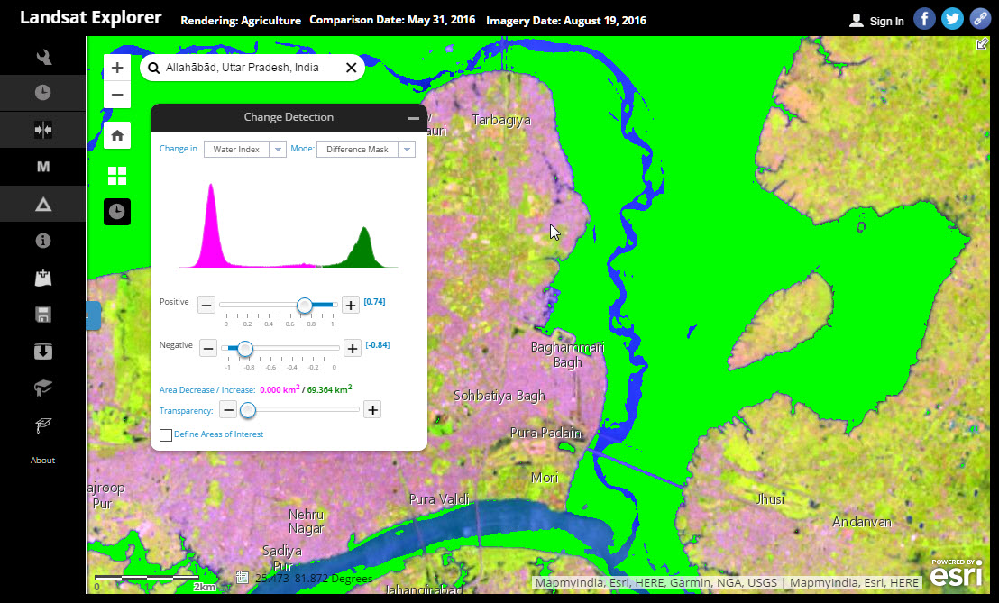
Curious to see how your hometown has expanded since you were a kid? Zoom to your hometown and use the time slider to compare before and after images. Want to quantify areas of agriculture usage or forest burn? Use the Mask tool to identify specific types of landcover, interactively setting thresholds. Want to measure the extent of a flood, like in Allahabad, India, below? Select two points in time and use the Change Detection tool to highlight the affected areas.
 With Landsat Explorer, you can easily and dynamically investigate questions about geology, vegetation, agriculture, and cities anywhere in the world, including the places that matter most to you. And, if you want to share your discoveries, you can save your results to ArcGIS Online or as local files. The app is driven by publicly accessible image services hosted on AWS and directly usable in a wide range of applications, including ArcGIS Desktop.
Ready to get started? Open the Landsat Explorer app and click the icon for a guided tutorial, or check out the Unlock Earth’s Secrets page to learn more about all our Landsat apps.


Article Discussion: