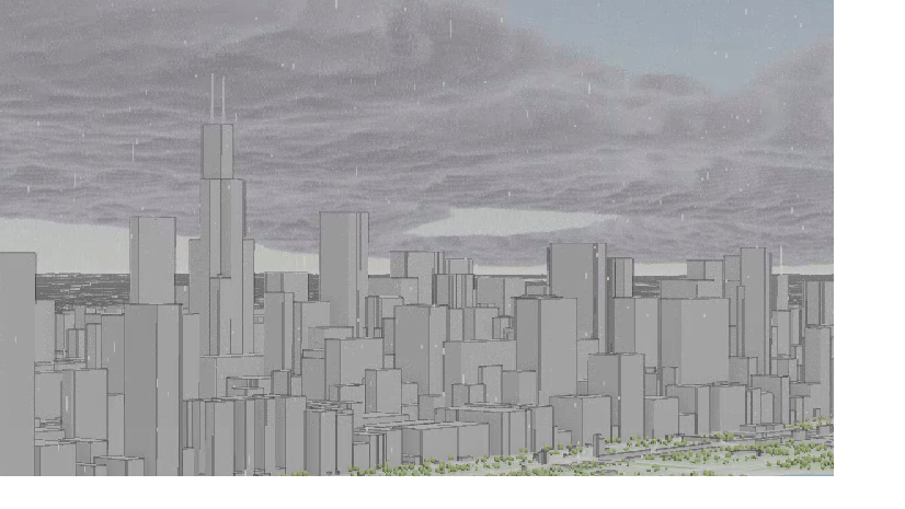
Google Photorealistic 3D Tiles
We are thrilled to announce support for Google’s global Photorealistic 3D tiles mesh dataset! This 3D Tiles dataset can be seamlessly integrated into any local or global scene. Whether you are exploring Zion National Park, Rio De Janeiro, or Tokyo, this authoritative global mesh dataset is the perfect compliment to your 2D or 3D layers.

Unlock the full potential of ArcGIS Pro by visualizing this dataset with your preferred coordinate system. Since the data is in WGS84/WGS84, you can effortlessly utilize projection on the fly , thanks to our extensive support for various coordinate systems and transformations. Whether you are working with Web Mercator, to CUBE (World), or Goode Homolosine (LAND), the world is truly at your fingertips.

To use this layer, you’ll need an API key from Google, and it’s usage is governed by Google’s API policies. Once you have your key, simply add a custom parameter in the Add Data from Path dialog, and you’re ready to visualize mesh content anywhere on the globe.
For optimal visualization, it’s best to use this dataset without the Ground elevation surface or other basemap layers. As with other integrated meshes, it supersedes the ground elevation surface, allowing any 2D layers to be draped over it. Take advantage of exploratory 3D analysis tools like line of sight or viewshed, and make temporary modifications by clipping or replacing parts of the mesh.
Later this year, Esri will be releasing a 3D basemap that integrates Google Photorealistic 3D Tiles. Learn more at go.esri.com/3Dtiles.

3D Tile KHR_Texture_Basisu
The KHR_Texture_Basisu extension is now supported for 3D Tiles layers. Leverage this extension to visualize textures with KTX version 2 with BASIS universal super compression. Take advantage of efficient asset transmission, reduced GPU memory, and better platform interoperability. This functionality adds to the list of already supported textures JPEG and PNG.
3D Tiles layer modification
You can now add modifications when visualizing an integrated mesh 3D tiles layer. This functionality is consistent with previous features added to scene layers, allowing you to cut, mask, or flatten parts of the integrated mesh. Please note that these modifications are temporary and only exist within the ArcGIS Pro scene. They cannot be shared as a web scene to ArcGIS Enterprise or ArcGIS Online.

We continue to add user requested functionality at each release. Looking for something that we do not support yet? Head on over to Esri Community and submit an ArcGIS Idea to let us know!


Article Discussion: