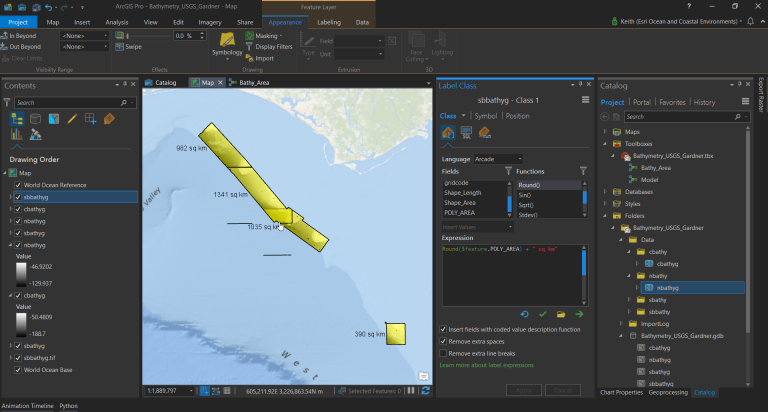
Calculating the extent and coverage for your bathymetry data just got easier.
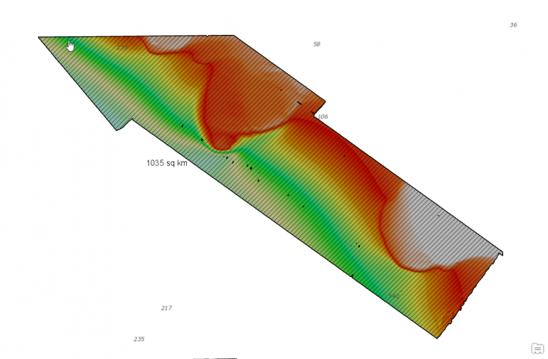
Bathymetry data typically comes as a processed image (.tif or .asc) or maybe even a Bathymetric Attributed Grid (BAG) file. This allows access to a single band of values that represent elevation. This data is commonly stored as 32 bit floating point. While that’s all very informative it’s sometimes difficult to understand how many of the pixels contain data and how many don’t and just how much area was mapped.
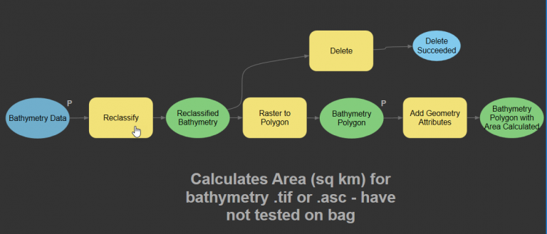
This tool reclassifies the bathymetry data and then generates polygon footprint for the areas where data exists.
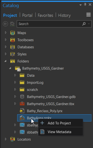
The tool started as a model in ArcGIS Pro and is now available as a geoprocessing package (.gpkx) so you can use it in your ArcGIS Pro projects.
What is a geoprocessing package?
A geoprocessing package is a convenient way to share geoprocessing workflows by packaging one or more tools and the data used by the tools into a single compressed file (.gpkx). Geoprocessing packages are created from one or more successfully run geoprocessing tools.
You can add the geoprocessing package to ArcGIS Pro by downloading it and copying the file (.gpkx) to your ArcGIS Pro Project folder in windows explorer. Then browse to that location in ArcGIS Pro using your Catalog and add the tool to the current project by right clicking on it.
Try it out! Questions or comments? – Join the conversation on GeoNet.


Commenting is not enabled for this article.