The latest release of ArcGIS Pro 2.8 focuses on performance and productivity. The Spatial Statistics team is excited to share some of the new capabilities in ArcGIS Pro 2.8. These include streamlined data preparation, new conversion tools for SAS® datasets, a new tool for smoothing time series data, updates to clustering methods, new and improved geoprocessing messages, and performance improvements.
Let’s look at some of these in more detail.
We have introduced a dedicated view in ArcGIS Pro 2.8 to streamline your data preparation tasks. This view is called Data engineering. It will help you explore, visualize, clean, and prepare your data quickly and confidently. In addition, the Data Engineering view and its associated ribbon help you better understand your data and prepare it for spatial analysis and mapping workflows.
In the Data Engineering view, you can do the following:
- Open a Data Engineering view for one or more layers.
- Explore fields by viewing a list of fields by type, and quickly mapping and charting the data to understand patterns.
- View statistics to gain a better understanding of the data values and distribution.
- Prepare your data by applying geoprocessing tools to clean, construct, integrate, and format the data.
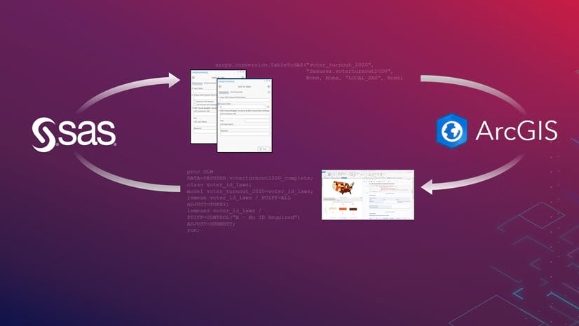
2) SAS®-ArcGIS Bridge
New at ArcGIS Pro 2.8, the SAS-ArcGIS Bridge consists of two new geoprocessing tools for converting between SAS datasets and Esri tables, as well as the SWAT and SASPY Python packages, which allow you to use SAS procedures and custom SAS code in notebooks. Additionally, SAS is now an alliance in the Esri Partner Network.
New tools:
- SAS To Table—Converts a SAS dataset to a table.
- Table To SAS—Converts a table to a SAS dataset
Time series are often messy, and noise can hide important patterns. Time Series Smoothing removes the noise in time series and often makes the underlying signal clearer.
The Time Series Smoothing tool smooths a numeric variable of one or more time series using centered, forward, and backward moving averages, as well as an adaptive method based on local linear regression. After smoothing short-term fluctuations, longer-term trends or cycles often become apparent. This tool is available in the Spatial Statistics toolbox (Utilities toolset).

4) Density-Based Clustering with Time Enhancement
Density-based clustering tool finds clusters of point features within surrounding noise based on their spatial distribution. In ArcGIS Pro 2.8, the two algorithms, Defined distance (DBSCAN) and Multi-scale (OPTICS) have been enhanced to find spatio-temporal clusters.
The new Time Field and Search Time Interval parameters identify clusters of points in space and time. In addition, new 3D options and charts have been added to better understand the patterns.

5) Other performance and productivity improvements
The incremental spatial autocorrelation tool has been improved to work with larger datasets with better speed and performance.
Various tools now use HTML formatting for their geoprocessing messages.

For a complete list of all the new capabilities in ArcGIS Pro 2.8, see What’s new in ArcGIS Pro 2.8.


Article Discussion: