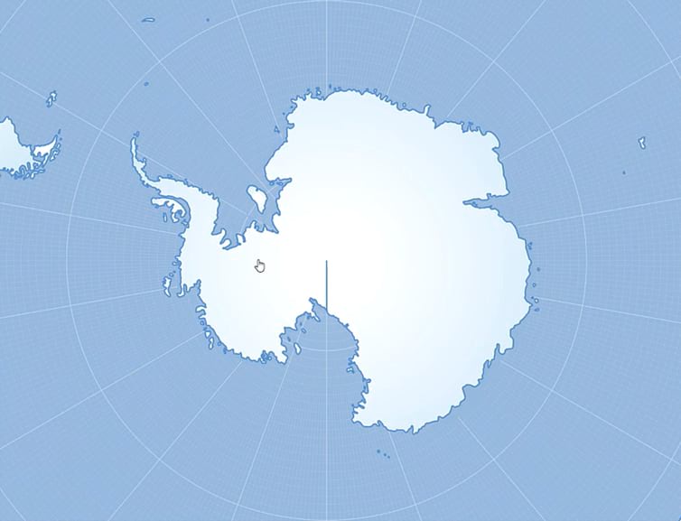
We’ve all had to deal with it. That infernal seam that runs along the International Dateline. It’s no big deal when your coordinate system uses 180 as a split, but it rears up when your projected coordinate system isn’t rectangular or has a center longitude other than zero.
Look at poor Antarctica, with an embarrassing seam showing. Well guess what! It’s not Antarctica’s fault; it’s living as a geographic coordinate system and has been asked to contort into a projected coordinate system. Of course there’s going to be a seam. I, for one, applaud Antarctica for being so accommodating and projecting on the fly.
But still it would be nice if that line weren’t there…

Not to worry! I’ll show you how to…
- Hide it, if that’s good enough. But I’ll also show you how to…
- Fix it!
Ready?
0:00 What’s up with that outfit? It’s cold in Michigan. We dress in layers.
0:12 Ah that International Dateline dragging its feet right through your polygon.
0:22 Here’s why you have that seam (thank Bojan Šavrič for the explanation).
1:15 Here’s an easy hack to hide that seam (drag your stroke beneath the fill).
2:00 Here’s an alternate hack the does the same thing, just with two layers.
2:47 Ok, those are some band-aids. How do we fix this for good though?
2:58 Create a re-projected version of the data in a Projected Coordinate System.
3:47 Editing out the vestigial nodes that sit at the International Dateline.
4:42 Bonus tip: how to copy over the symbology of one layer to another.
Ok, happy non-vestigial-International-Dateline-mapping my friends!
Love, John


Article Discussion: