It’s that time of year when geographers draw close together to reflect warmly on our shared calling to make our world a more spatially cognizant place. We gather round the plotter, zip our fleece vests all the way up, don our coziest hiking boots, and swap stories of topological nuances, landcover classification algorithms, and stereograms of yore. But we are a making sort of people with very particular dispositions, so when we see a sphere that isn’t adorned as a globe we see it as an opportunity to set the world just a little bit more right.
Naturally, when we hang ornaments on a tree, we yearn that they were actually little globes and feel just the slightest pang of regret for each of our non-globe ornaments we pretend to feel fondly toward. But this is not the season of pretending. This is a time of authenticity and closeness. So what could be better then to fire up our map-making neurons, gather the children round, and dive into this tangible act of worldbuilding.
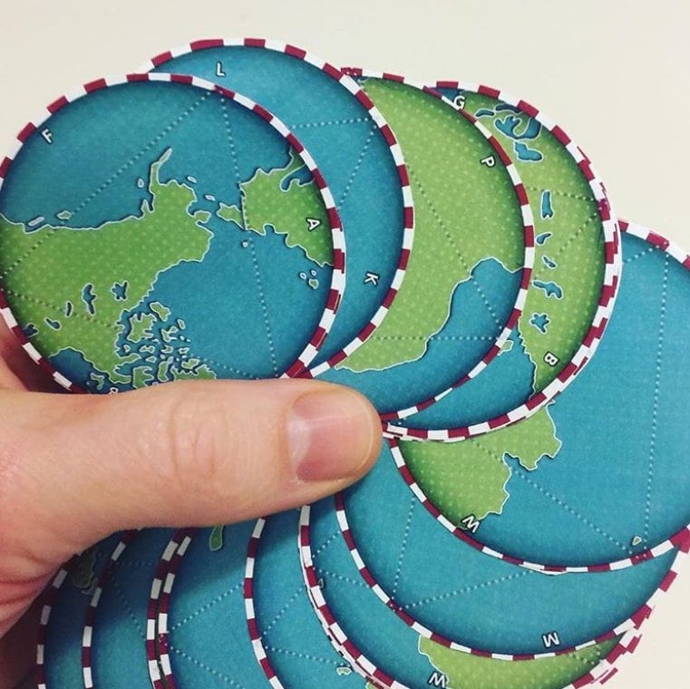
Here is a template (4MB zip file) with all the graphics and instructions you’ll need to be cranking out your own dazzling little yultide orbs. Get ready to live.
Step 1. Cut out all 20 little maps (tip, there are 4 PDF pages, you can stack the North Pole / Lower Latitudes and the South Pole / Upper Latitudes pages and save half the cutting).
Step 2. Crimp along the dotted lines and start assembling the little suckers. There are little letter guides to help you with the assembly (you think it’s be easy, but I tell you, you’ll be thankful for them; by the way, adding these letters was easily the most mind-bending part of building this template). Glue sticks or staplers have worked for me. It will get pretty crazy at the end, but you are a geographer and you’ll push through that. Nothing of value comes without some sort of effort.
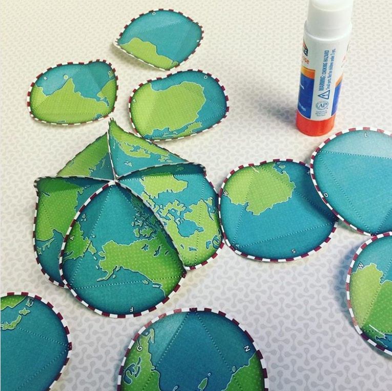
Step 3. Enjoy. Make them with your kids. Give them to your friends. Geography is its own gift, so imagine the force-multiplying potential of these things. Hang them wherever you see fit, which is anywhere you please. Also, don’t forget to tack in a loop before it’s all closed up.

And that’s it. You can stop reading right here. Unless, of course, you want to see how to just just assemble these things but how to actually make make them in ArcGIS Pro…
Let’s do this.
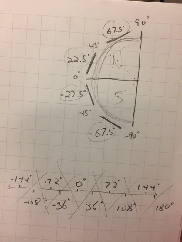
I first had to figure out all the orientations of my 20 map frames so they tessellate reasonably well over the geodesic sphere. This took some scratching.
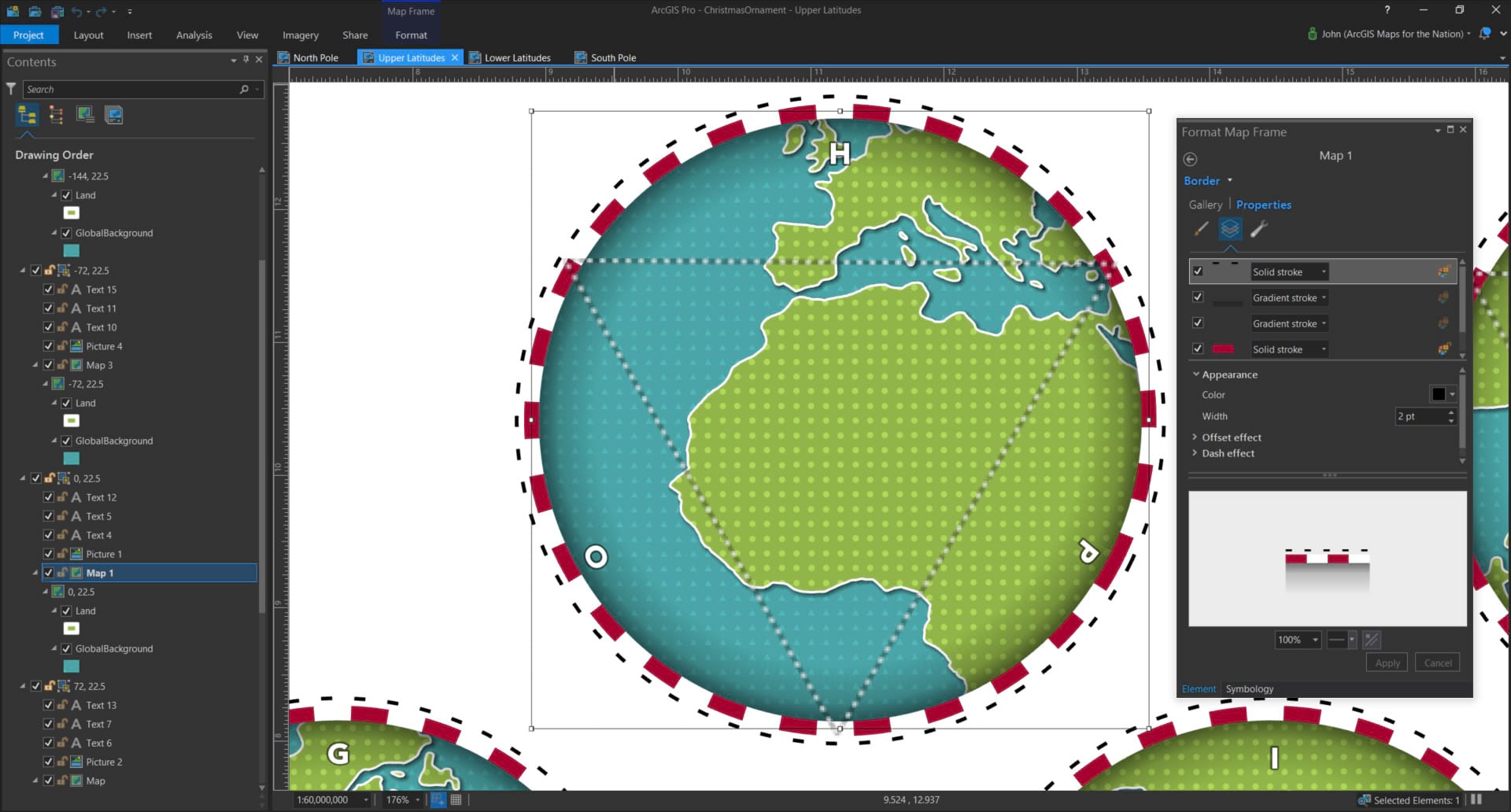
Then I chose some symbology that looked reasonably Christmasy. The global land areas were drawn by Dylan Moriarty, available at Project Linework. I used a gradient line to give a shadow effect, and a wrapping-paper-like pattern via a regularly placed marker symbol.
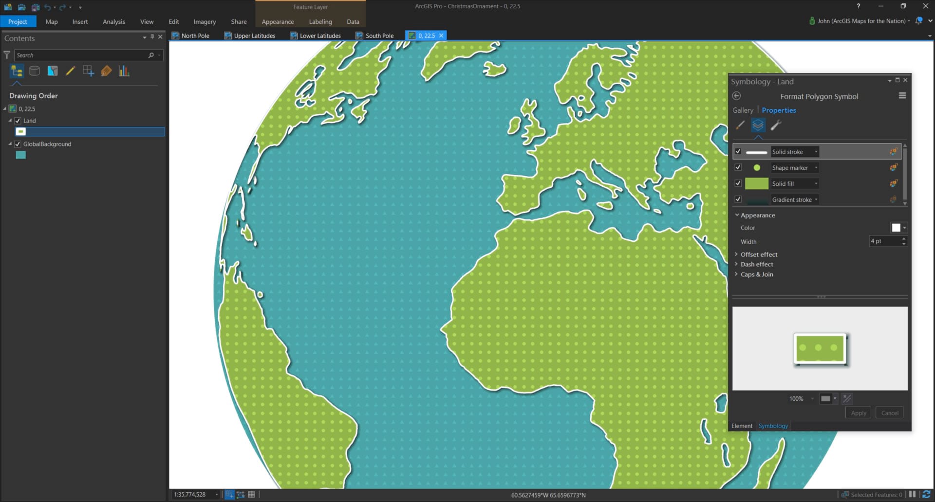
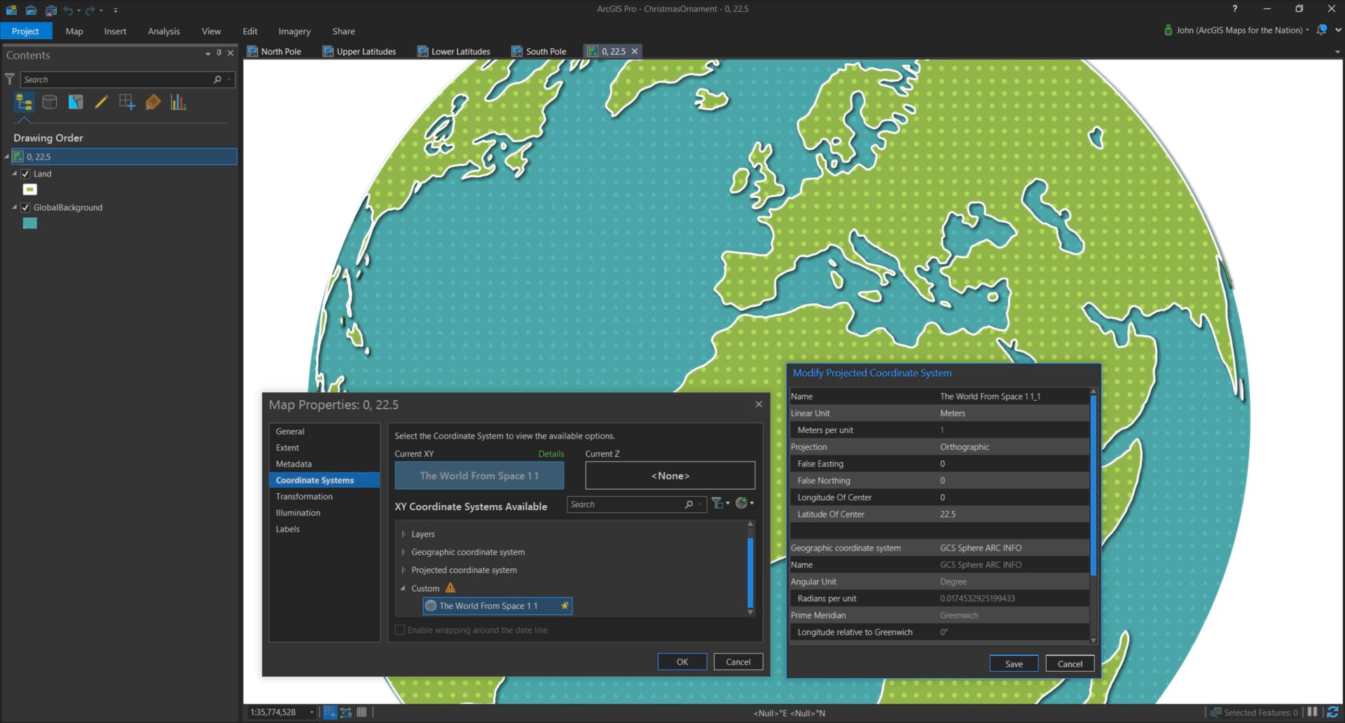
The projection is an orthographic view (The World From Space, one of my very favorites), tweaked for each of the 20 separate maps to center over the right coordinate.
I brought the map frame into the layout and changed the shape to circular.
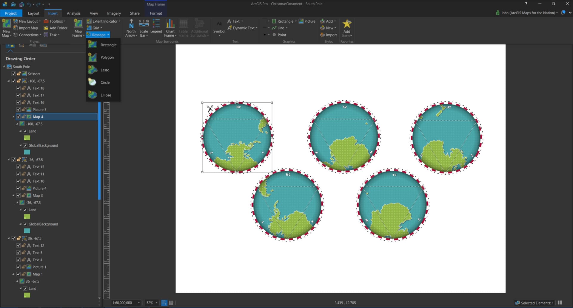
I gave the map frame’s border some over the top Christmas themed styling. Once it looked the way I wanted, I copy/pasted it for the 19 other little maps and then changed which map each frame held. Does that make sense?
There you have it! And if you are interested in diving into this Pro project yourself (maybe you want to change the symbology or tweak the scale or add pictures of your family or elves or whatever), then you can download it righhhhhhhhht here.
Merry Geodesic Globe Ornament Making! John

Commenting is not enabled for this article.