ArcGIS Solutions align with your business needs, transform your use of ArcGIS, and help you maximize the investment you are making in location-based data and technology.
In the March 2023 release, you will find several new ArcGIS Solutions for state and local governments, utilities, defense, and public safety agencies. There are also many enhancements to the existing solution portfolio that can be leveraged by organizations of all types.
New ArcGIS Solutions
Here is a quick summary of what’s new in the March release:
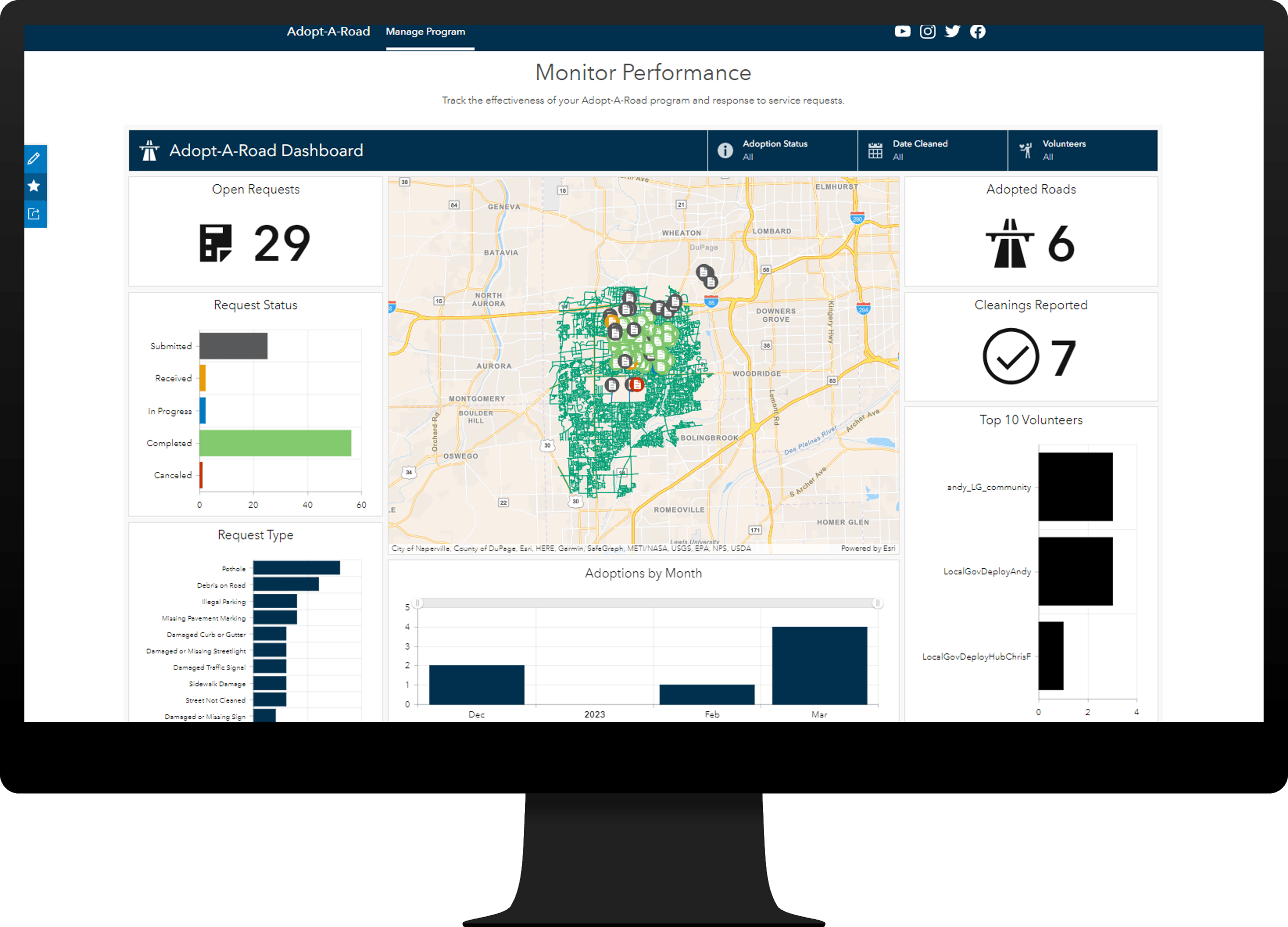
Adopt-A-Road
Adopt-A-Road can be used to operate road adoption programs that allow volunteers to adopt roads and clean them for the community.
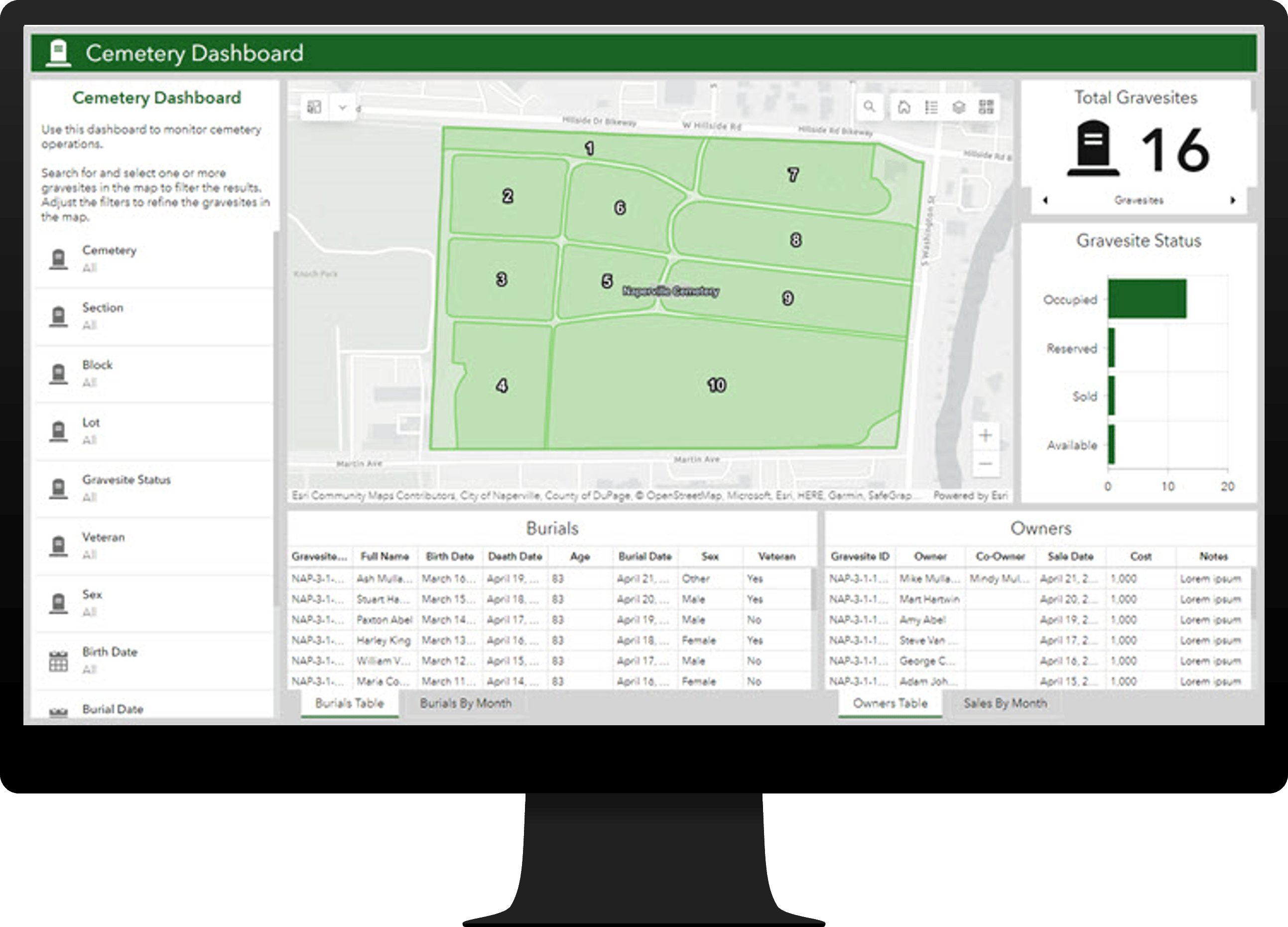
Cemetery Management
Cemetery Management can be used to develop an authoritative cemetery and gravesite inventory and share gravesite and burial information with the public.
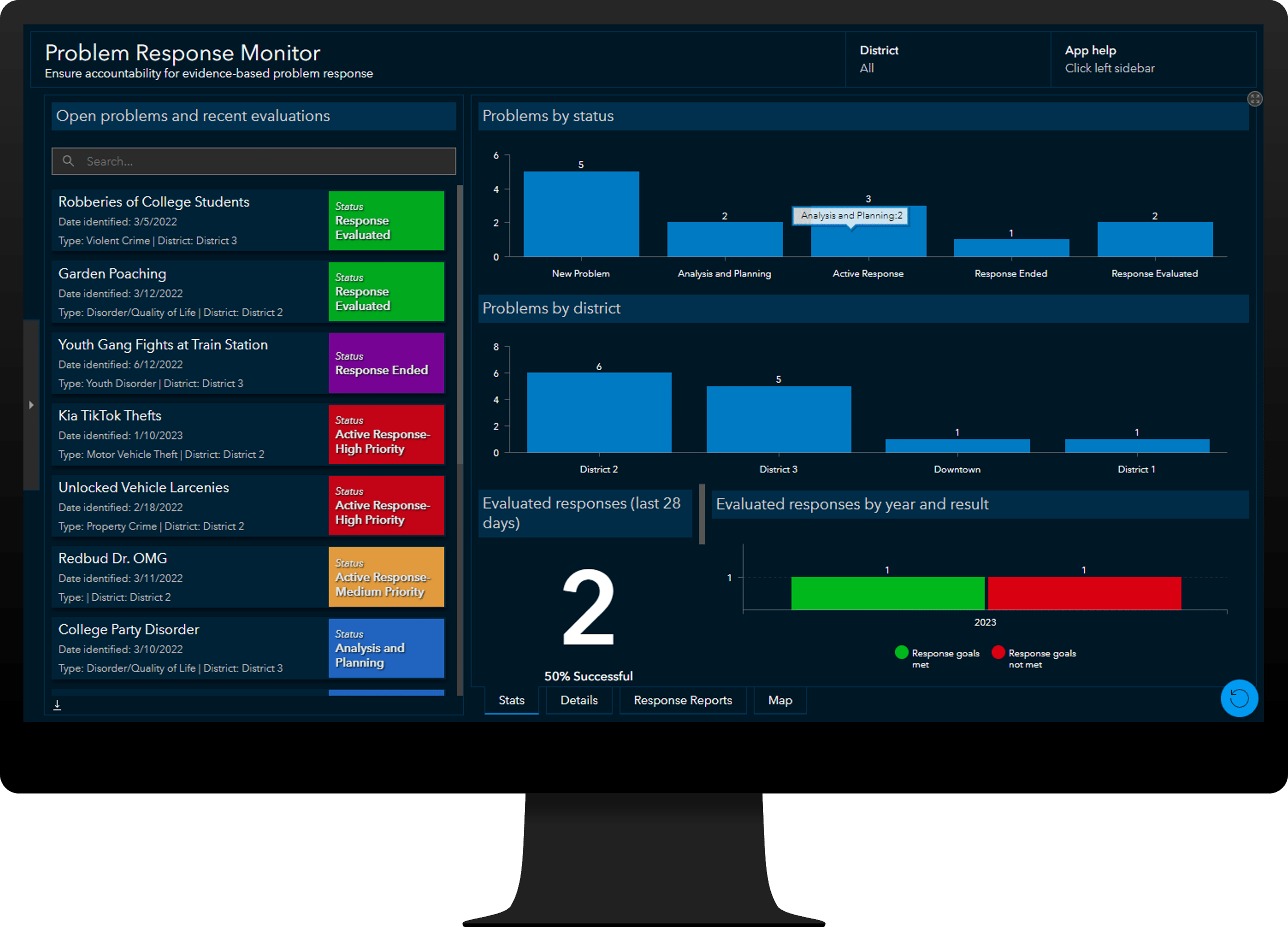
Crime Problem Management
Crime Problem Management can be used to plan, manage, and evaluate evidence-based responses to crime problems.
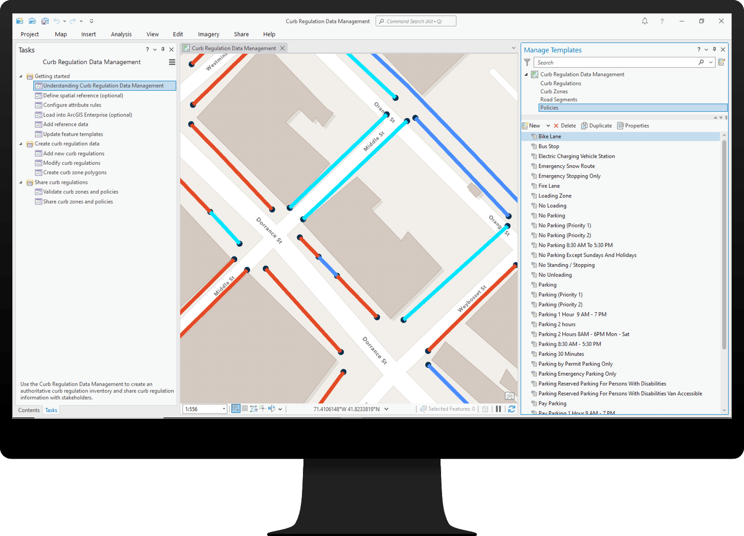
Curb Regulation Management
Curb Regulation Management can be used to maintain an authoritative inventory of curb regulations and visualize how curbsides are being used.
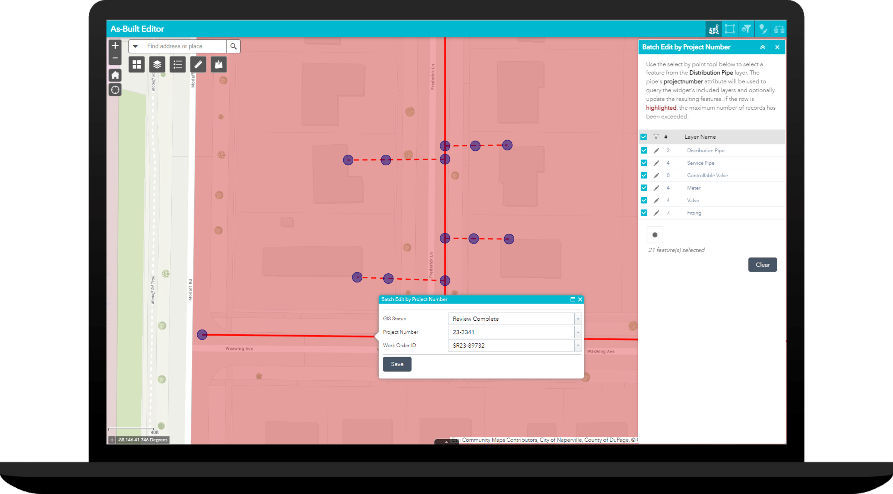
Gas As-Builting
Gas As-Builting can be used to Streamline the documentation of newly constructed assets and rapidly make that information accessible to help gas utilities operate optimally, make better decisions, reduce potential for damage, and increase safety.
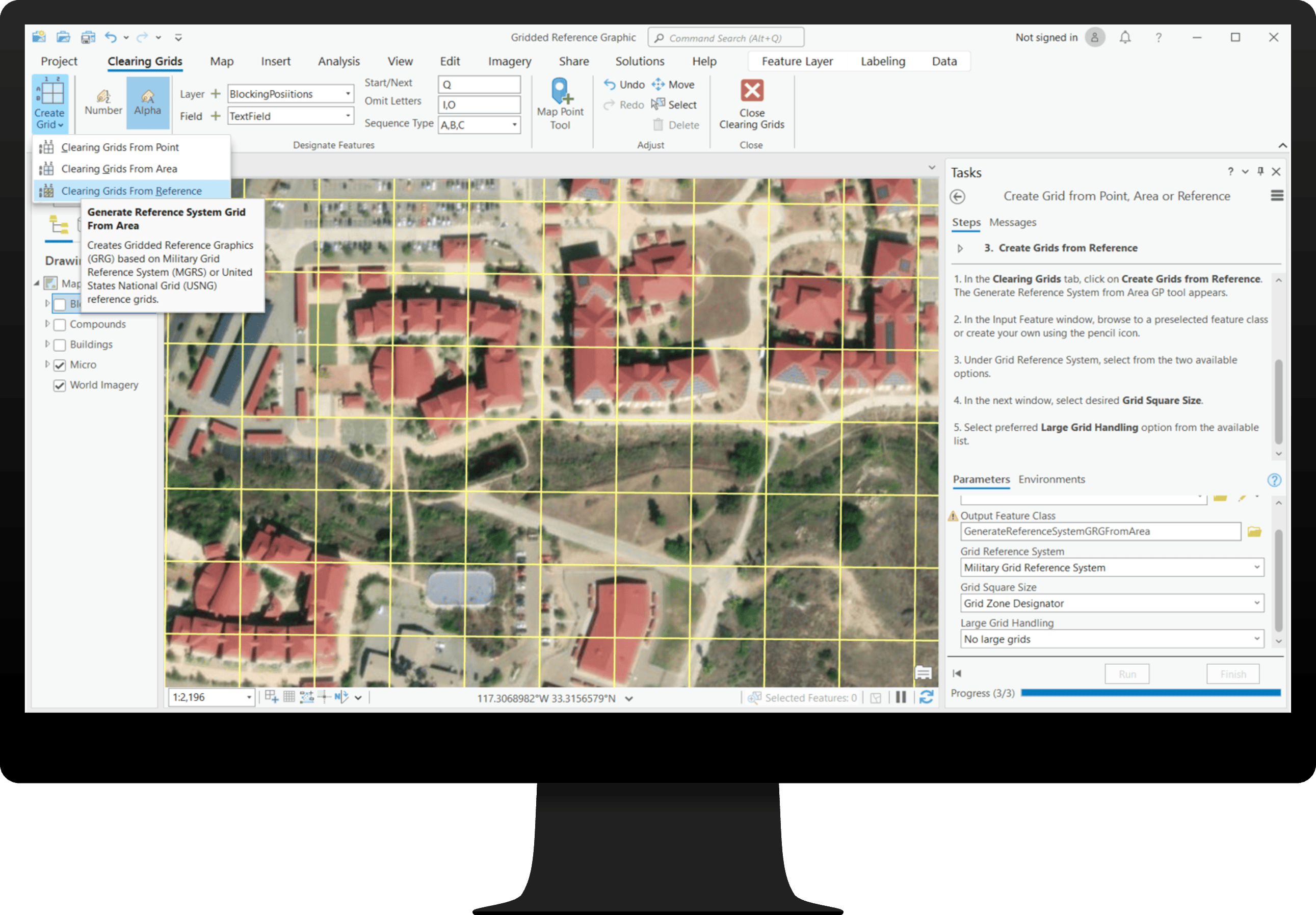
Gridded Reference Graphic
Gridded Reference Graphic can be used by special forces and conventional military organizations to coordinate real-world field operations. Gridded Reference Graphic uses a set of visual components including grids and markers representing entities to guide clearing operations.
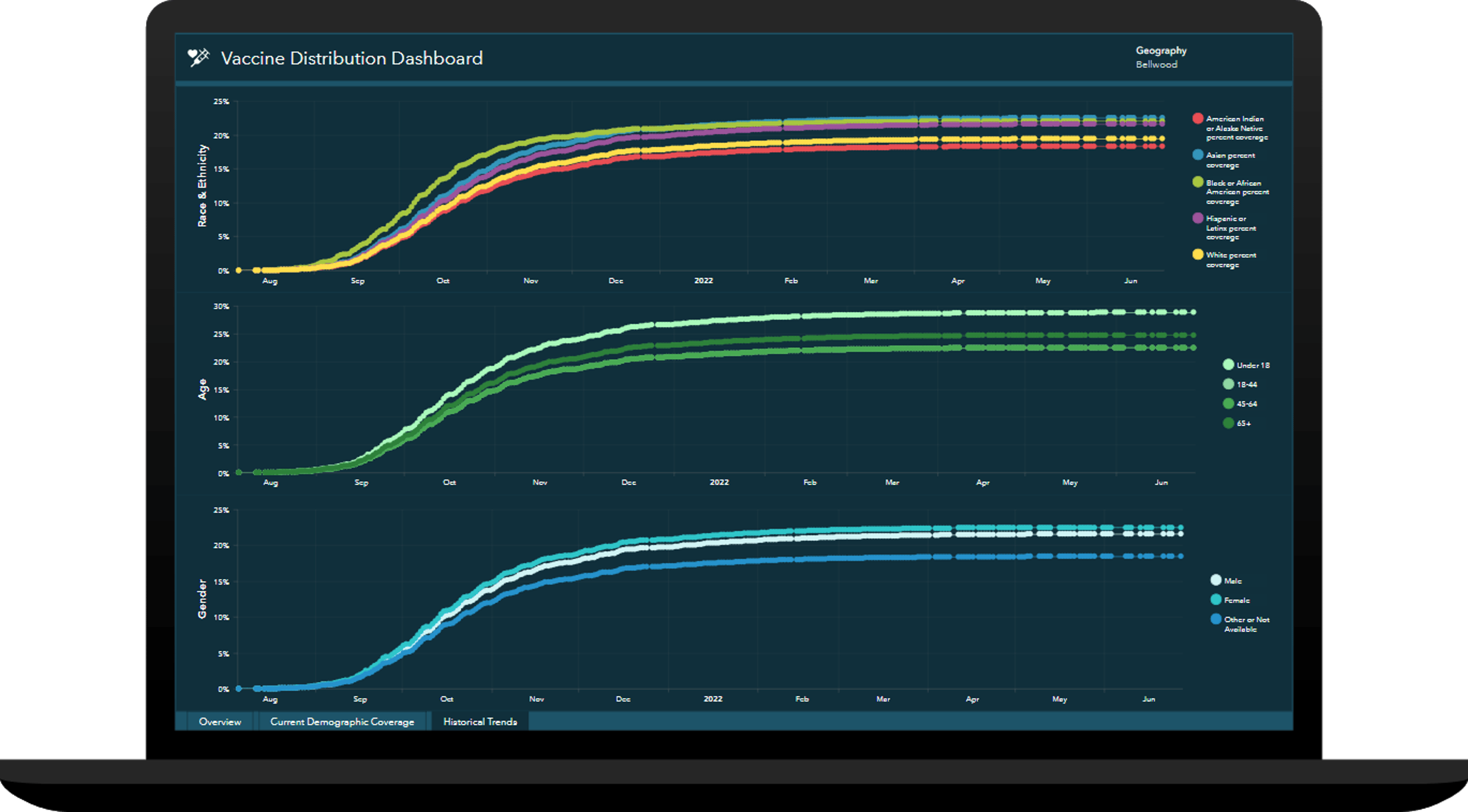
Immunization Outreach
Immunization Outreach can be used to inventory vaccine providers, communicate vaccination coverage, and promote available resources.
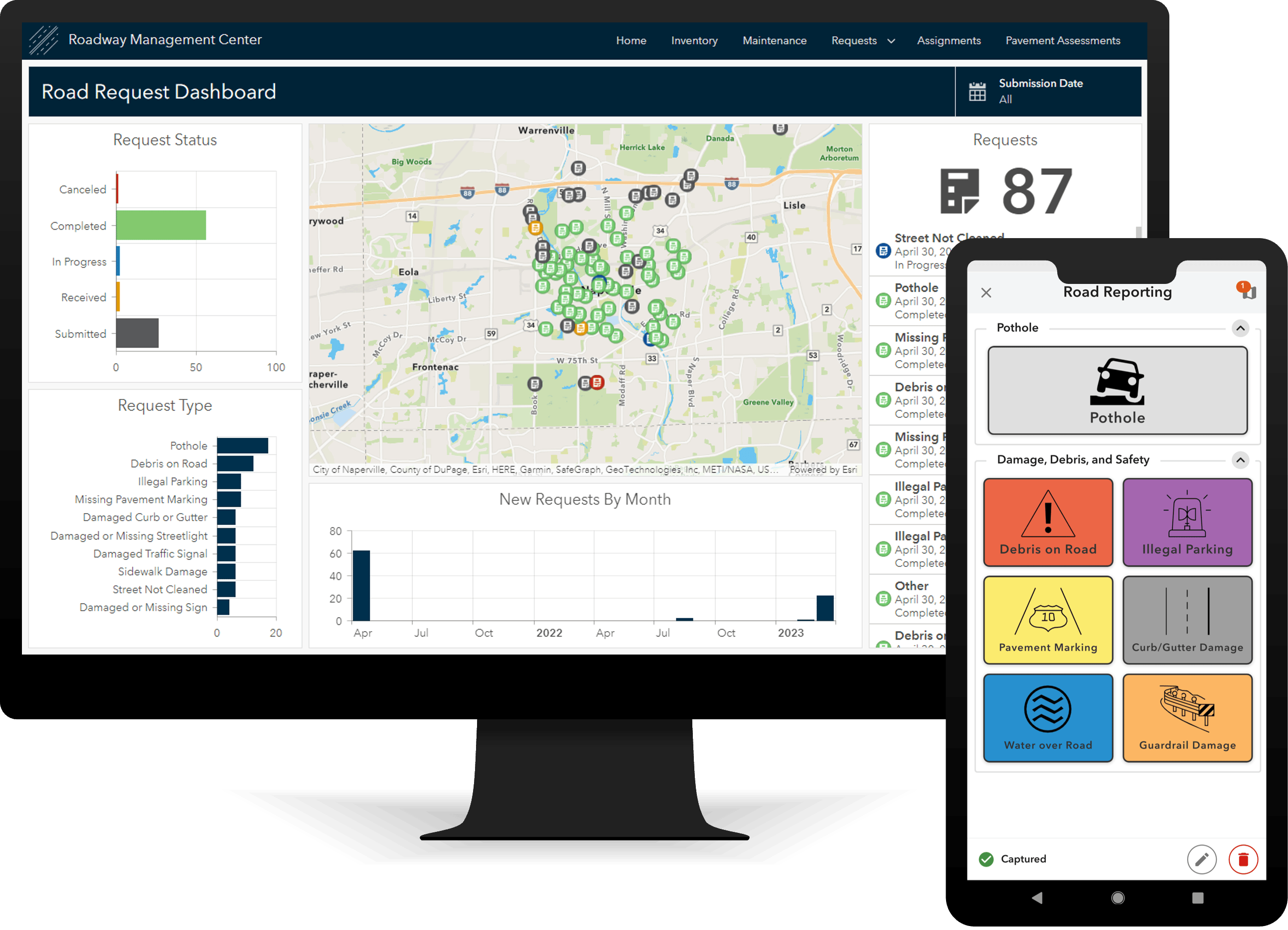
Roadway Management
Roadway Management can be used to inventory public roads and their characteristics, conduct routine pavement condition assessments, and streamline inspection and maintenance activities.
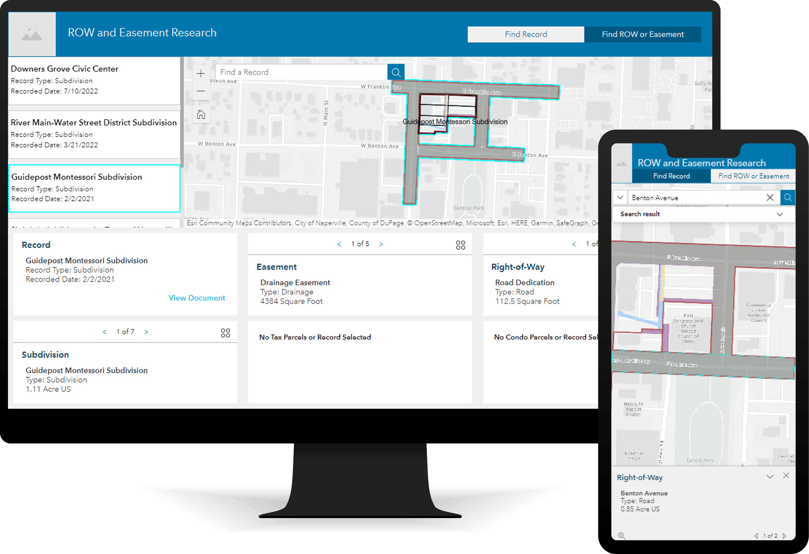
ROW and Easement Data Management
ROW and Easement Data Management can be used to improve infrastructure planning, utility maintenance, and other functions that require access to land.
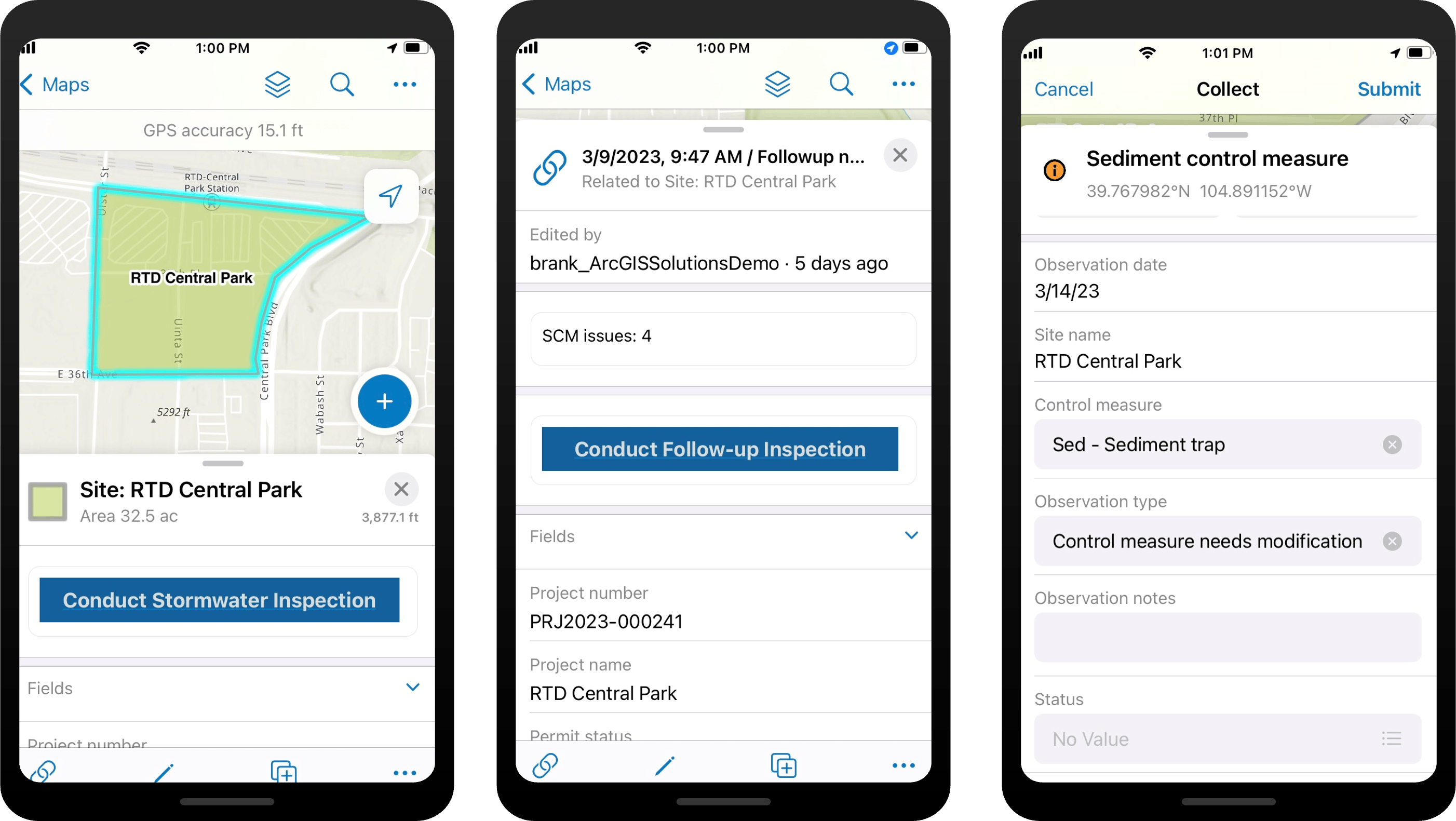
Stormwater Construction Activity Management
Stormwater Construction Activity Management can be used by organizations to streamline the inspection of construction sites and understand the effectiveness of control measures.
And that’s not all. Several other solutions were also updated in this release:
- 3d Basemaps
- Address Data Management
- Communications Data Management
- Communications Utility Network Foundation
- Crime Reduction Stats
- Daily Activity Dashboard
- District Energy Utility Network Foundation
- Electric Utility Network Foundation
- Emergency Debris Management
- Emergency Management Operations
- Flood Impact Analysis
- Gas and Pipeline Utility Network Foundation
- Homelessness Outreach
- Outage Damage Assessment
- Pipeline Referencing Foundation
- Police Transparency
- Pre-Incident Planning
- Sewer Utility Network Foundation
- Stormwater Utility Network Foundation
- Sustainable Development Goals
- Target Hazard Analysis
- Tree Management
- Walkout Survey
- Water Distribution Utility Network Foundation
Finally, learn more about other lifecycle changes and issues that have also been addressed in this release.
One more thing…
We have also shared with the community a series of videos that demonstrate the key capabilities in many of our ArcGIS Solutions. Please check them out, they are a great way to learn more about a given ArcGIS Solution.


Article Discussion: