ArcGIS Solutions align with your business needs, transform your use of ArcGIS, and help you maximize the investment you are making in location-based data and technology.
In the November 2022 release, you will find several new ArcGIS Solutions for state and local governments, utilities, defense, and public safety agencies. There are also many enhancements to the existing solution portfolio that can be leveraged by organizations of all types.
New ArcGIS Solutions
Here is a quick summary of what’s new in the November release:
Active Transportation Outreach
Active Transportation Outreach can be used to inventory your existing active transportation facilities and engage with the public to promote a more active lifestyle.
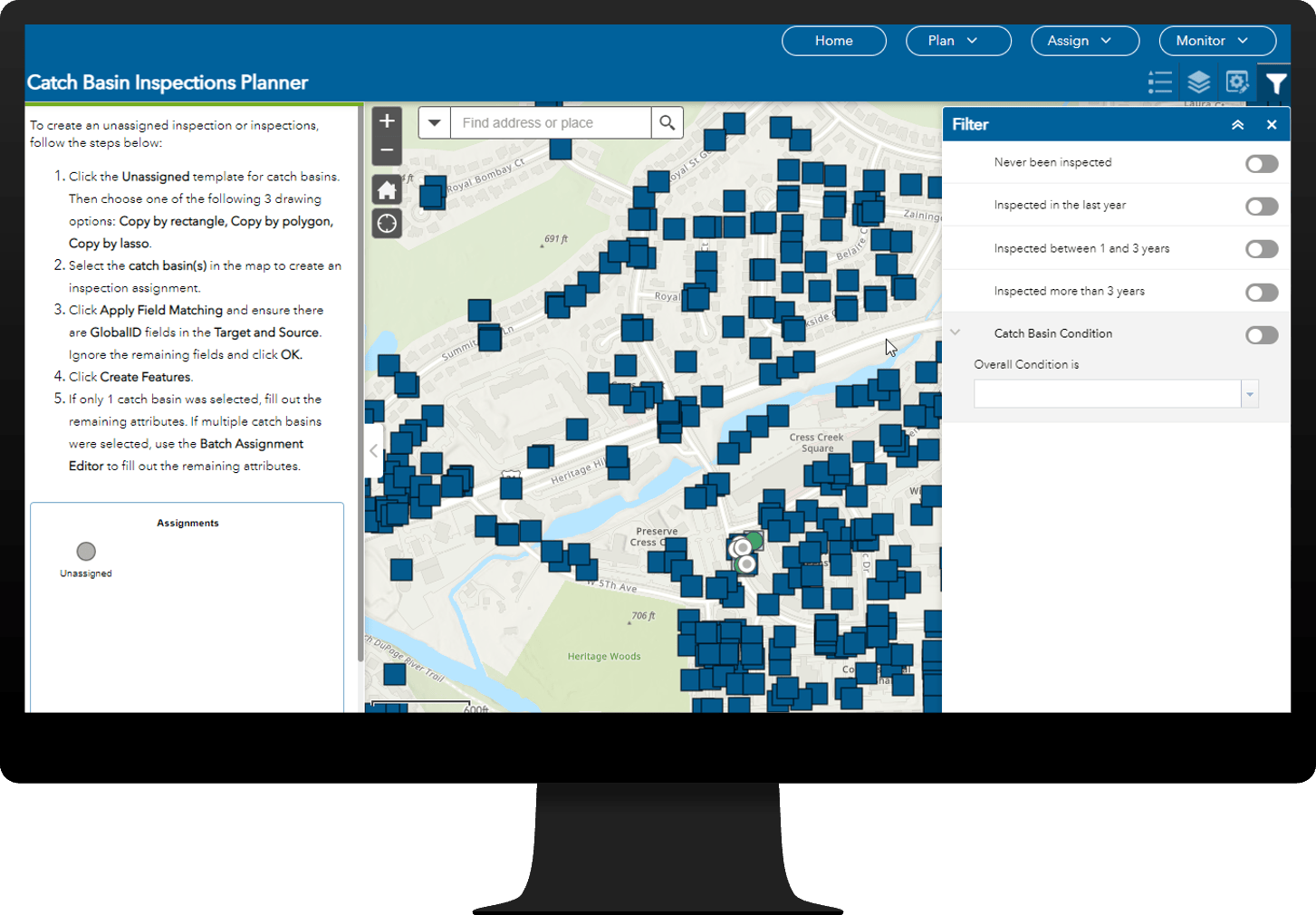
Catch Basin and Outlet Inspections
Catch Basin and Outlet Inspections can be used to streamline the inspection of catch basins and outlets.
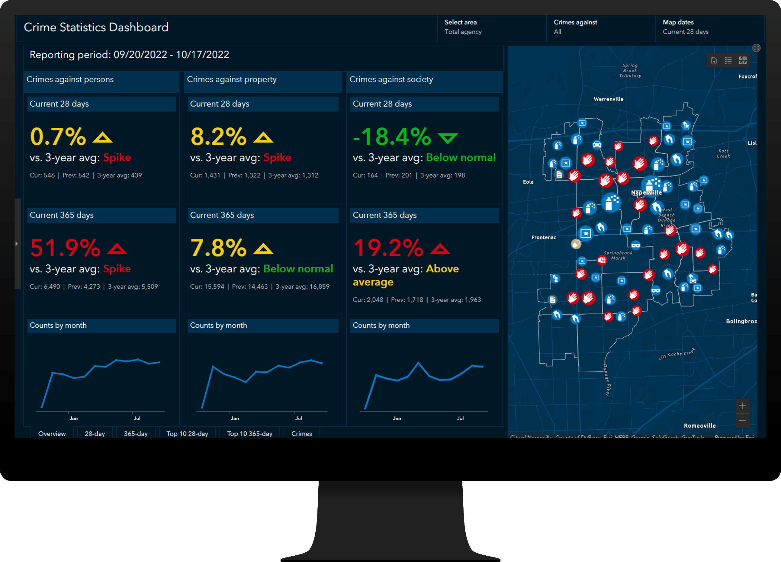
The Crime Reduction Statistics solution can be used to generate key statistics and reports, monitor crime trends, and modernize CompStat practices.
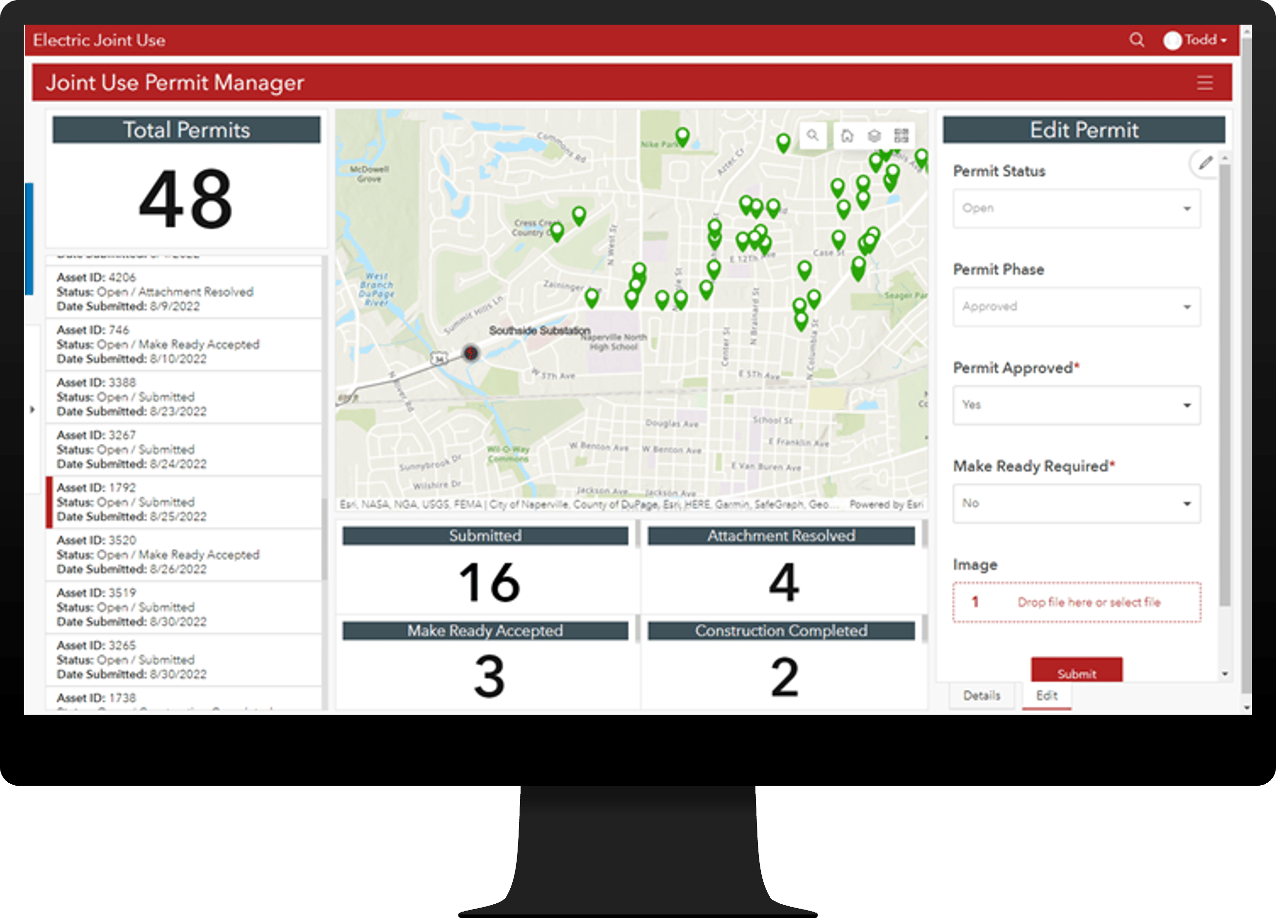
Electric Joint Use can be used to manage utility pole joint use and streamline the joint use permitting process.
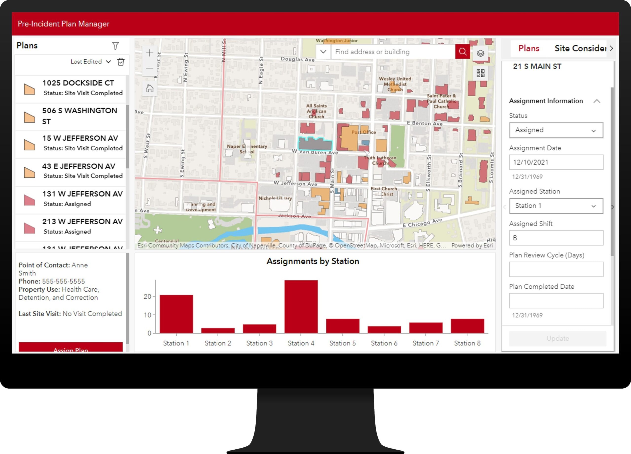
Pre-Incident Planning can be used to inventory fire pre-incident plans and understand hazards and risks that affect responding personnel and building occupants.
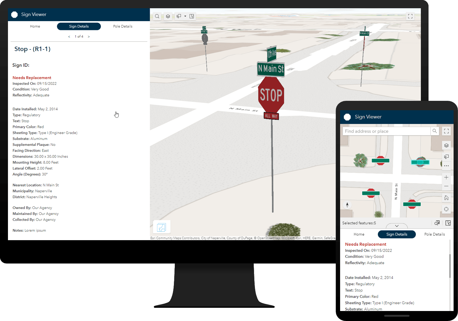
Sign Management can be used to collect roadway signs and poles, streamline inspection and maintenance activities, and understand asset conditions.
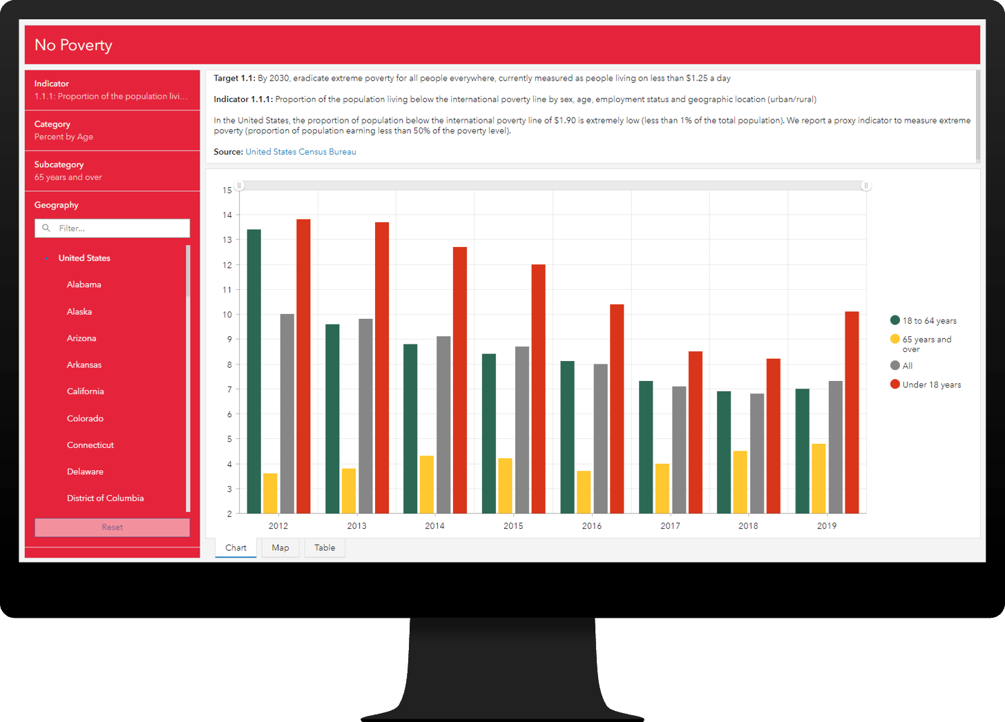
Sustainable Development Goals can be used to share progress made on the United Nations (UN) Sustainable Development Goals, and their key indicators, with the public and other interested stakeholders.
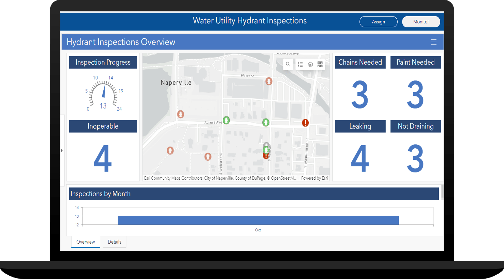
Water Utility Hydrant Inspections
Water Utility Hydrant Inspections can be used to streamline fire hydrant inspections and monitor inspection programs that help water utilities increase hydrant reliability.
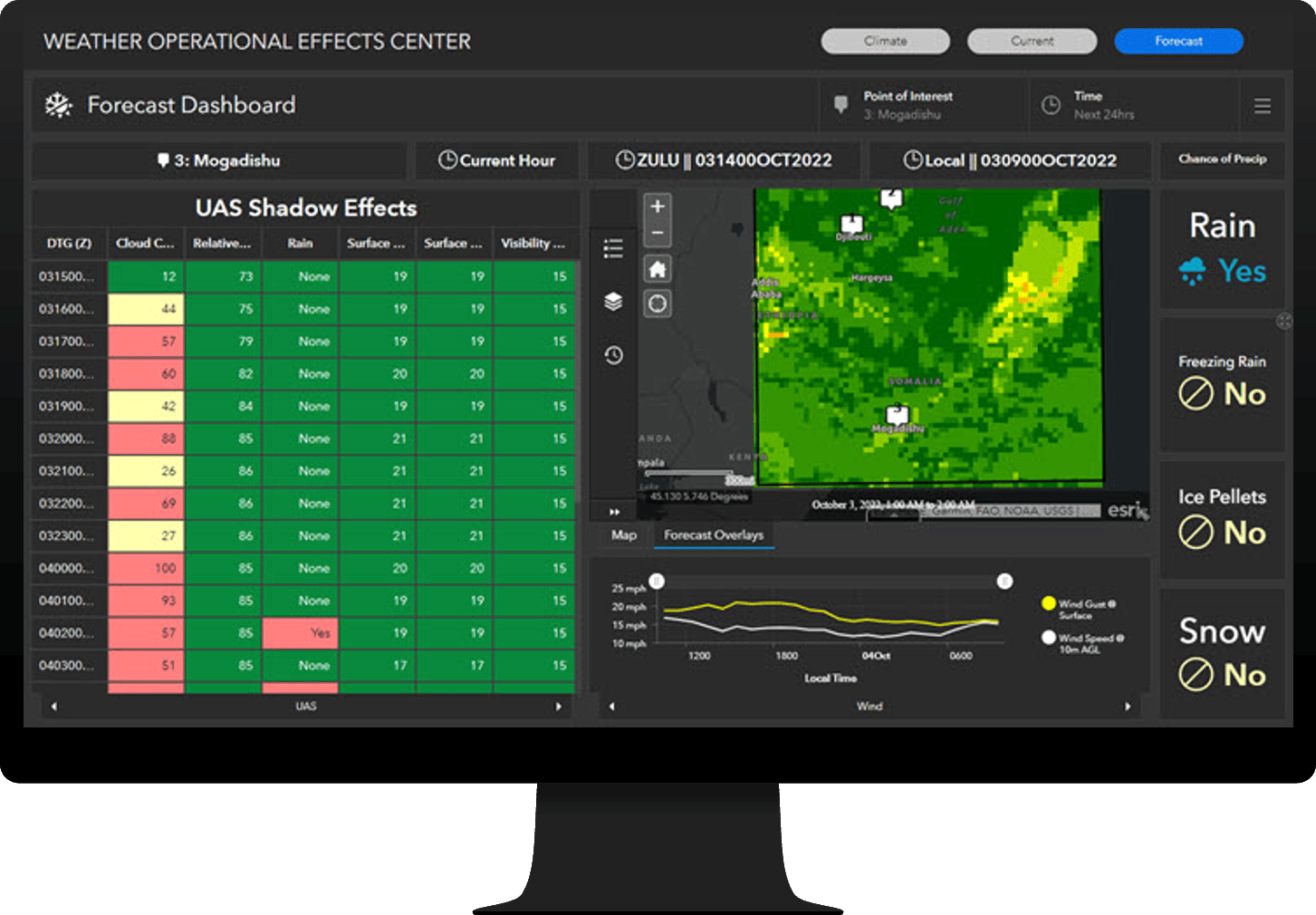
Weather Operational Effects can be used to quickly understand the impact of weather on military operations.
Enhanced ArcGIS Solutions
Several existing ArcGIS Solutions have also been greatly enhanced in the November release:
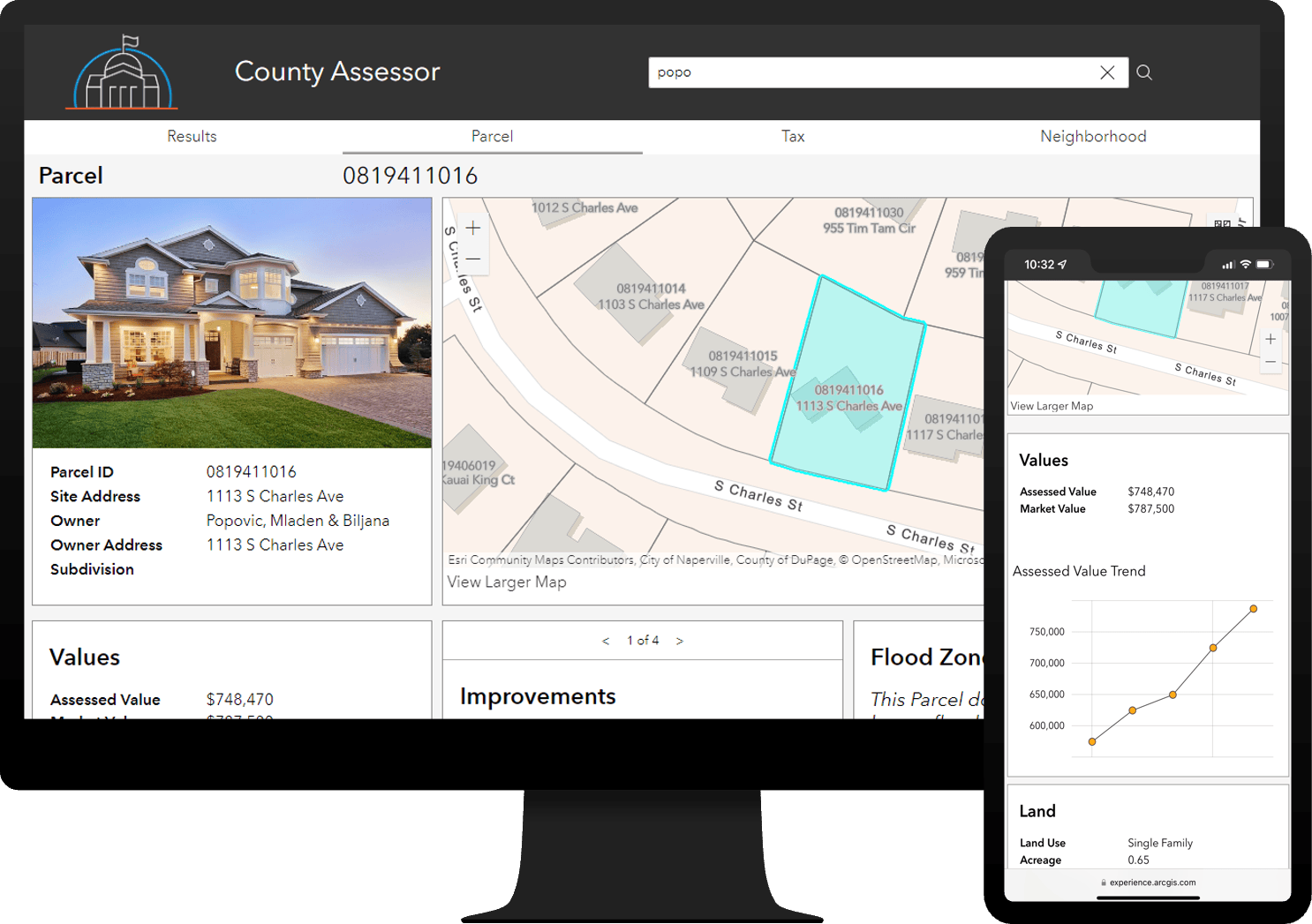
Equitable Property Value can be used to promote fair and equitable property values and share authoritative property information with the public and other interested stakeholders.
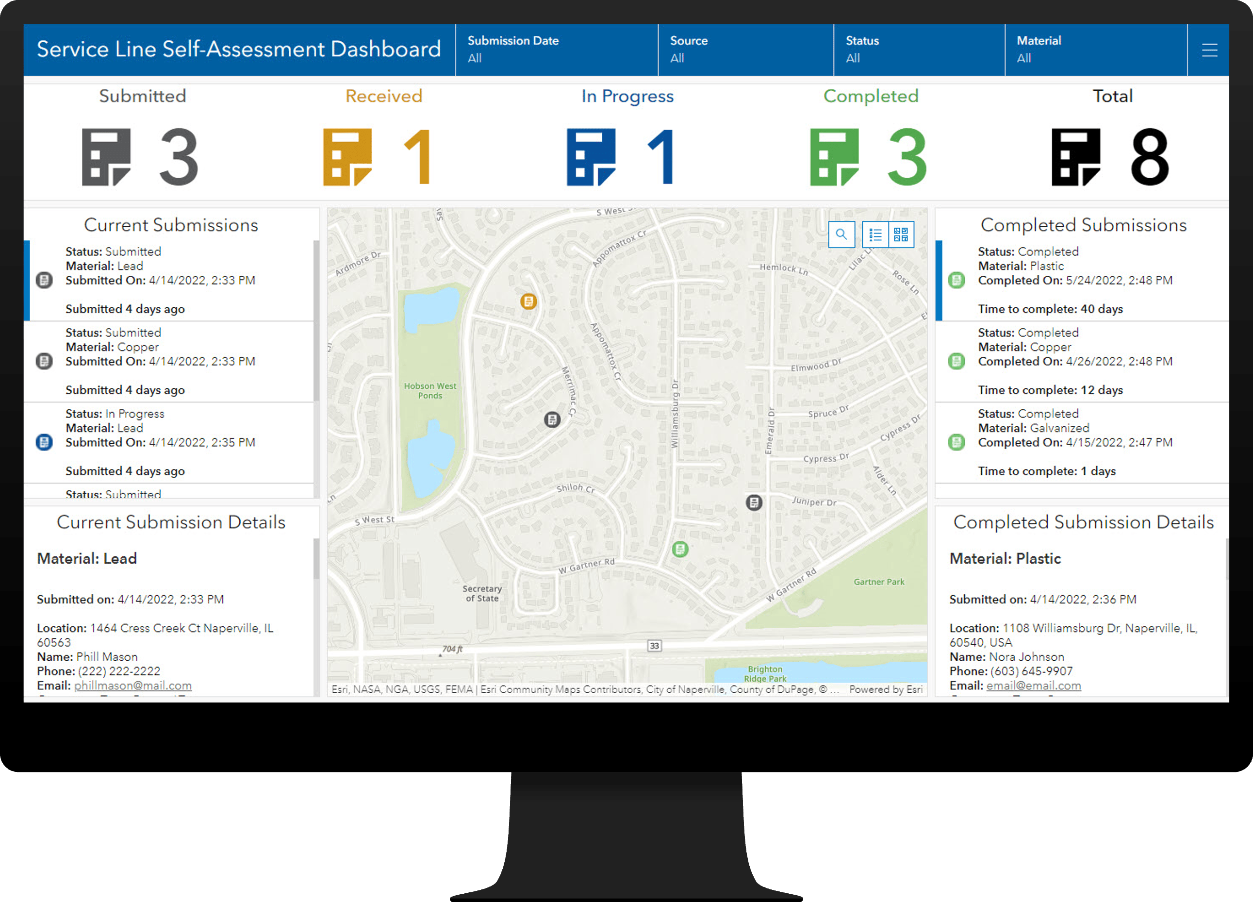
Lead Service Line Inventory can be used to develop a lead service line inventory and monitor the replacement of service lines required to comply with the Environmental Protection Agency’s (EPA) Lead and Copper Rule Revisions.
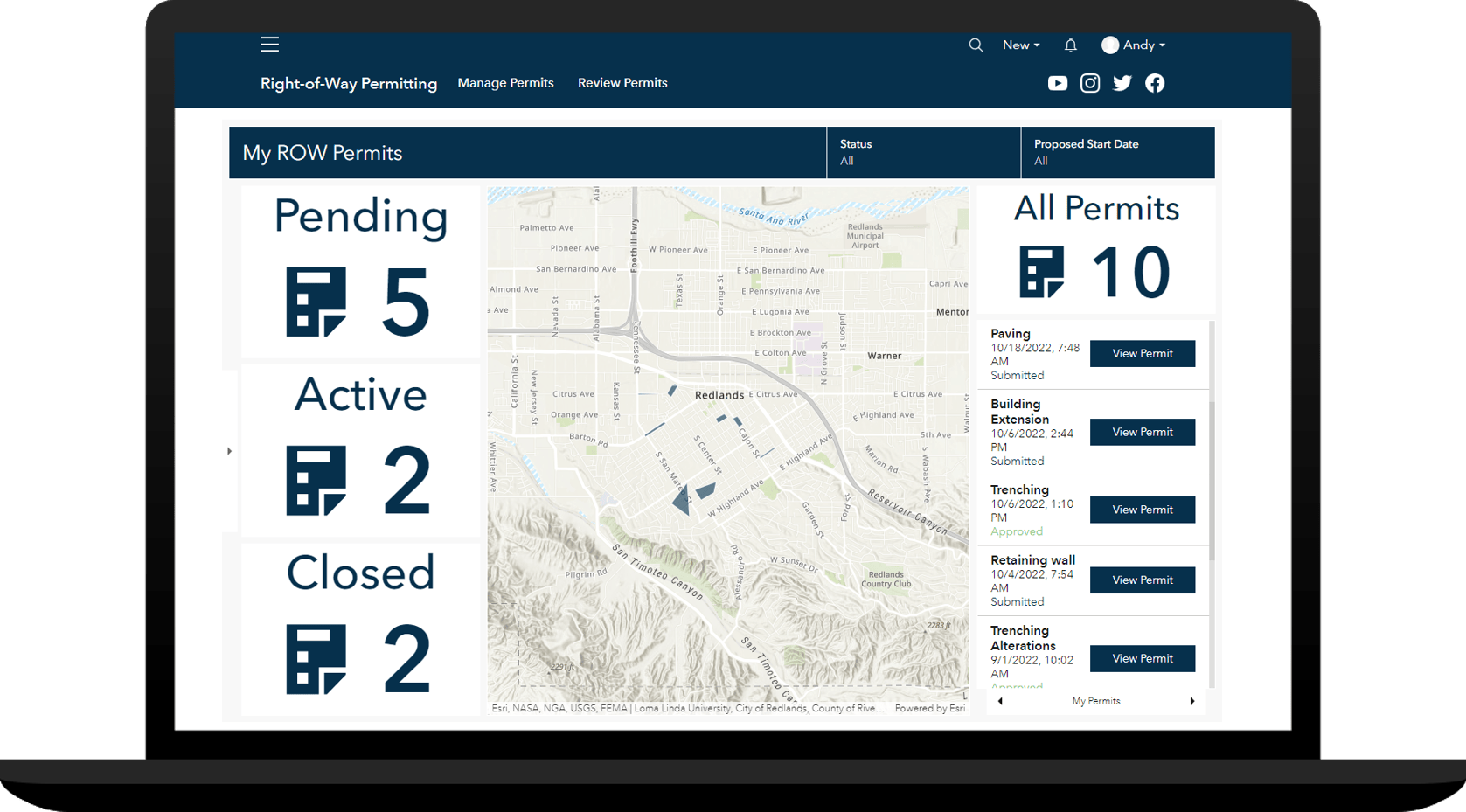
ROW Permitting can be used to collect and organize permit applications, coordinate the permit review process, gather feedback during permit review, and share approved permits with internal and external stakeholders.
And that’s not all. Several other solutions were also updated in this release:
- Adopt-A-Catch Basin
- Daily Activity Dashboard
- Police Transparency
- Social Equity Analysis
- Stormwater Data Management
- Water Distribution Data Management
Finally, learn more about other lifecycle changes and issues that have also been addressed in this release.


Article Discussion: