This summer (July/August), we released a collection of eleven new solutions, including a series of new coronavirus (COVID-19) back to work offerings, our first racial equity solution, new utility data management solutions, several operations solutions for states National Guards, and a new set of special event solutions for local governments. We have also made enhancements to eight solutions and changed the lifecyle status to fourteen of our solutions.
New ArcGIS Solutions and the ArcGIS Solutions app
In June, we released the ArcGIS Solutions App, a new way to quickly deploy ArcGIS Solutions to your organization. This application helps you quickly discover and deploy ArcGIS Solutions in your organization. Designed to make deploying ArcGIS Solutions easier, you can browse the collection of solutions, search for a specific solution, or filter the gallery to quickly find a solution. Once you discover the solution you are interested in, the information panel will provide an overview of the solution and an option to deploy it. Learn more about the ArcGIS Solutions App in this blog post.
Now, a quick summary of the new ArcGIS Solutions we released this summer.
Coronavirus (COVID-19) Back to Work Solutions
Coronavirus Site Safety can be used by businesses, educational institutions, and government agencies to create coronavirus (COVID-19) health safety plans for their facilities, sites, and campuses; and monitor the health safety plans as locations reopen.
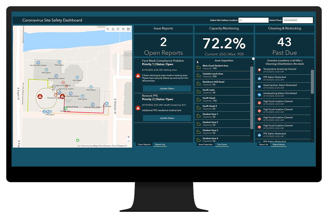
Coronavirus Health Screening can be used by businesses, utilities, and government agencies to conduct coronavirus (COVID-19) health screenings before employees and visitors enter a facility, or location.

Utility Data Management Solutions
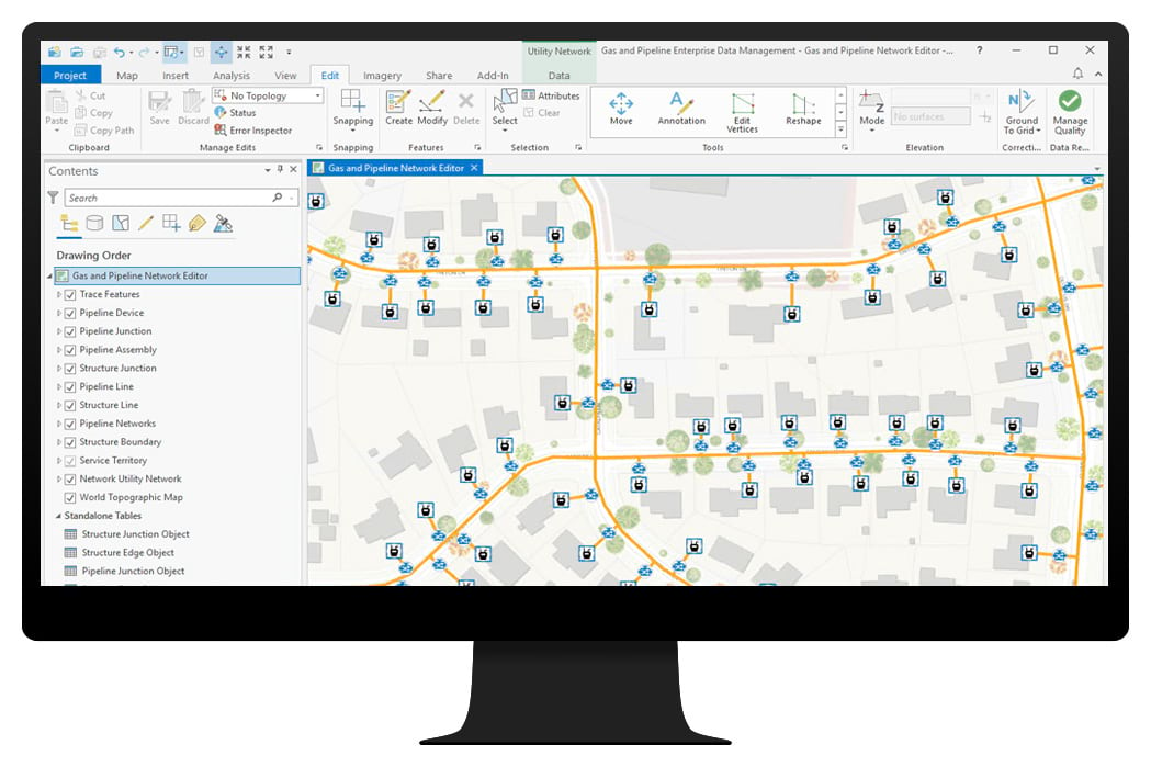
Gas and Pipeline Enterprise Data Management can be used by gas utilities to maintain vertically integrated gas systems and hazardous liquid pipelines in a Utility Network. It includes the Utility and Pipeline Data Model (UPDM) and common gas and pipeline data management workflows.
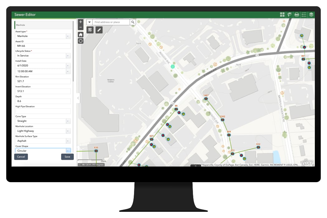
Sewer Data Management can be used by sewer utilities to map a sewer system, produce sewer maps, view reports, and continuously improve sewer system data with map notes.
Special Event Solutions
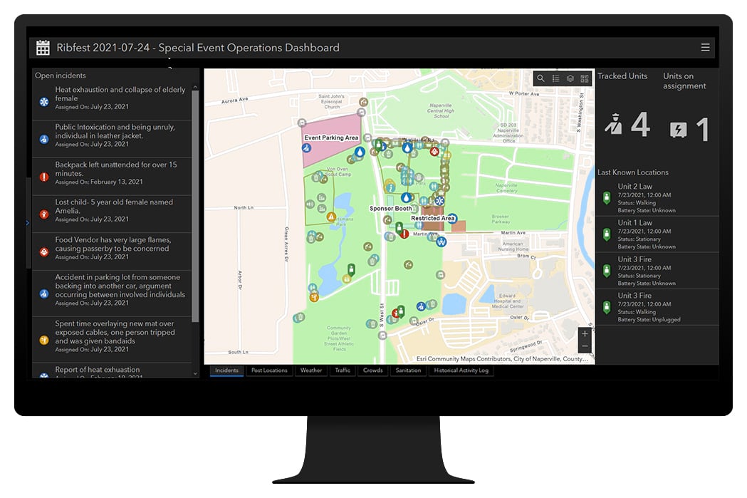
Special Event Permitting and Operations can be used by local government event coordinators to manage special event permits, protect event attendees, and promote special events occurring in the community.
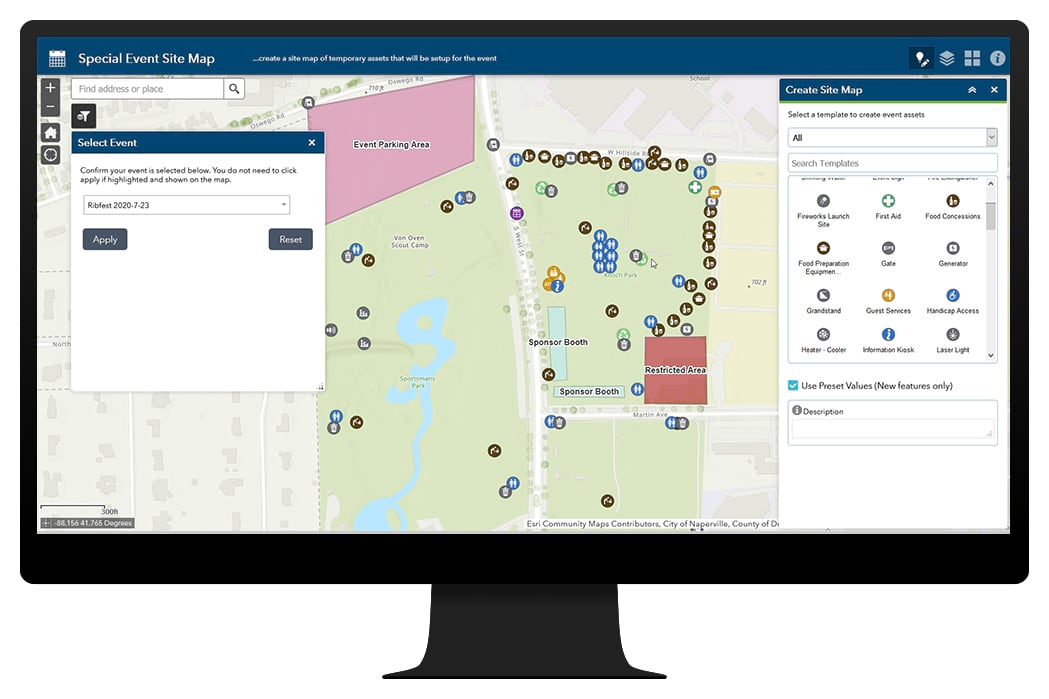
If you are a public safety agency that may not be interested in permitting capabilities, Special Event Operations can be used by public safety event planners to develop safety plans and monitor public safety operations during a special event.
National Guard and Military Solutions
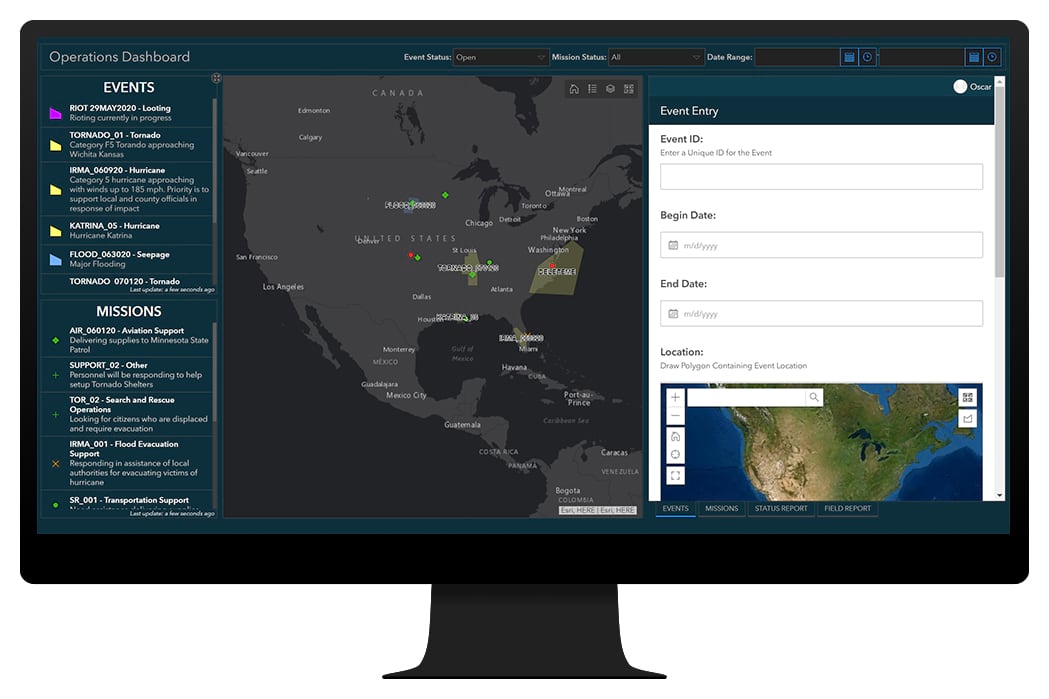
Operations Management can be used by the states National Guard and other service branches to respond to an event and manage resulting missions.
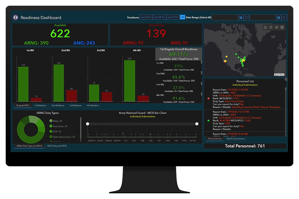
Readiness Management can also be used by the states National Guard and other service branches to capture individual and unit force readiness and share authoritative information with decision makers.
Additional Solution Offerings
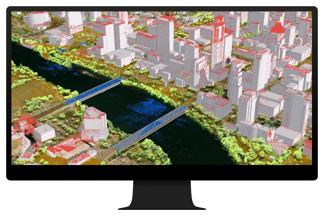
3D Basemaps can be used to author high-quality 3D base-maps and visualize above-ground and under-ground utilities.
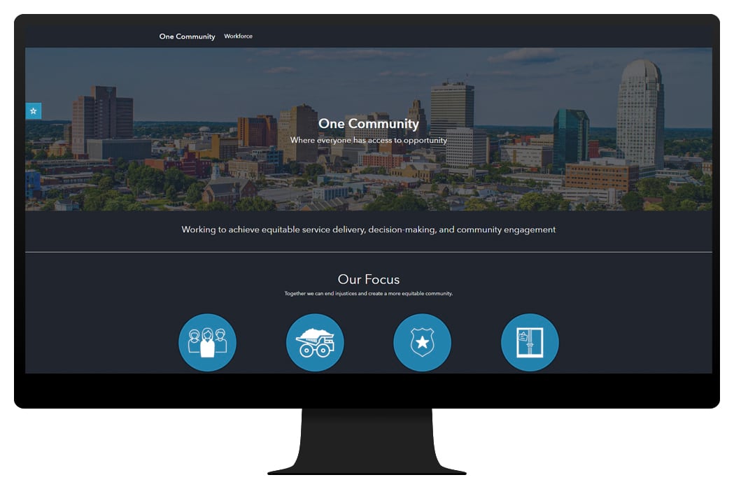
Racial Equity Community Outreach can be used by government agencies to communicate key racial equity initiatives or programs, visualize workforce diversity metrics, gauge public sentiment, and share authoritative information about racial equity with the community.
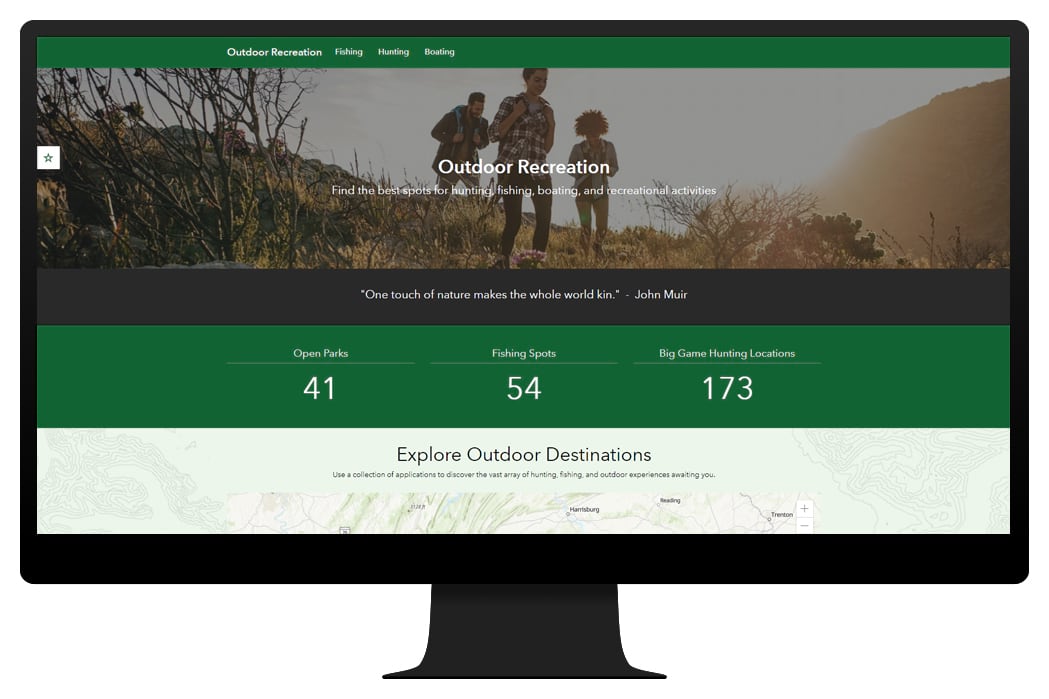
Recreation Outreach can be used by fish and wildlife agencies and parks and recreation departments to understand key license trends, promote recreation opportunities, and share outdoor amenities with the public.
Updated ArcGIS Solutions
- ArcGIS Pro Intelligence 2.6
- Citizen Problem Reporter
- Coronavirus Business Reopening
- Election Outreach
- Multi Source Data Feeds
- Parcel Drafter
- Performance Management
- Road Network Data Management
ArcGIS Solutions Lifecycle Changes
- 3D Tools for Sewer moved to the Retired Lifecycle Phase. Capabilities replaced with 3D Basemaps.
- Events Calendar moved to the Mature Lifecycle Phase. Capabilities replaced with Special Events Permitting and Operations.
- Events Coordination moved to the Mature Lifecycle Phase. Capabilities replaced with Special Events Permitting and Operations.
- Events Map Gallery moved to the Mature Lifecycle Phase. Capabilities replaced with Special Events Permitting and Operations.
- Events Permit moved to the Mature Lifecycle Phase. Capabilities replaced with Special Events Permitting and Operations.
- Events Permit Review moved to the Mature Lifecycle Phase. Capabilities replaced with Special Events Permitting and Operations.
- Events Site Map moved to the Mature Lifecycle Phase. Capabilities replaced with Special Events Permitting and Operations.
- Gas Utility Network Configuration moved to the Retired Lifecycle Phase.
- Leak Logger Analysis moved to the Mature Lifecycle Phase.
- Local Government 3D Basemaps moved to the Mature Lifecycle Phase. Capabilities replaced with 3D Basemaps.
- Nighttime Flow Analysis moved to the Mature Lifecycle Phase.
- Sanitary Sewer Network moved to the Mature Lifecycle Phase.
- Water Conservation Dashboard moved to the Mature Lifecycle Phase.
- Water Service Request moved to the Mature Lifecycle Phase.
ArcGIS Solutions General Improvements
- Support for ArcGIS Pro 2.6 and ArcGIS 10.8.1
- Support for ArcGIS Enterprise 10.8.1
ArcGIS Solutions are free and fully supported configurations for ArcGIS that help you improve operations, gain new insight, and enhance services.


Commenting is not enabled for this article.