Health and Human Services organizations need to collect household-level community health information. Sometimes this is done as a part of planning or response to an emergency event. Other times it serves the routine yet important function of providing a community health baseline. No matter the purpose, information about how community health needs change over time or during or after an emergency event should be captured efficiently to provide actionable information. When decision makers have timely access to community health information it helps support situational awareness and extends the breadth and depth of understanding community needs.
Emergency events like the COVID-19 pandemic, wildfires, hurricanes, and severe weather all heighten the need to understand local impacts.
The Community Health Assessment Solution was created to help health organizations collect community information, at the household-level, required for disaster response or health action plans. The solution delivers a set of capabilities that include: planning community health survey areas, collecting survey responses from households, and monitoring key indicators as the assessment occurs.
The Community Health Assessment Solution follows the Community Assessment for Public Health Emergency Response (CASPER) framework. The World Health Organization developed this framework which has been adopted by the U.S. Centers for Disease Control and Prevention. A CASPER survey calls for a two-stage cluster sampling methodology which is made easier with the Community Health Assessment Solution. After cluster identification, health assessments are conducted, and the process is monitored in real-time.
Plan survey areas
Typically, a Community Health Assessment, using the CASPER methodology, is accomplished using 30 clusters. In urban areas, census blocks are commonly used as the geographic unit defining the clusters. Among all possible clusters (i.e. census blocks) in a community, 30 are randomly selected after weighting the possibilities by the number of households in each. The Community Health Assessment Solution provides an ArcGIS Pro project with tasks that guide the user through the random cluster selection process. Census block information for this solution is provided by a layer in the ArcGIS Living Atlas.

Assign teams
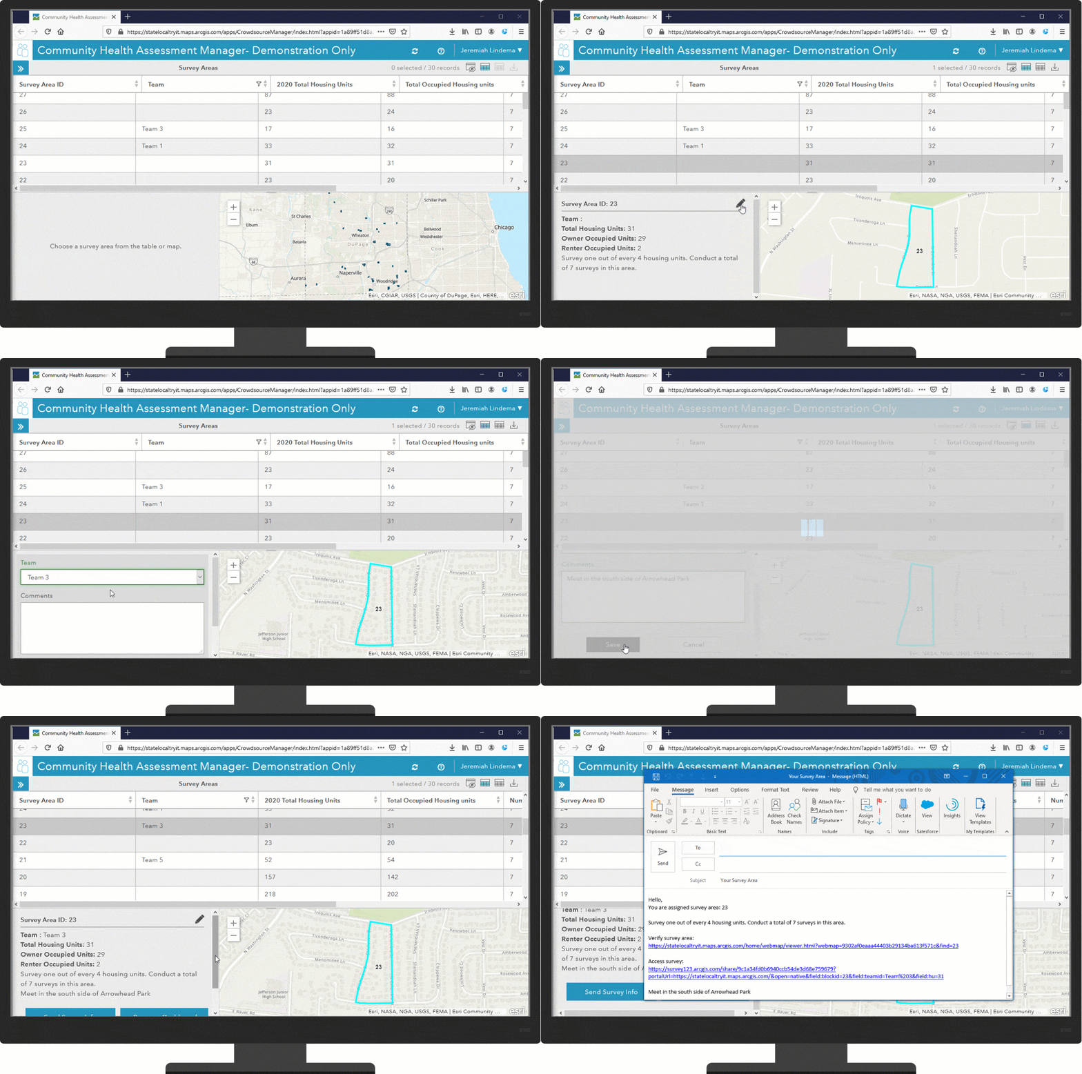
After the clusters are selected for the community health assessment, a survey team leader or assessment manager can quickly assign teams to conduct the surveys within the selected clusters. Once an area has been assigned in the Community Health Assessment Manager app, an email can be generated to send directly to team members, providing a link to their survey area, information on how many households to interview, and at what interval to survey (according to the CASPER methodology, there is a formula for selecting households to interview at discrete intervals to achieve the desired systematic random sampling).

Conduct health assessment surveys
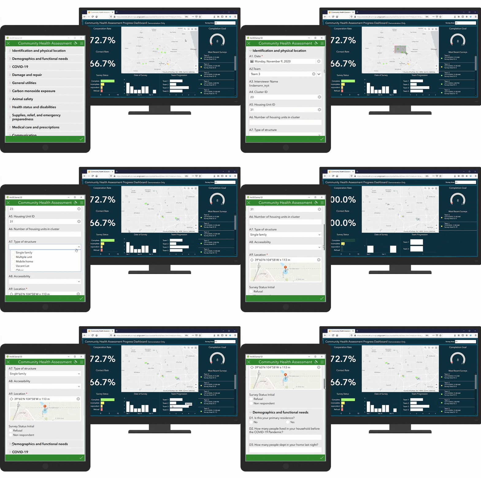
Survey team members in the field are no longer tied to a clipboard and pen to collect information. With the digital Health Assessment Survey they can use a tablet or smartphone to perform the survey. When the survey is opened, relevant information identifying their assigned cluster and team is pre-populated on the form. By default, the survey includes all questions currently available in the CASPER toolkit, with the addition of questions related to COVID-19 impacts. Since health assessments are done in different communities for different reasons, there may be a need to add new questions, modify existing questions or remove unnecessary questions. The Health Assessment Survey is fully configurable and can be altered as required. As surveys are completed in the field, the assessment manager will be able to monitor the progress of the assessment in real-time.

Visualize key metrics
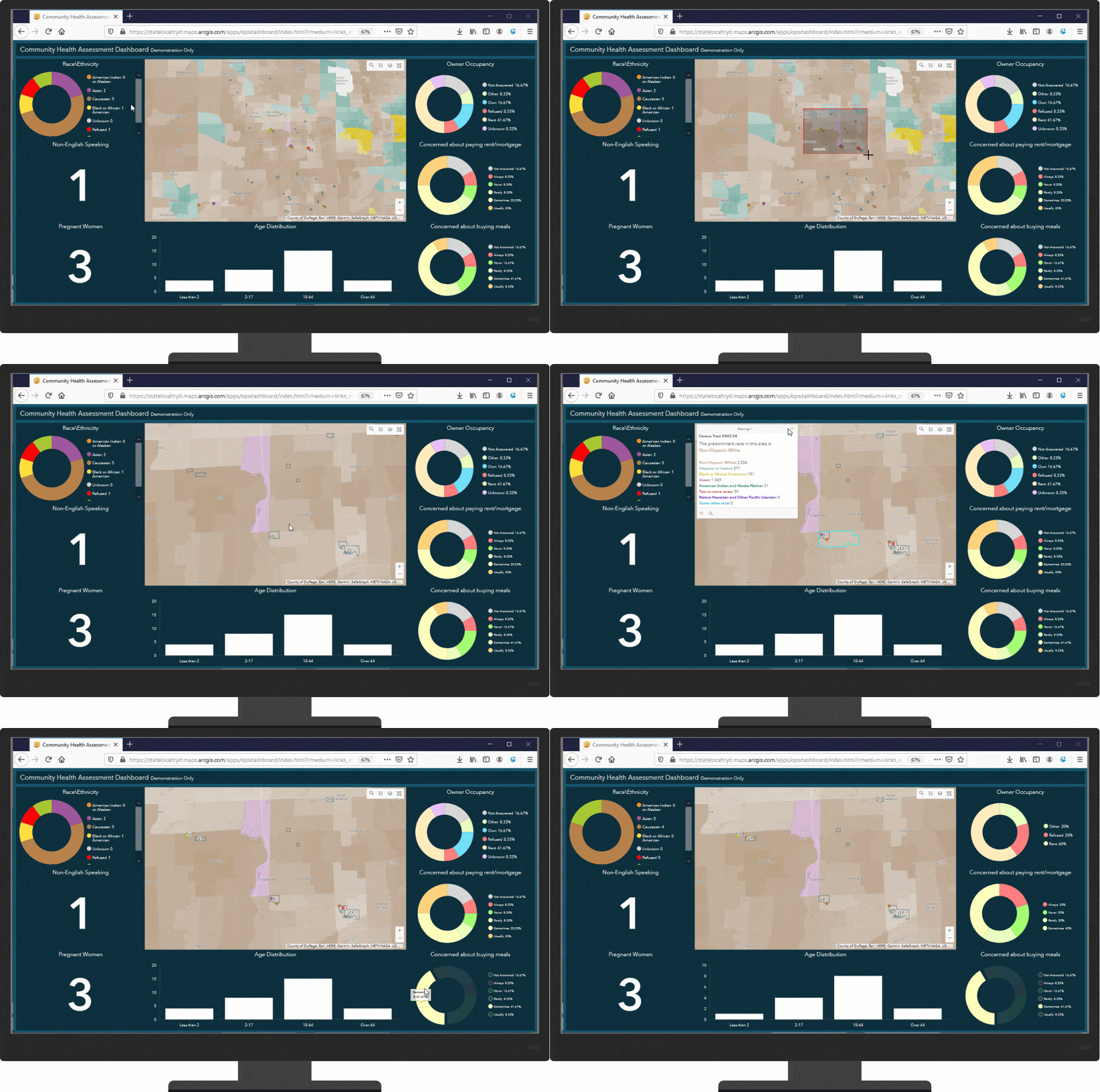
Executives want a high level summary of the demographic and functional needs responses to the survey to understand the patterns of basic needs within their community. Key metrics such as access to healthy foods and ability to keep up with housing costs are vital health indicators. In addition, visual cues in the dashboard indicate whether the demographics of those surveyed align with the overall make-up of the community, maintaining data-driven insight on issues of health equity. The Community Health Assessment Dashboard allows executives to quickly access this information.

Additional resources
Learn more about the Community Health Assessment and other solutions and how to deploy them on the ArcGIS Solution site. For questions and feedback, chat with us on GeoNet or contact Esri Support Services.
Finally, Esri is providing several resources to help organizations combat the coronavirus. The COVID-19 GIS Hub is the place to access additional resources and to request GIS assistance from Esri.


Article Discussion: