Note: In June 2024, this solution was updated to modernize several applications and incorporate several minor enhancements.
More than 1 million people died from a drug overdose since 1999. During the coronavirus (COVID-19) pandemic, overdose deaths accelerated, and more people died in a 12-month period ending in April 2021 than any other previous year. Raising awareness about opioid overdoses and response requires collaboration between public health, public safety, mental health and treatment providers, medical personnel, and community-based organizations.
The Opioid Epidemic Outreach solution delivers a set of capabilities that help local governments inventory prevention and treatment resources, communicate the severity of the epidemic, and promote resources available to those in need. Understanding how and where the epidemic is impacting the community helps local governments optimize resource allocation and make smart prevention and treatment investments. Showcasing where resources are available helps those suffering from the epidemic find the help they need.
Increase public awareness
In response to this growing epidemic, many state and local governments filed lawsuits against drug manufacturers for failing to state the addictiveness of the pills. In the summer of 2021, more than 40 states settled with several large pharmaceutical companies. The opioid settlements will provide funds to local governments that were impacted by the opioid epidemic and will be used for prevention, treatment, and recovery resources. The settlements will also provide education on the dangers of opioids, including synthetic opioids (primarily fentanyl) that are now causing the majority of overdose deaths.
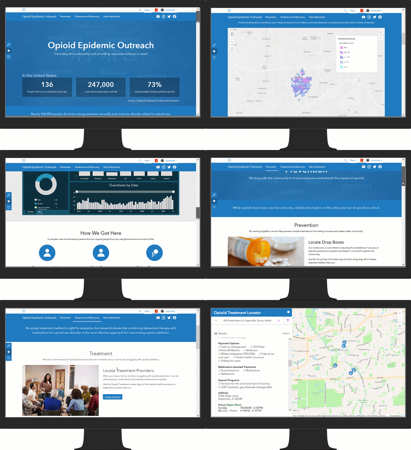
Improving opioid epidemic outcomes starts at the community level. It requires a transparent public education program that provides information about overdoses in your area and resources available to assist those in need. The Opioid Epidemic Outreach solution can be used to launch an educational outreach web destination, share current metrics with the public, share available resources and improve outcomes of the epidemic.

The Opioid Epidemic Outreach solution leverages an ArcGIS Hub site to help with education and showcase the prevention, treatment and harm reduction resources. From this destination, community members can visualize key overdose metrics and aggregated overdose data that partners can use to base their outreach efforts upon. Community members can assist with various volunteer activities and report drug paraphernalia that needs to be cleaned up.
Sharing overdose information
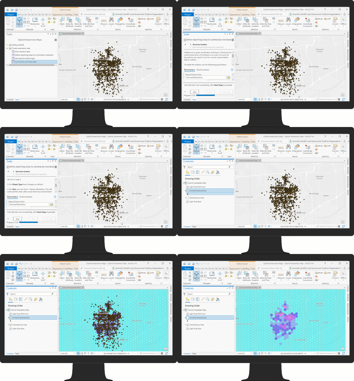
Understanding where overdoses are occurring helps you communicate where the problem is occurring and focus prevention and education outreach campaigns. Many states have rules that prohibit individual overdoses from being shared publicly.

To help you safely share overdose information, the Opioid Epidemic Outreach solution includes an ArcGIS Pro project that can be used to aggregate overdose data in to reporting areas, such as city wards, or anonymize the data in to standard hexbins. The results can be shared on the Opioid Epidemic Outreach ArcGIS Hub site.
Inventory opioid prevention and treatment resources
Opioid prevention and treatment resources in a community change frequently. New providers become available and operating hours, or contact information, at certain facilities change over time. Inaccurate, or dated, information makes it difficult for residents in your community to find the resources they need.

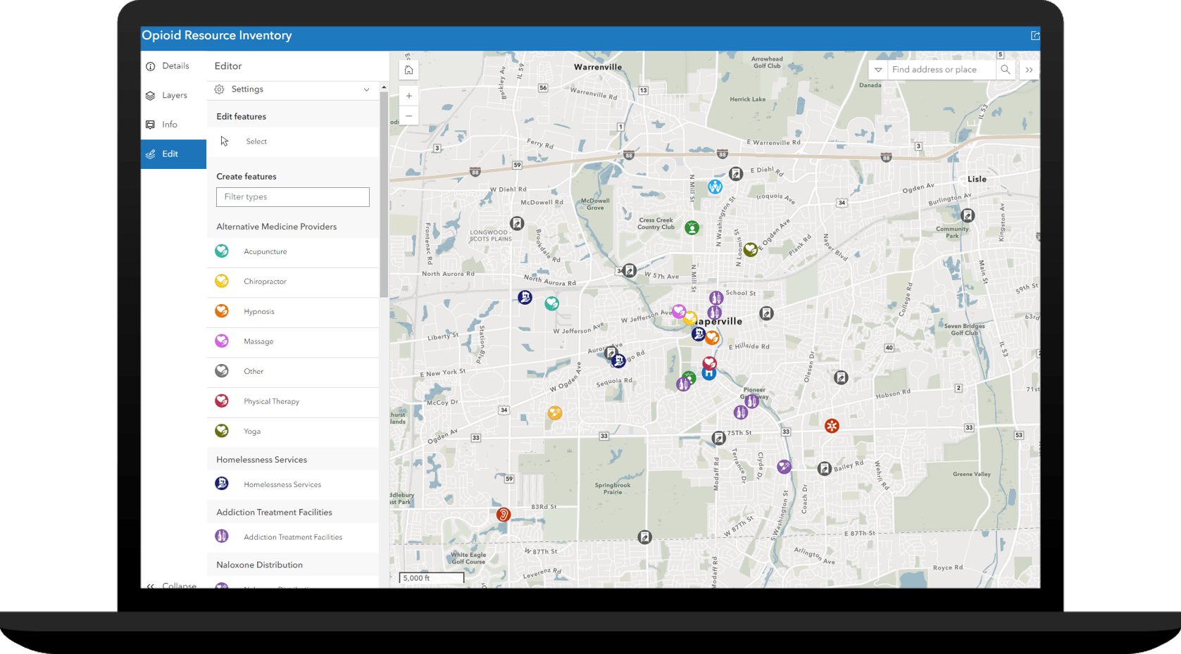
The Opioid Resource Inventory app can be used by health and human service agencies to inventory resources that will be shared with the public on the Opioid Epidemic Outreach site.
Additional Resources
Learn more about the Opioid Epidemic Outreach solution and how you can quickly deploy this solution on the ArcGIS Solution site. For questions and feedback, chat with us on Esri Community or contact Esri Support Services.

Article Discussion: